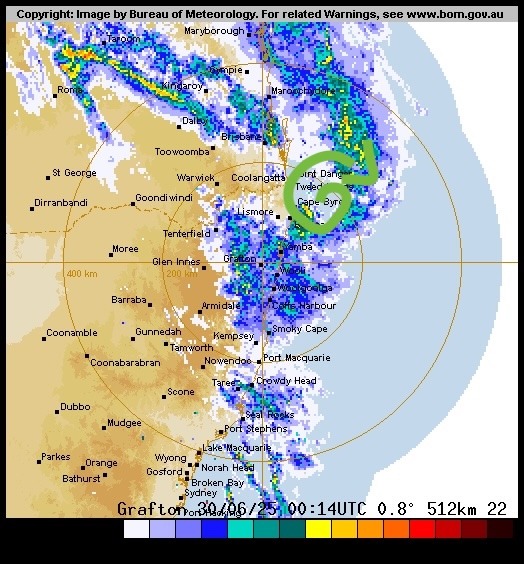
As promised a quick update on the ECL currently developing to our north. Here’s where it is sitting right now:
…and here’s how models continue to show it developing / moving:
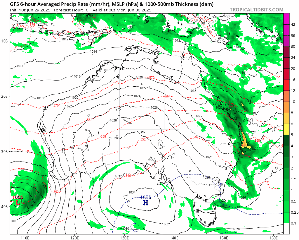
You can see the low develop quickly under the influence of warm oceans and an incoming upper trough. A second upper trough then draws it closer to the coast as it moves south. South (likely Sydney / Illawarra) of us will see some very strong winds and heavy coastal rain as it draws back in…for us we’ll see rain continue while the low sits to our north, with a progression to drier and gusty-to-strong south westerly winds as it moves to our south.
The wrap-around the low will likely bring some precipitation to the hills to our west over coming days, but less for us on the leeward side of the range. Once the system finally clears away later this week we should all see a return to sunnier and drier weather.
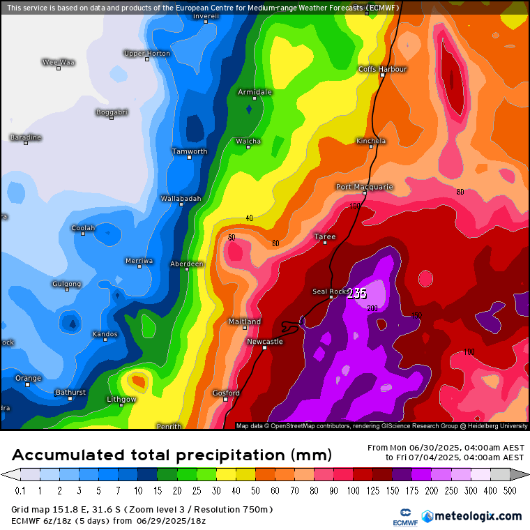
As per the above, current forecasts show moderate totals for us (mainly today) but higher totals as you move south:
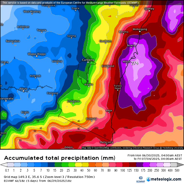
…while south of Sydney will likely cop some much higher totals as the low moves closer to shore:
Unless anything changes the next post will be in a week or so when the next set of monthly charts are released. Until then wishing you a good week 🙂