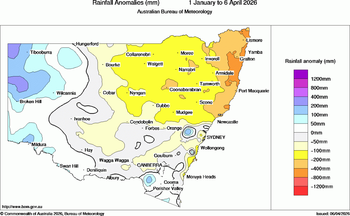
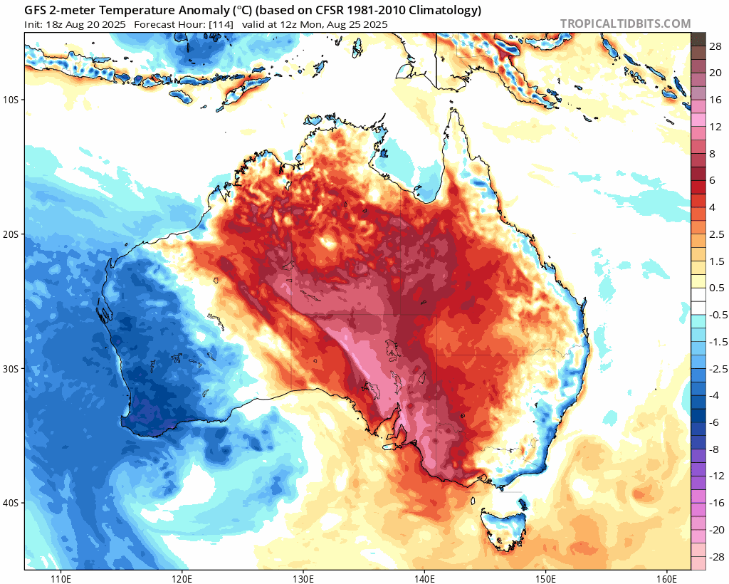
Wow – reaching the end of winter and it’s not feeling like spring today. We’ve got cold and wet weather as a result of an upper cold cut off low that is sitting to our west and dragging in warm, wet air off the ocean. That’s a heap of instability – warm air rises, condensates and we get heavy showers and longer rainy spells. Here’s how it’s looking from above, courtesy of Andrew Miskelly / Weatherzone:
The good news is that the system is weakening and moving east – so we should see rain clear offshore over the next 24 hours with sunnier and drier weather moving back in. There’s the chance of a shower or two over the coming weekend as a low develops offshore and brings a southerly surge along the coast….but we then see a southern ocean low moving east as we head into next week. That system will bring a strong cold front across the country – and as it does it will draw some much warmer air across our region through the middle of next week:
….and still time for it to change but looking like we could see temps in the upper 20s, perhaps hitting 30c next Wednesday:
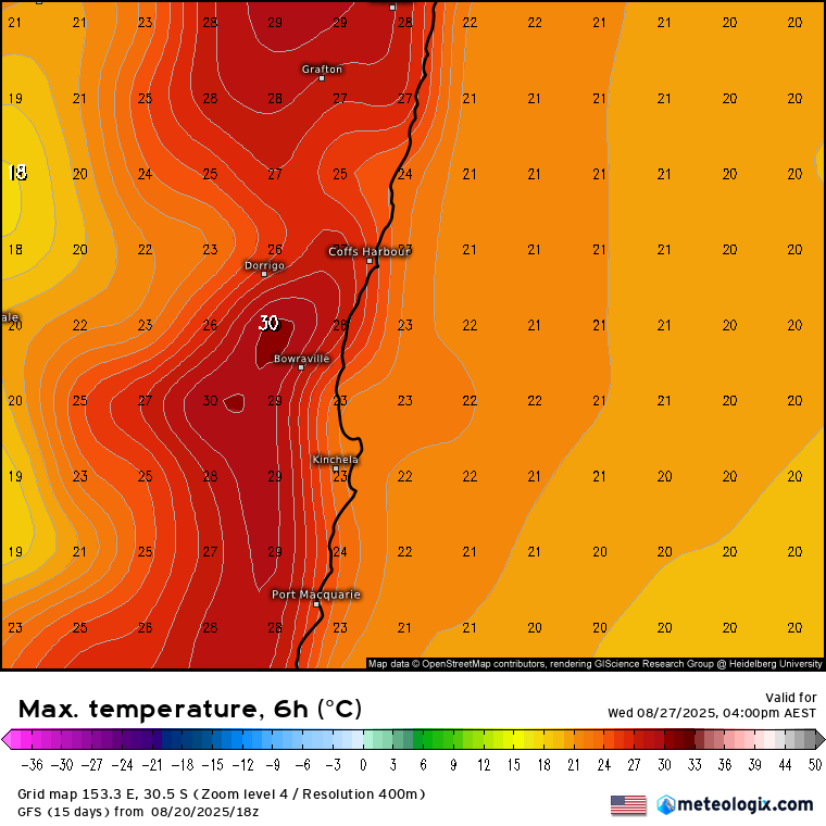
That will feel a little different to this week! The same cold front that will be drawing down the warmer air will move through late Wednesday, with temperatures dropping again for Thursday. We should still see some warm sunshine however – very different to today…
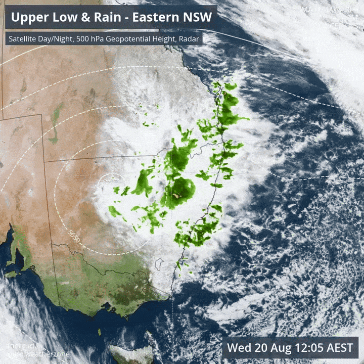
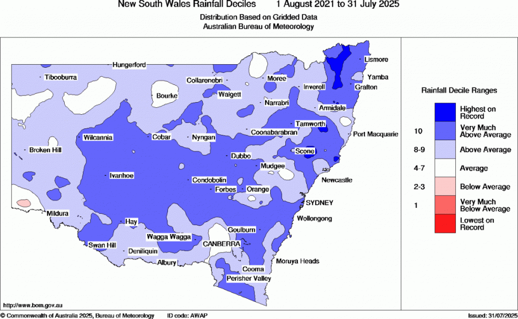
Worth noting that if it feels wetter than normal that’s because it has been – the BoM 4 year rain map shows most of NSW sitting with totals very much above average, with hilly areas of NE NSW sitting on the highest 4 year totals on record:
The forecast through to the end of the year flags a continuation of the wetter weather at times – and as per a recent post this could be a part of a longer trend. I’ll be back with longer term forecasts over the coming week, but until then hope you can stay dry and warm – the sun will be back!