…but looks like it might be *just* to our south! We’ve got a very dynamic period of weather coming up with a strong upper trough moving in from the west. That trough will turn into a cut off upper system across NSW, and then get reinforced by another upper system later next week. Combine that with warm ocean temperatures and onshore winds and we have the ingredients for some strong winds, heavy rain and perhaps even an east coast low. Definitely a week to watch the weather, particularly if you live in the southern Mid North Coast / Hunter region.
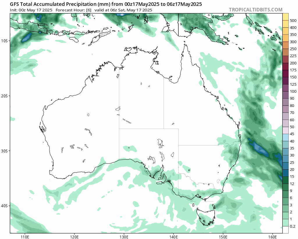
Looking at the forecast surface / upper animation as we can see the upper trough move in, cut off into a upper cold pool and generate some decent weather at the surface:
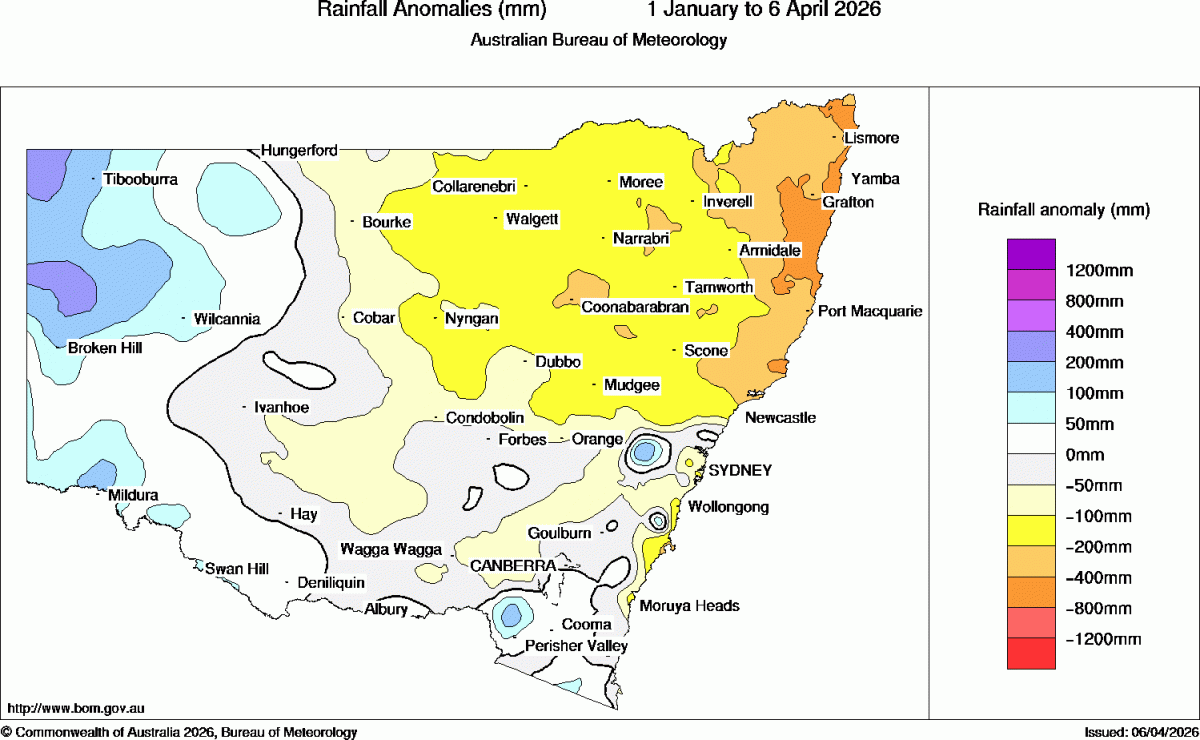
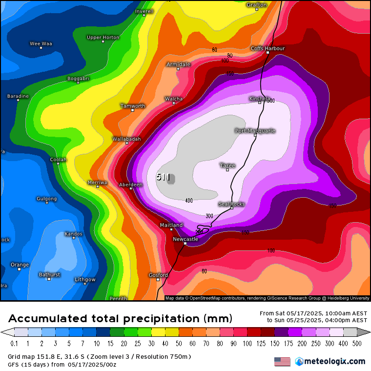
The result? Some BIG rain totals across parts of the Hunter and (likely southern) Mid North Coast. Here’s the accumulating rain totals for the same period:
If that looks like a heap of rain you’d be right – flooding likely incoming for populated parts of the Mid North Coast / Hunter. Models right now keep the majority of the rain to our south – and let’s hope it remains that way as there will likely be some high accumulating totals this week. Here’s how it looks from a couple of the main models:
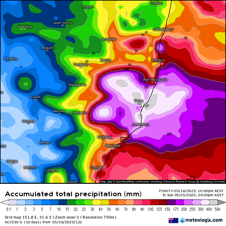
The European model keeps the higher falls much further south:
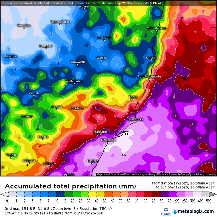
As you can see there’s the chance of some very high totals for some locations. What we can say is that some locations will see some flooding rain…and right now the models are trending to our south, meaning that while we should see more rain we’re likely to miss the really high totals…however these situations can be hard to pin down closely, so we need to be aware that there is a chance that we could see some river rises this week if the higher totals move in our direction. Some potentially good news – if the low forms a long way to our south we’ll see little rain and offshore winds -> drier and sunnier weather! Fingers crossed…
We’ve had a really wet spell recently so even lower totals have the potential to cause more problems for our road network as it buckles under the ongoing rain. Our recent totals haven’t been that high, but ongoing lower totals combined with higher than average cloud cover (reducing evaporation) mean the ground really hasn’t had a chance to dry out for some time – resulting in the cancellation of the Bellingen Show, monthly markets, landslides and more 🙁 Here’s how the daily rain totals look for the last 30 days:

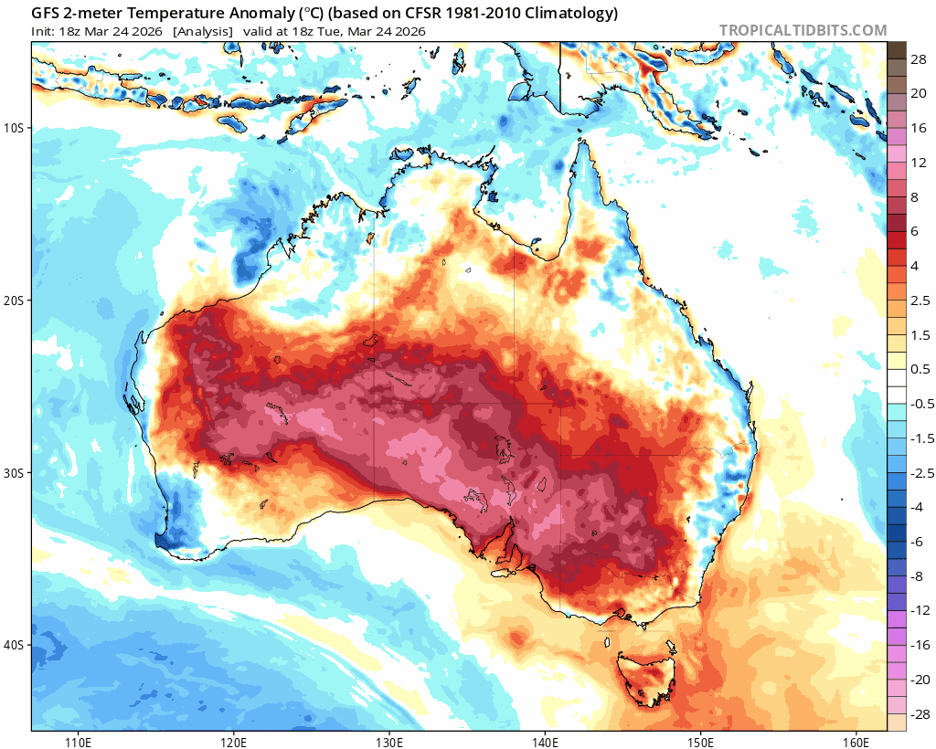
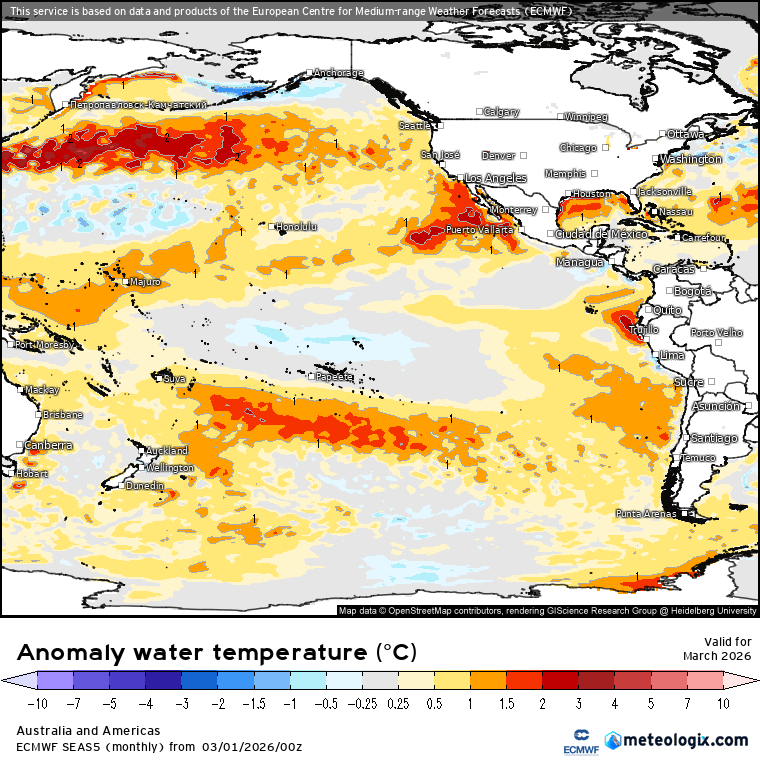
Warmer than average ocean temperatures off our coast add to rain totals when other conditions line up. We’ve also seen southern ocean fronts (that would usually push wetter weather off the east coast more quickly) remain stuck way too far south. That is, in part, due to the positive SAM (Southern Annular Mode) – you can see it turning positive in March (when our wetter weather kicked in) and has remained positive ever since:

The dissapointing news is that the SAM is looking like it will remain positive over the next 4 weeks, with an increased risk of wetter weather / east coast lows as a result:

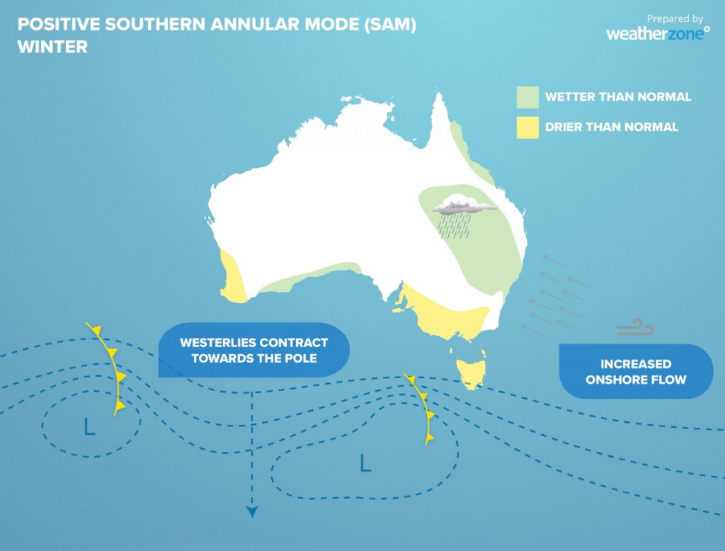
This graphic from Weatherzone is actually pretty decent at highlighting the impacts of the +ve SAM:
We’re entering what is traditionally our drier time of year, so climatologically speaking we should see some drier weather at times over the next few months.
Looking even further ahead and the forecast for the Pacific over the coming Spring / Summer is always much harder at this time of year – small changes now can have BIG impacts months down the line…however models are currently trending cool to neutral for the El Nino / La Nina zone:
If those forecasts remain looking similar over coming months then we’re likely looking at another wetter than average summer / autumn….but things can change a heap at this time of year so we’ll share another update on the Pacific pattern as we head into winter.
That’s it for now – keep an eye on forecasts over coming days, keep fingers crossed that we miss the higher totals!