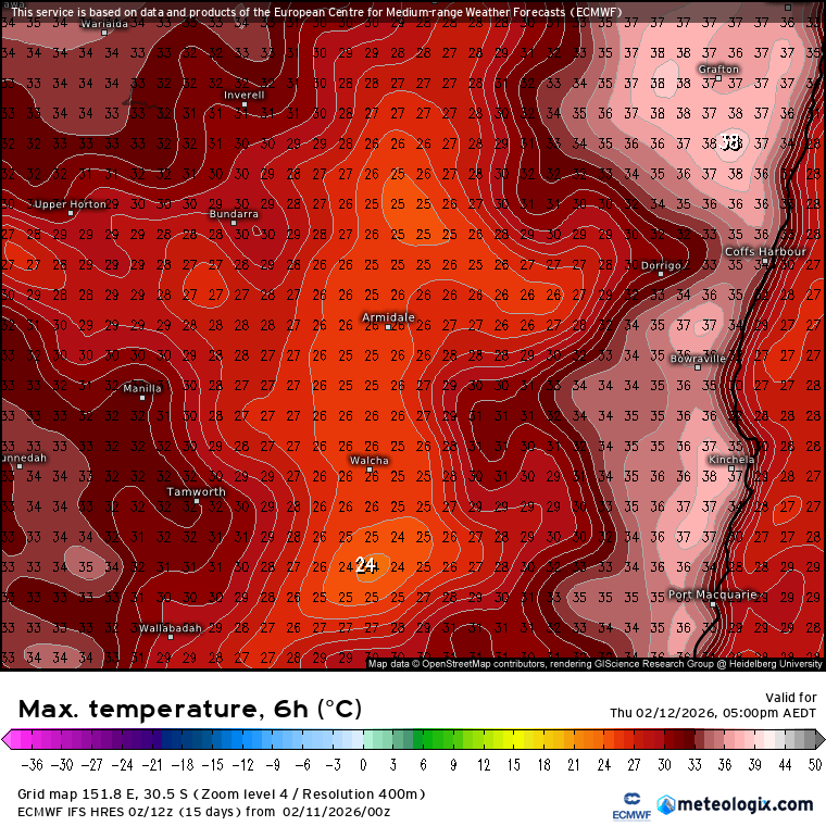
We’re still on track for some very cold air to move up from deep down south and across our area over this weekend. The upper chart animation from the GFS model shows it moving in / across our region:
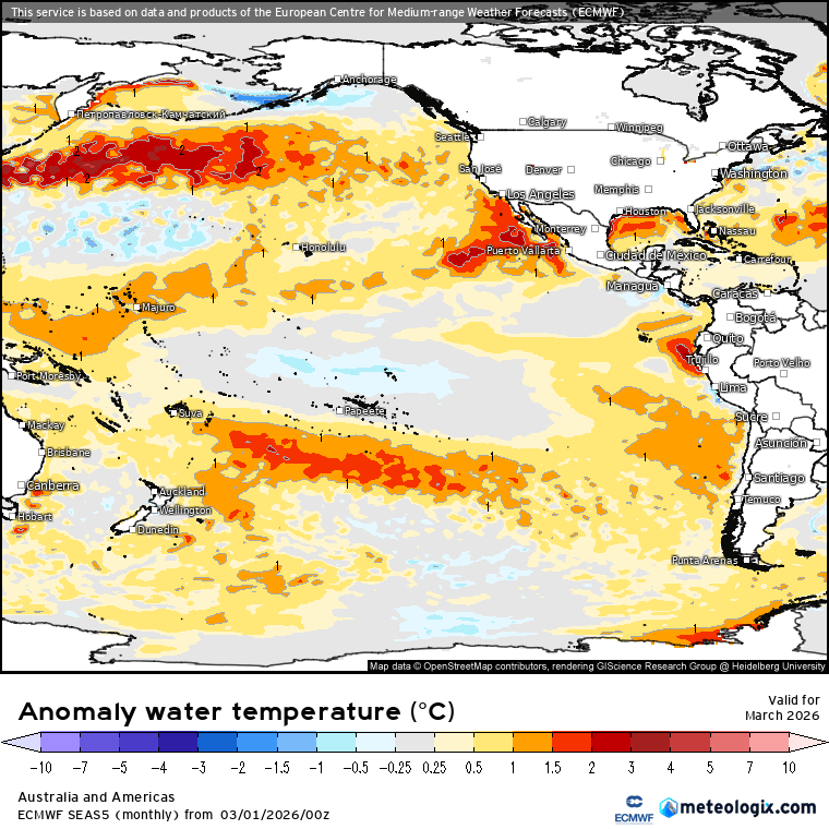
Pretty cool to see the cold air move across our region – and with some cold air up high combining with warmer than average ocean temperatures off the NSW coast:
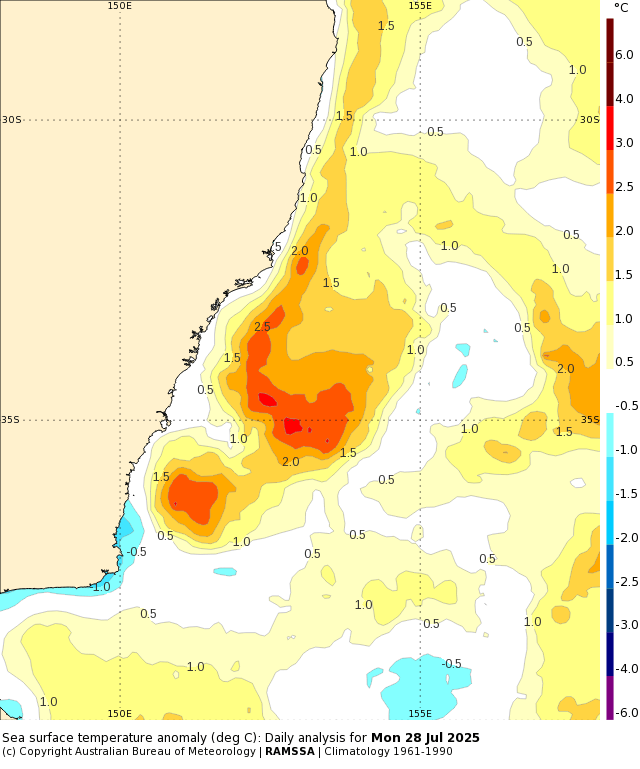
…we’ll see some very unstable conditions through the weekend. It’s a classic scenario for an East Coast Low to form, and that’s what we should see happening through the weekend. The key is *where* the low forms – and that’s really hard to pin down. It’s worth thinking of it like a pan of water put on the stove to boil – you know you’ll see bubbles forming on the bottom of the pan as the water heats up, but it can be really hard to pin down where those first bubbles will form…and that’s the same scenario we’ll face this weekend. Showers and storms (more coastal) will develop as the atmosphere destabilises…but exactly where the low will end up focussing is, literally, up in the air. This explains the differences in the model outputs. Remember if we’re north of the low we’ll see offshore winds and much lighter winds / less rain…but if we’re to the south we’ll see a lot more of both.
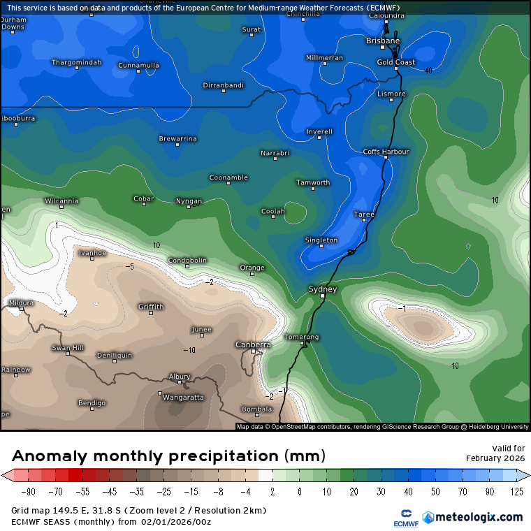
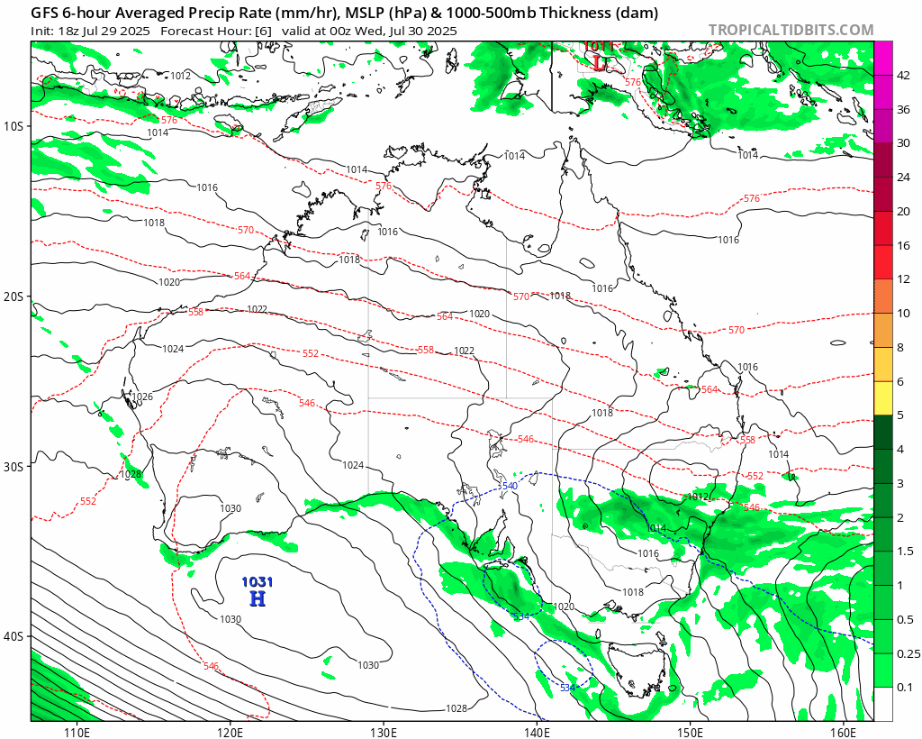
The GFS model currently shows us getting a good blast of wind and rain:
….while the European model likewise develops the low but keeps it further south:
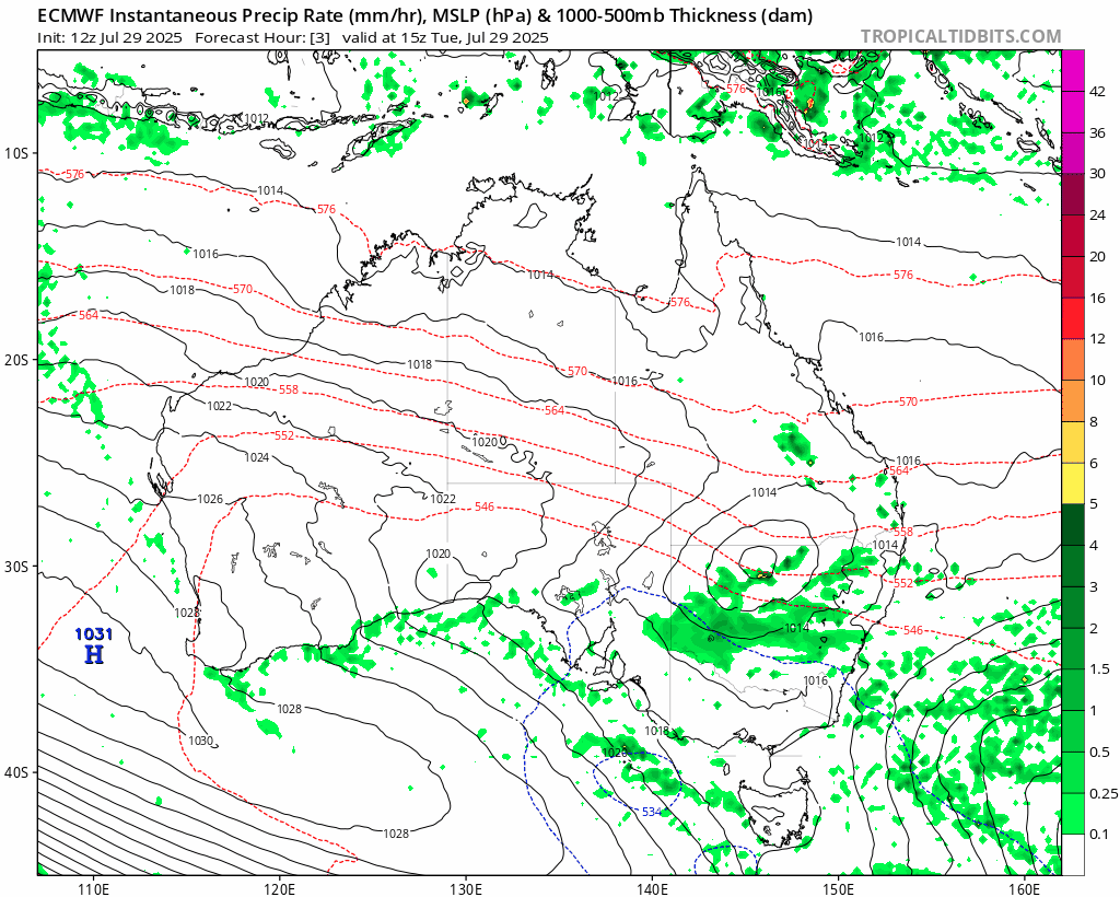
As such it’ll likely be a wait and see, with models only really aligning as we head into the weekend.
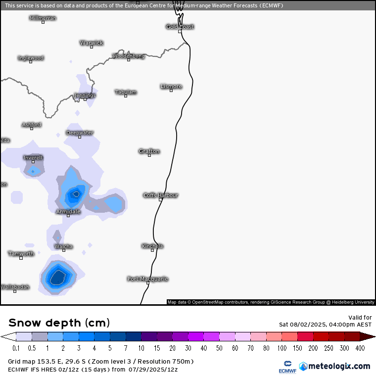
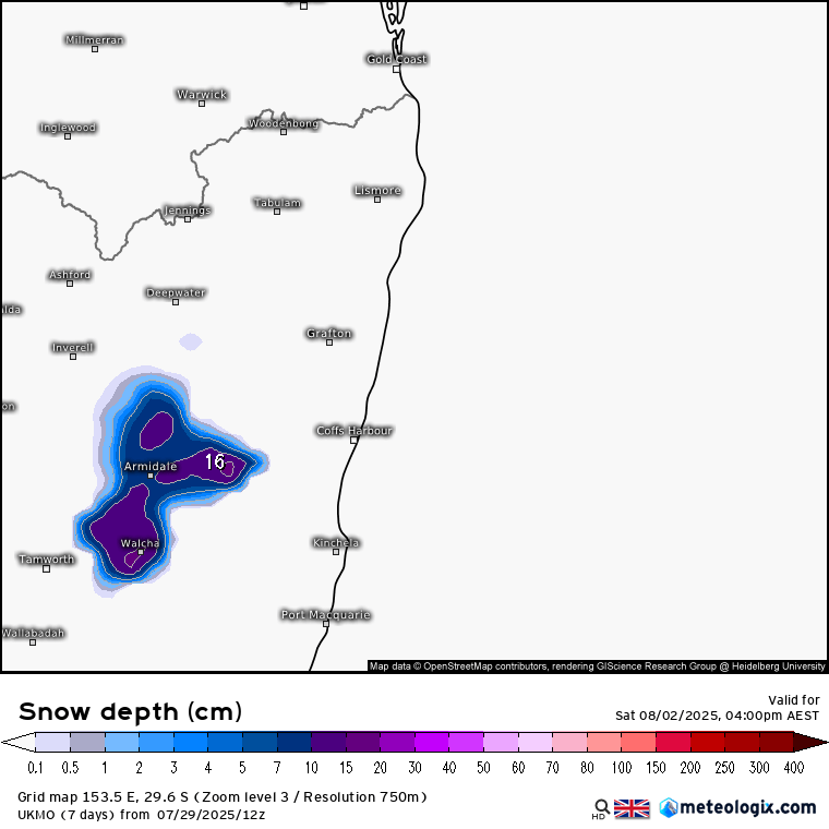
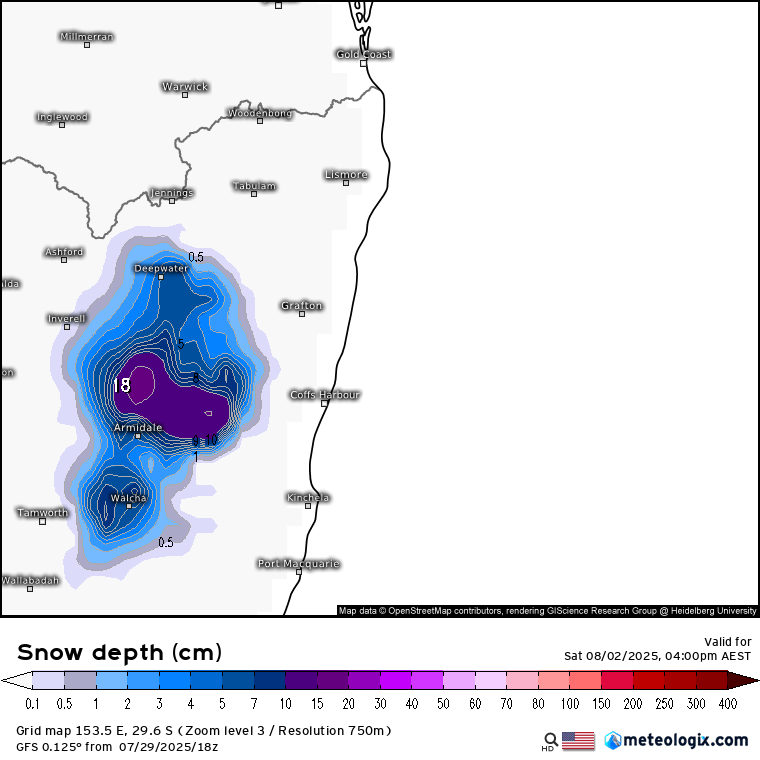
What is looking possible is for some snow to fall over the hills to our west – Cathedral Rocks / Guyra / Black Mountain all looking possible for some accumulations as that very cold air up high mixes down towards the surface and combines with low level moisture. The positioning of the low will determine how much snow falls to our west, but there is the potential for some decent falls. At this time Saturday looks like the day to head west if you want to catch some snow fun – but wrap up well as it’ll be cold (obviously) and possibly fairly windy. Worth flagging that the freezing levels will be fairly close to ground level…so also a risk that it’ll remain a wet and cold event with more rain and less snow. We’re pretty marginal for snow up this far north so nothing that unusual there.
Current 4pm Saturday forecast snow depths from various models (this will likely change as we head into the weekend – however right now all models are showing some snow possible):
European model:
UK model:
American model:
That’s if for now – thanks for taking the time to make it to the end. Wrap up warm, keep dry and see you again soon.