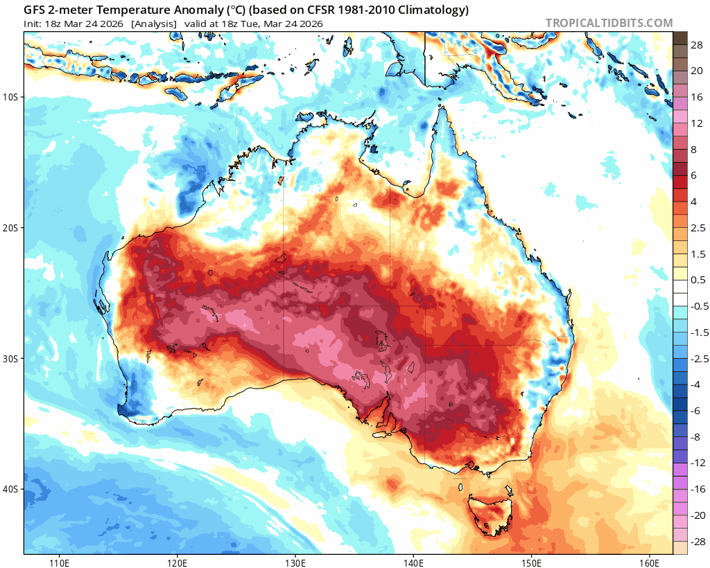
Sure enough inland SE Aus was recently blasted with some record-breaking heat – both in terms of temperatures reached and duration of the heatwave. Two locations actually managed to hit the 50c mark – not something you see very often in Aus.
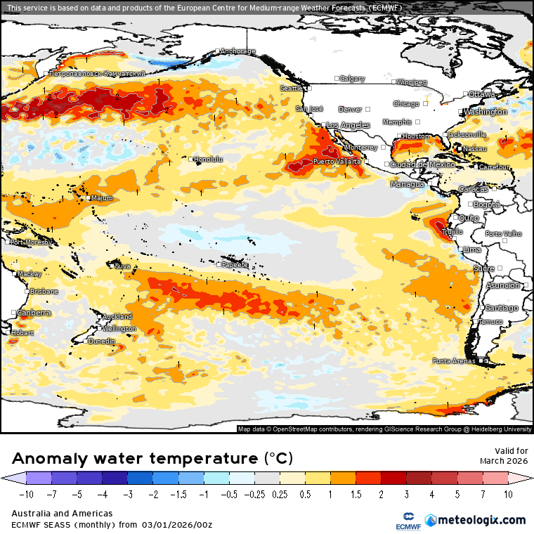
Looking at our region and we luckily missed out on the worst of the heat. We’ve also been fairly dry for this time of year – but it looks like we could see some wetter weather over the next couple of weeks. Ocean temperatures are around 26 to 27c just offshore:
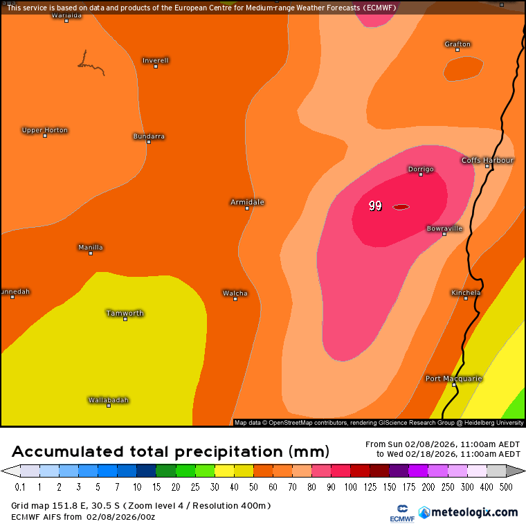
…and it looks like we could see winds turn onshore over coming days. The 10 day AI EC model gives us around 100mm for the period:
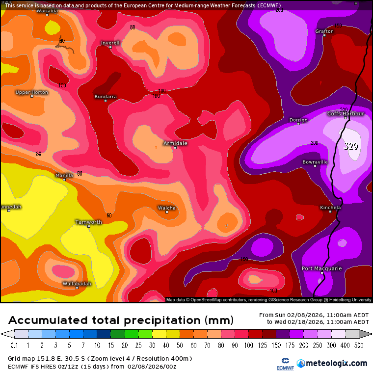
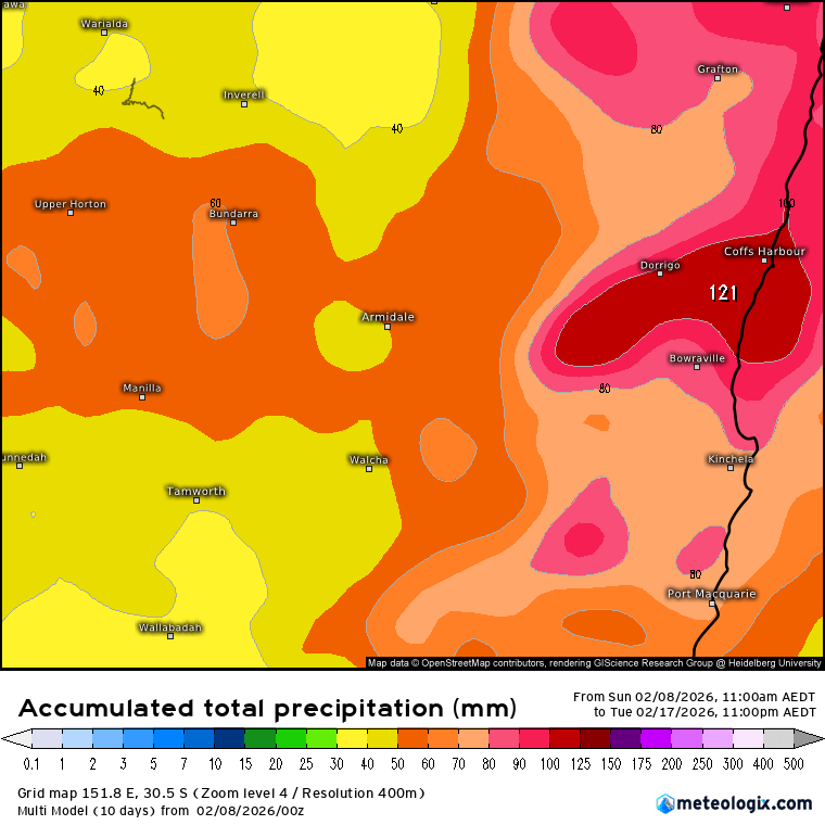
…while some of the more traditional models show much higher totals over the same period. Here’s the (likely well over the top) Australian ACCESS model 10 day forecast:
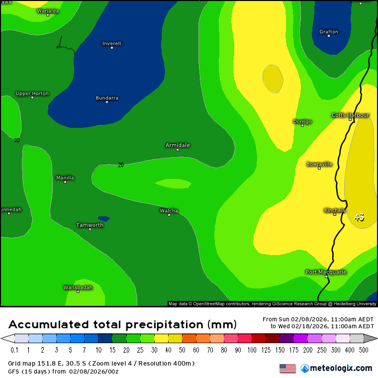
…with the European model showing not too dissimilar totals:
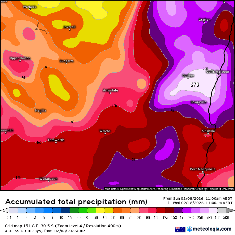
…BUT crucially, other models, such as the American GFS model show much lower totals:
…so right now some models are showing some potentially significant falls, while others are not quite there. At times like this a decent rule of thumb is to go for the average – and right now that gives us just over 100mm over the same period:
When the models show such divergence in totals it tells us that there are the ingredients there for a decent rain event but not necessarily all the triggers. As such it’s worth being aware we could see a wetter spell but definitely no guarantee at this time. As such worth being aware it could get wet, but also a good chance it’ll pass us by with not much falling. Models should fall into line around mid-week and I’ll post an update then.
Worth noting as well that the ground is actually fairly dry to a decent depth right now so it would take some good totals to see any riverine flooding – though with dry ground any heavier falls can lead to some flash flooding in some locations…however if we do end up with models trending towards some of the higher totals we could see flood watches later this week – but that’s a long way away in the weather world…
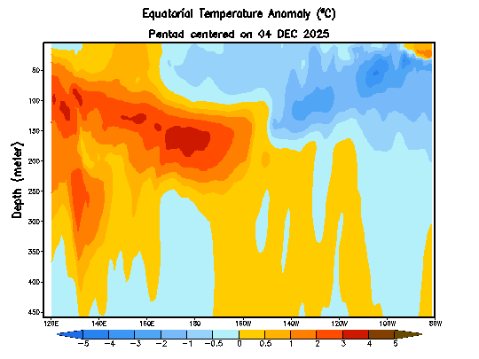
Looking much further ahead and the recent westerly wind bursts in the Pacific have generated another warm sub-surface kelvin wave. This wave will move from west to east and should surface close to the south American coast over coming months. We can see it building in the latest animation:
…and sure enough models are still forecasting a possible transition to El Nino-type conditions as we move through our winter:
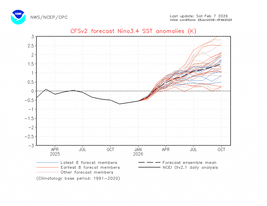
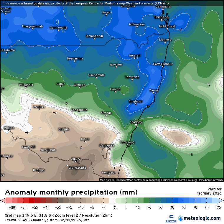
Before we get there though we still have the autumn predictability barrier to pass through – a small change at this time of year can have big impacts as we head through winter. Regardless models are putting their money on an El Nino as we hit spring. That has the potential to dry things out for us – as an example here’s the forecast rainfall anomaly for this month:
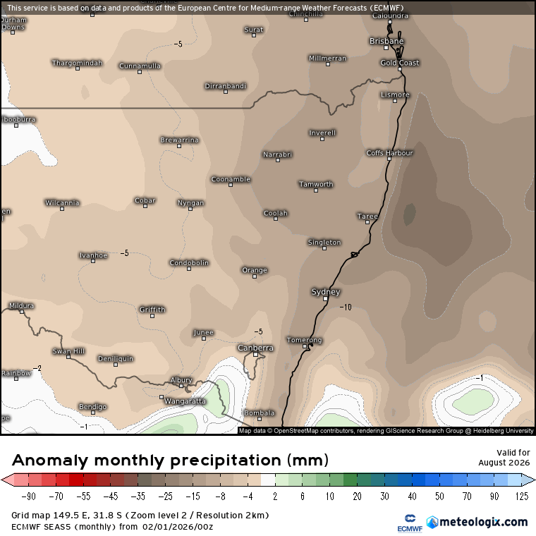
…while here’s the current forecast for August:
Something I’ll keep an eye on over coming months – updates to follow. Worth noting that there are a couple of other key influencers on our weather that will also impact how much late winter / spring rainfall we’ll see – the Indian Ocean Dipole and the Antarctic circulation. We’ll have some idea of how the Indian Ocean is going to trend over coming months, with the Antarctic a little harder to predict so far in advance. It took all three turning dry (plus a drought already in progress) to bring us the 2019 fires.
That’ll do for now – a reminder that we could see wetter weather later this week…but how much is still, literally, up in the air. Thanks for reading and see you again mid-week.