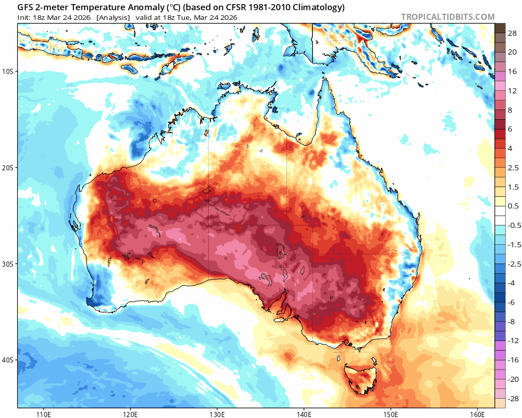
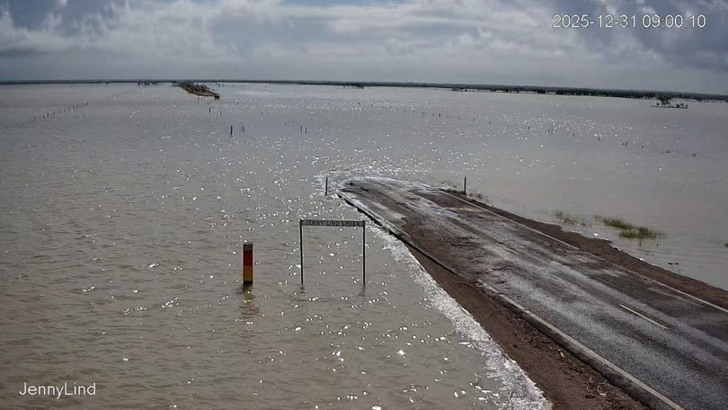
Welcome to 2026! Hope you had a fantastic Christmas and New Year. I’ll kick off with an apology to anyone who went to Woodford expecting a flood. The previous posts talked about a significant upcoming flood event in Queensland – but it’s a huge state and this one was expected to focus further north, as it did.Here’s the latest weekly rain totals for Qld – and worth noting that some places have seen well over a metre of rain in the last week – huge totals, even for our tropical north:
…and here’s how that translates on the ground:
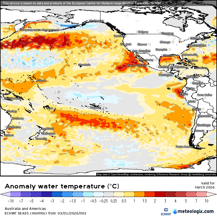
Waters around the tropical north have been sitting well above average, and some of that warmer water (though cooling as it moves south) has arrived off the NSW coast:
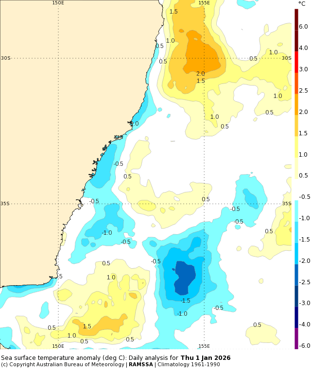
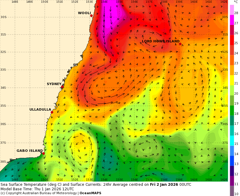
That’s a big blob of water sitting more than 2c above average…and a strong East Australia Current will push more hot water south over the coming 5 days:
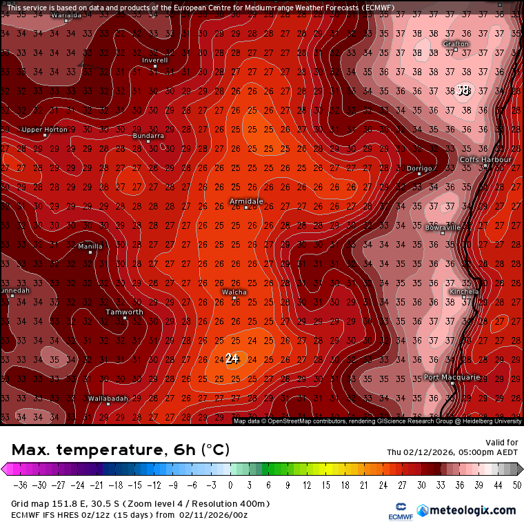
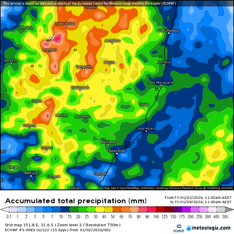
That warm water will increase humidity levels, which will combine with some strong sunshine and result in a few afternoon summer storms, particularly over the hills. Steering winds (that push those storms across to the coast in spring) are weaker in summer, so whilst some areas, particularly over the hills, will see some good totals, other areas could well miss out. 7 day rain totals are forecast as follows:
Once we move beyond the one week mark winds start to turn more onshore. If that happens as currently forecast we’ll likely see heavier showers start to move in from the ocean, with the rain focus likewise closer to the coast. As an example (don’t take it for granted, it will change again tomorrow!) here’s the current two week forecast rain total for our region:
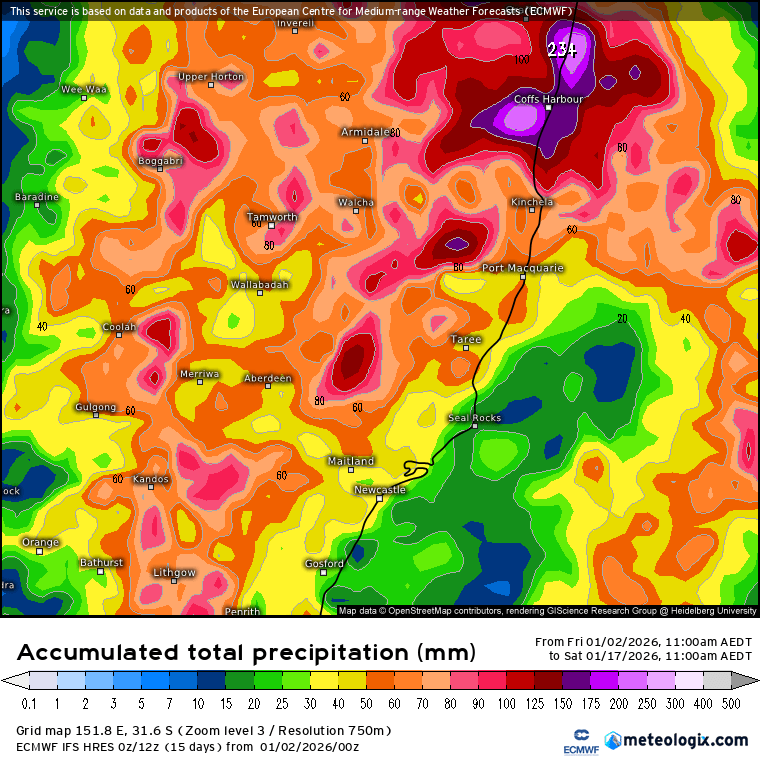
Should note that as this stage we’re not looking at higher totals than we’d normally expect at this time of the year – we’re heading into wet season so an uptick in rain totals isn’t unusual.
We’re also likely to see a tropical low develop in the Coral Sea over the coming week. As is usually the case, models are all over the place with what happens when…and where it forms will have a real impact on where it ends up. There’s a heap of posts on social media hyping up rain totals…but right now nobody can say what will happen with any detail…so it’s going to be something I’ll keep an eye on it over coming days and will post again if anything significant looks likely. Regardless, we’ll likely see that increase in showery activity as winds turn onshore and blow over the very warm (27c+) ocean just offshore. Enough energy in that water to power some decent showers and storms regardless of what happens at the broader scale.
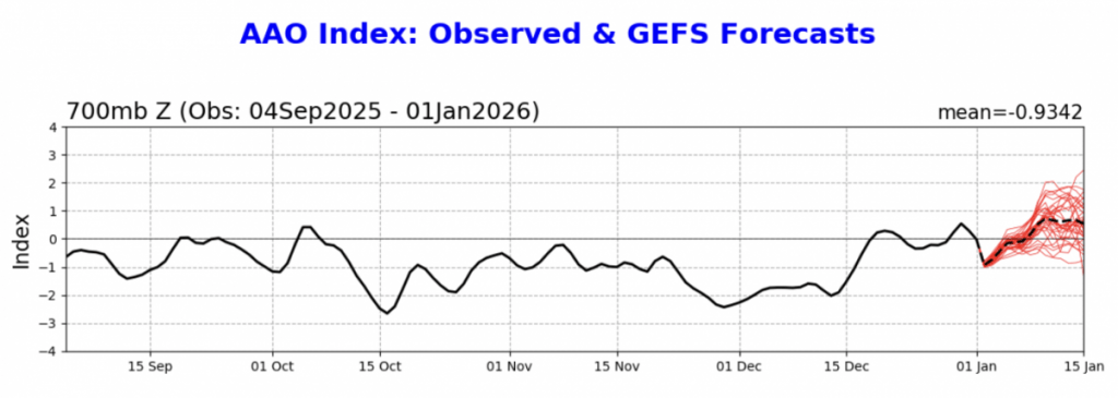
Looking longer term and the impacts of the weaker-than-average southern circulation have now departed, pretty much on schedule. You can see it go from long-term negative back into the positive over coming days:
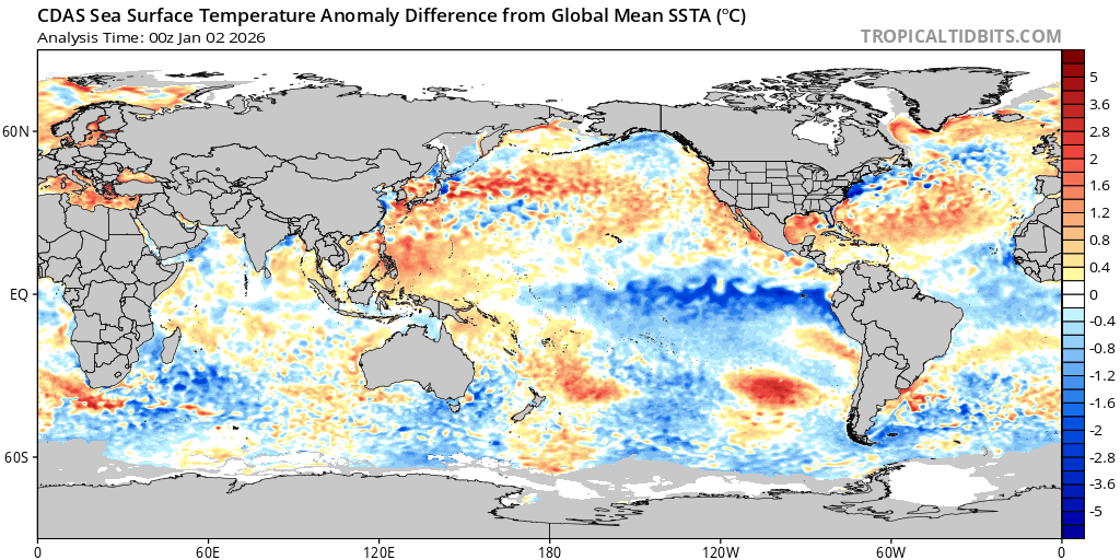
That means we’ll be looking to the Pacific for our summer influence – and that’s sitting in a decent La Nina pattern for now:
Those impacts will likely last until April to May – so expect an increased risk of wetter conditions through that time.
A late night post so that’ll do for now, back again later in the week with an update on rain potential over coming weeks. Until then thanks for reading and all the best for 2026 🙂