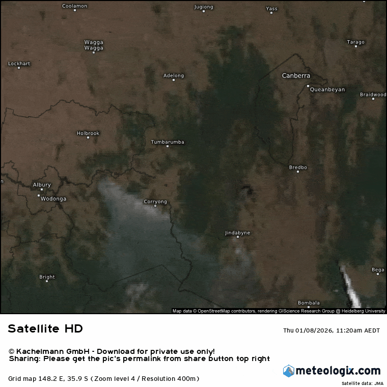
A few days since a post…and a time of year where the weather can get a little more interesting. It’s been pretty dry recently – but luckily for us not as dry as it has been down in Victoria where they’ve seen numerous fires exhibiting extreme behaviour, with pyro-cumulonimbus seen on several fires. Such extreme events used to be rare but are becoming more common with climate change. I grabbed a couple of animations from one of the fires as the pyro-storm developed. Here’s how it developed from above over two hours:
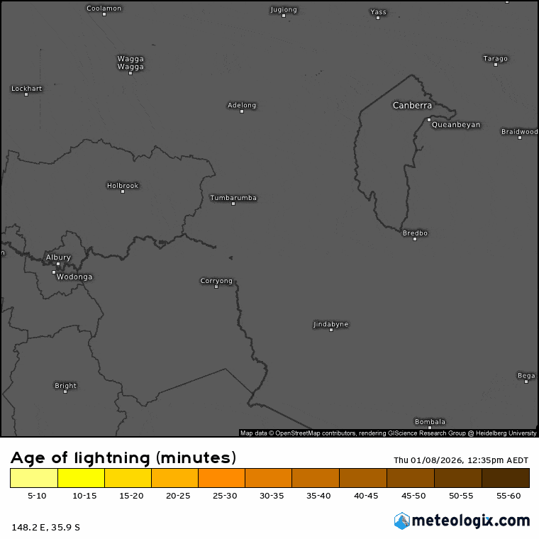
…and here’s how the lightning developed at the same time – starting new fires at a time of already extreme fire behaviour:
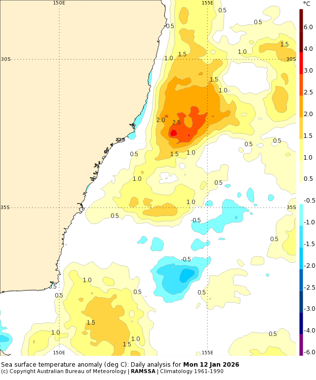
Not good. Back to now and ocean temps offshore are sitting well above average:
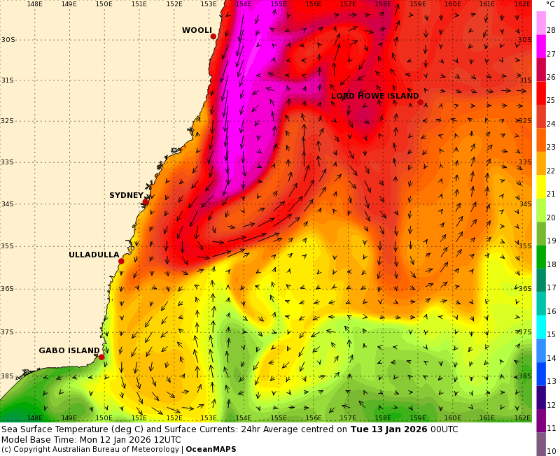
…and that’s a result of some very warm water pushing down the coast in the East Australia Current:
When you’ve got those sort of temps offshore you always need to keep an eye out for onshore winds – there’s enough energy out there to power some very decent downpours…and that’s what parts of the NSW coast will likely see over coming days. Onshore easterly winds will feed into a trough along the coast, with even the chance of a small low developing if the trough deepens enough. At this time it looks like the trough will extend far enough down the coast to push the strongest winds onshore far to our south:
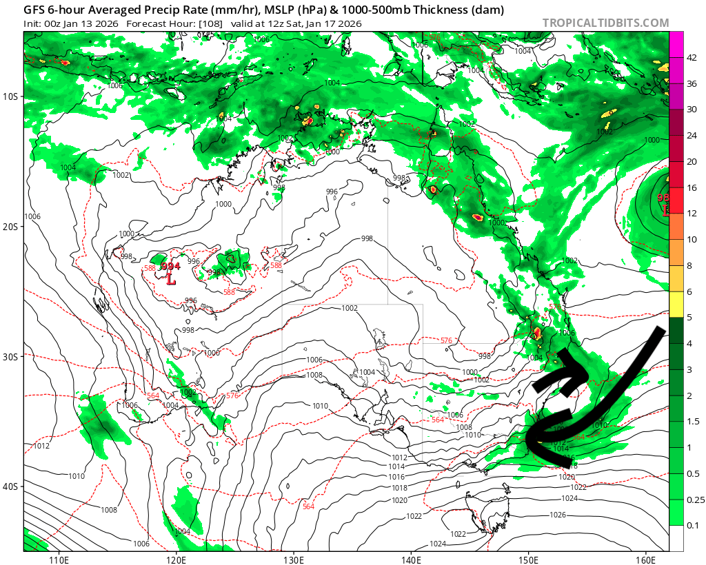
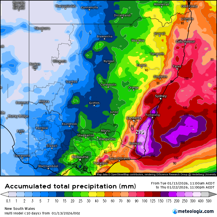
…however that doesn’t keep us out of the woods with onshore winds at times still likely to bring showers across multiple days, with decent totals likely to accumulate. Most current models show a similar pattern, with heavier falls hitting the south coast and lighter (but still significant) falls elsewhere along the coast. If we take an average across all models the coming 10 days gives us the following totals:
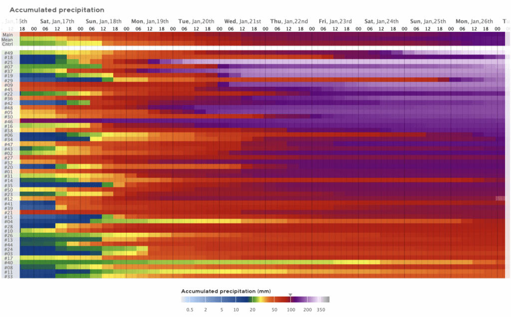
…but worth being aware that with the high ocean temperatures offshore it won’t take much for us to see higher totals. In fact if we look at multiple runs of one of the better models we can see over 50% of the model runs give us over 100mm:
…so something to watch. If it pans out as forecast don’t be surprised to see flood watches for areas to our south…and if the models change and forecast significantly higher totals for our region I’ll post an update. Regardless don’t be surprised to see us heading into a more summery onshore-showery spell at times over the coming week….
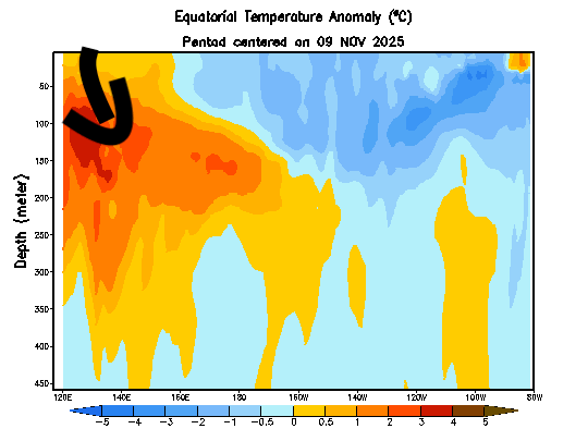
Looking further ahead and there’s already a warm kelvin wave making its way under the Pacific and heading east:
…and forecasts show another westerly wind burst across a key area of the Pacific over coming weeks:
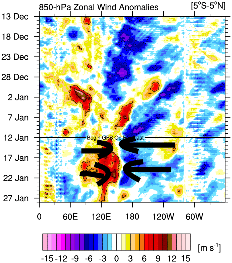
Excuse the poor arrows! Why does this matter? Because those (red) westerly winds push water from the west…and those (blue) easterly winds push water from the east. Where they meet the water can’t go up…so it goes down and likely generates another warm under-ocean wave that will also push to the east and then surface:
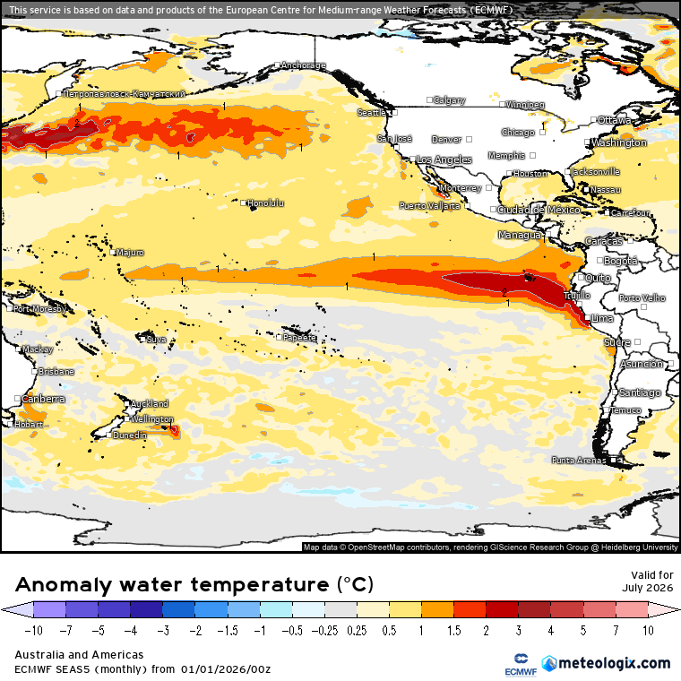
…and sure enough if we look at the forecast ocean temperature anomalies for July we can see that happening, with much warmer waters forecast for the Eastern Pacific:
BEFORE that happens we’ve got a good few months to go…and it’s by no means impossible to see other wind patterns jump into the mix and put a block on the developing El Nino pattern…but right now that’s not happening. One to watch over coming months.
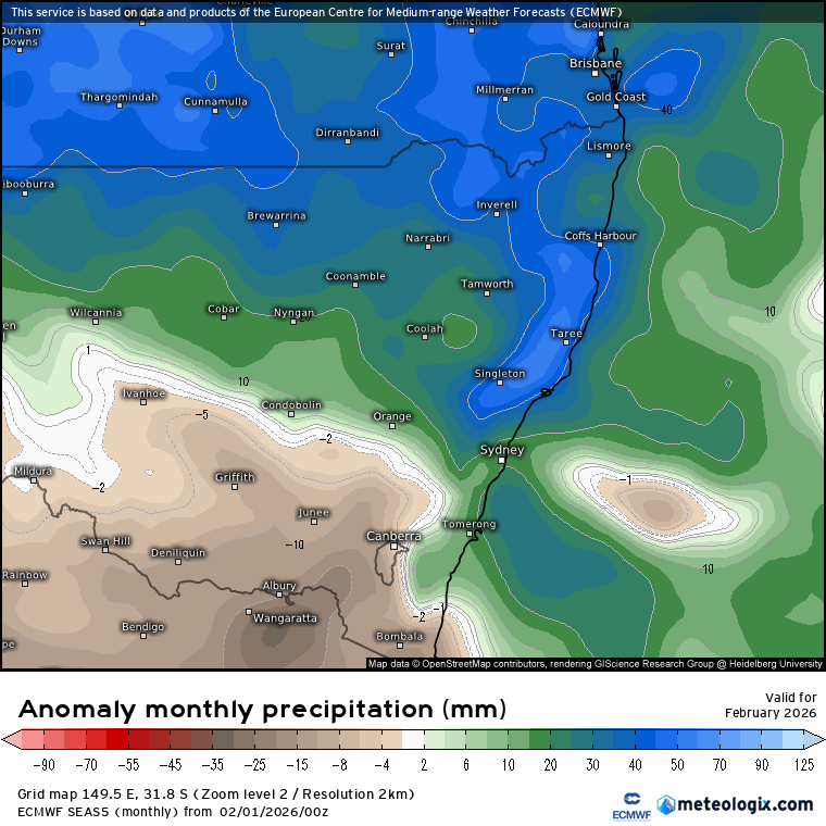
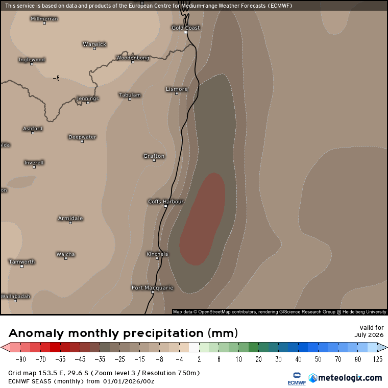
If it does play out as currently forecast we would likely see drier conditions move in late winter – for example here’s the latest rain anomaly forecast for our region for July from the European model:
…however before that happens we need to remember that (1) the El Nino pattern is not yet in place, and there are no guarantees it will develop…it’s just looking that way right now, (2) the forecast shows increasing chances of drier weather as a result of that pattern…but we can always get wetter spells even when the chances are for drier than average, (3) we have to also look to the southern circulation and Indian Ocean circulation later this year to see if they favour wetter or drier, and (4) if anywhere is going to get some rain even during drier spells it’s usually around our region…but regardless it’s worth being aware that drier conditions are looking possible later this year – more to come on that one over coming months…
For now we’ll have a chance to enjoy some summer showers over coming weeks – enjoy and keep dry. Thanks for making it this far through the post. I’ll post again if more significant / flooding rain look possible / when the next event looks likely.