We’ve got some very toasty waters just offshore from the NE NSW coast – tropical water getting pushed south:
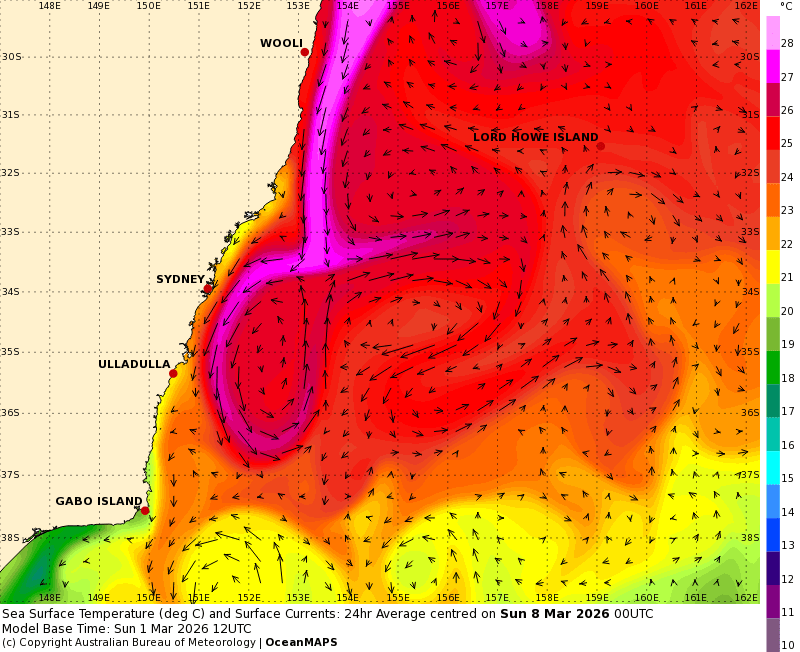
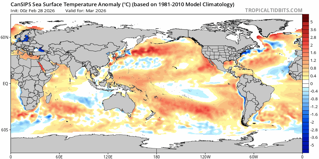
…from a warmer than average Coral Sea:
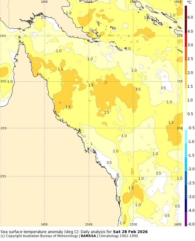
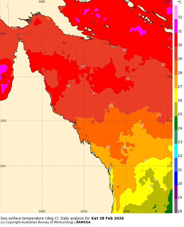
Combine the season with warmer than average ocean temperatures and sure enough the Coral Sea is hot enough to support cyclones. Current temps looking like this:
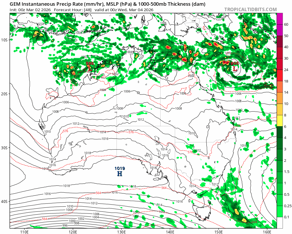
…and the satellite image showing a cyclone starting to develop just offshore:

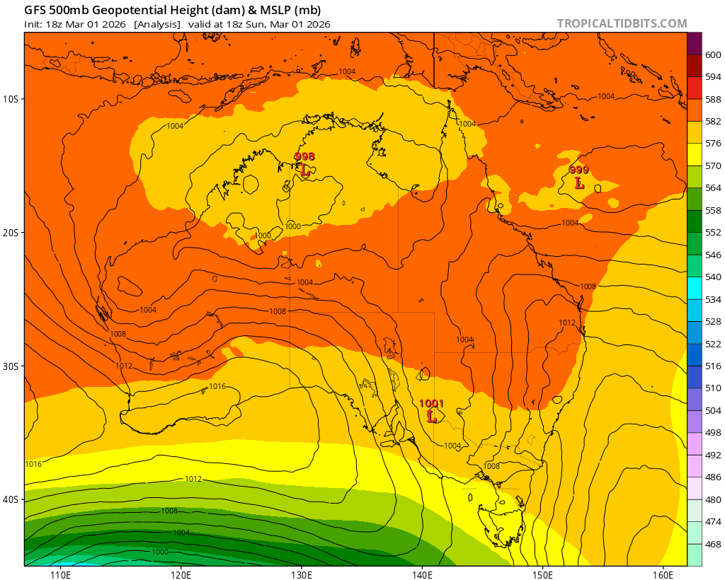
Models show this system developing further as it moves towards the Qld coast over the coming days. An upper trough then approaches from the west and looks to drag the system south east. There is a lot of time for things to change, but right now here’s how one of the models see the system developing / moving:
If it does pan out as currently forecast we could see some significant totals across parts of SE Qld. The EC and GFS models show this with their currently forecast rain totals:
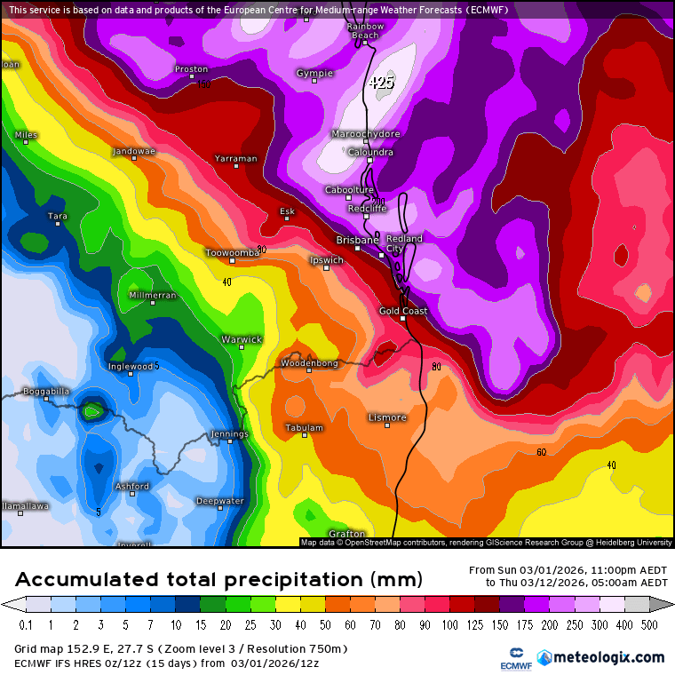
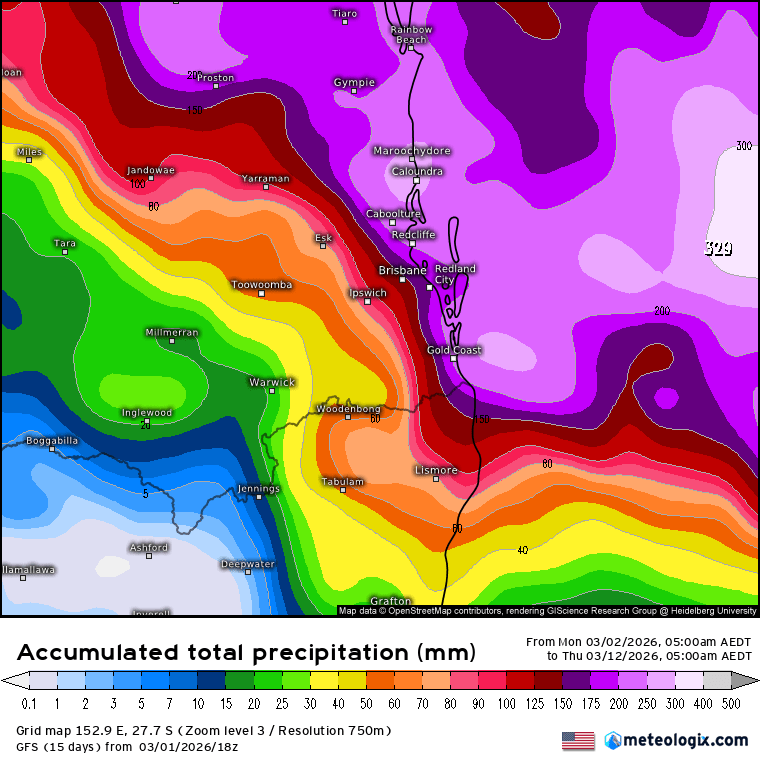
Lots of rain to our north but not much for our region according to those models. The latest Canadian model however shows the system moving further inland before moving SE – and thus bringing the chance of some wetter weather across our region:
Tropical systems are dynamic things and tricky to forecast. They usually bring significant weather with them – and a small change in their movement can bring vastly different outcomes for different regions…as such we’ll be watching this one closely – it’s a case of be aware (because there is the risk of some wetter weather) but not alarmed (as there is a good chance regions to our north will see the highest totals). I’ll post again later in the week with updates for our region, by which time we’ll have a much better idea of who will see the most impact from this system.
Looking further ahead and the potential for an El Nino still remains. Most models still show a significant warming across the eastern Pacific over coming months:
….however right now the conditions needed to reinforce the development of an El Nino are not in place…so it’s still a case of watch and see. A utumn is the time of year that sets the tone for the year to come so we’ll keep a close eye over coming weeks to see which way the atmosphere wants to move. If it does develop as currently forecast expect to see warmer and drier conditions as we move into late winter. More on that later this week when the latest longer term models are released.