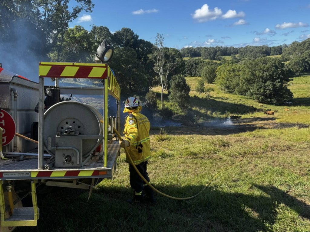
We’ve had a fairlyu dry couple of weeks – dry enough for local RFS brigades to have callouts to escaped burns:
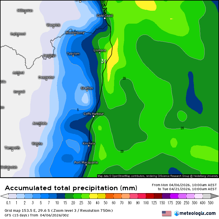
It’s actually looking fairly dry for the next couple of weeks as well. The current 2 week forecast rain totals from the GFS model flag how little we’re likely to see – just a few coastal showers from time to time, a few of which could make it further inland…but certainly no current forecast of any significant rain:
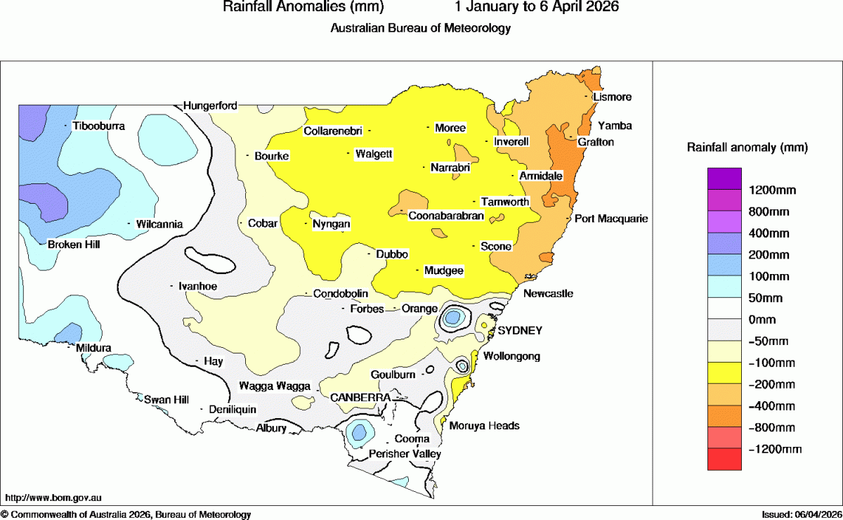
This follows the pattern of the year to date which has been significantly drier than average. Here’s how the year to date is looking:
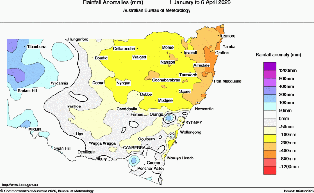
That map shows much of coastal NE NSW sitting at over 400mm below average.
If any significant weather events look likely I’ll post an update – but for now expect the dry to continue.
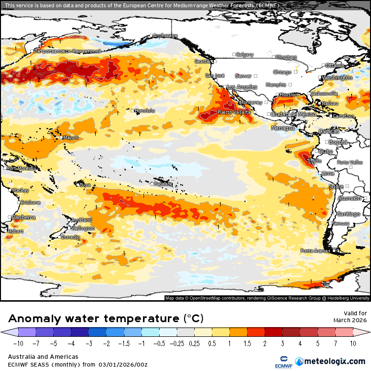
Looking further ahead and the latest Pacific outlooks have been released – and they all currently show a strong El Nino heading into our spring. Strong events have an ocean temperature anomaly in the 3.4 region of at least 1.5c above average – and if forecasts pan out we’re looking like easily making that threshold. The BoM outlook:
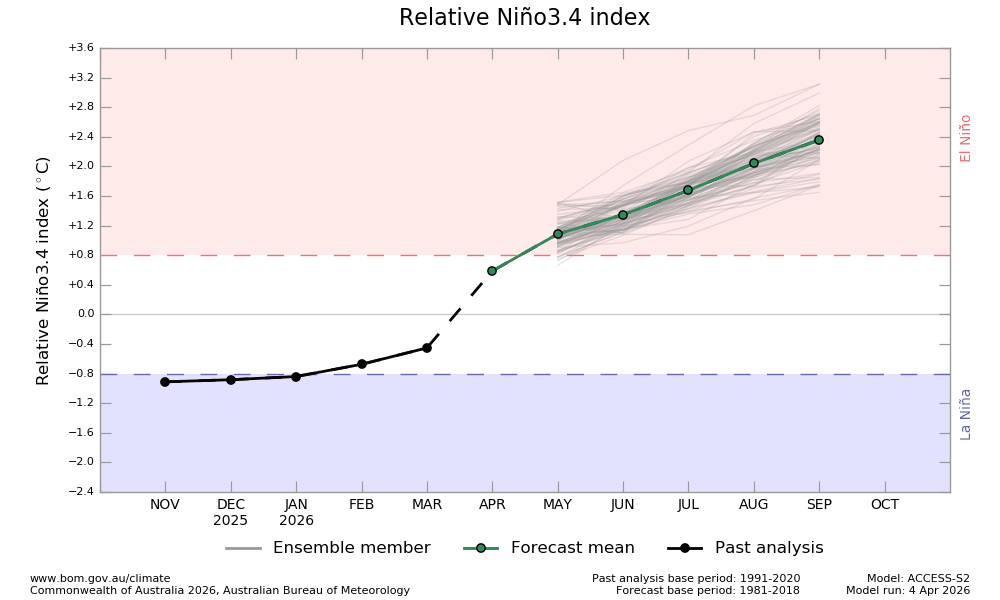
…shows us hitting 2.4c and rising by September. The CFS model:
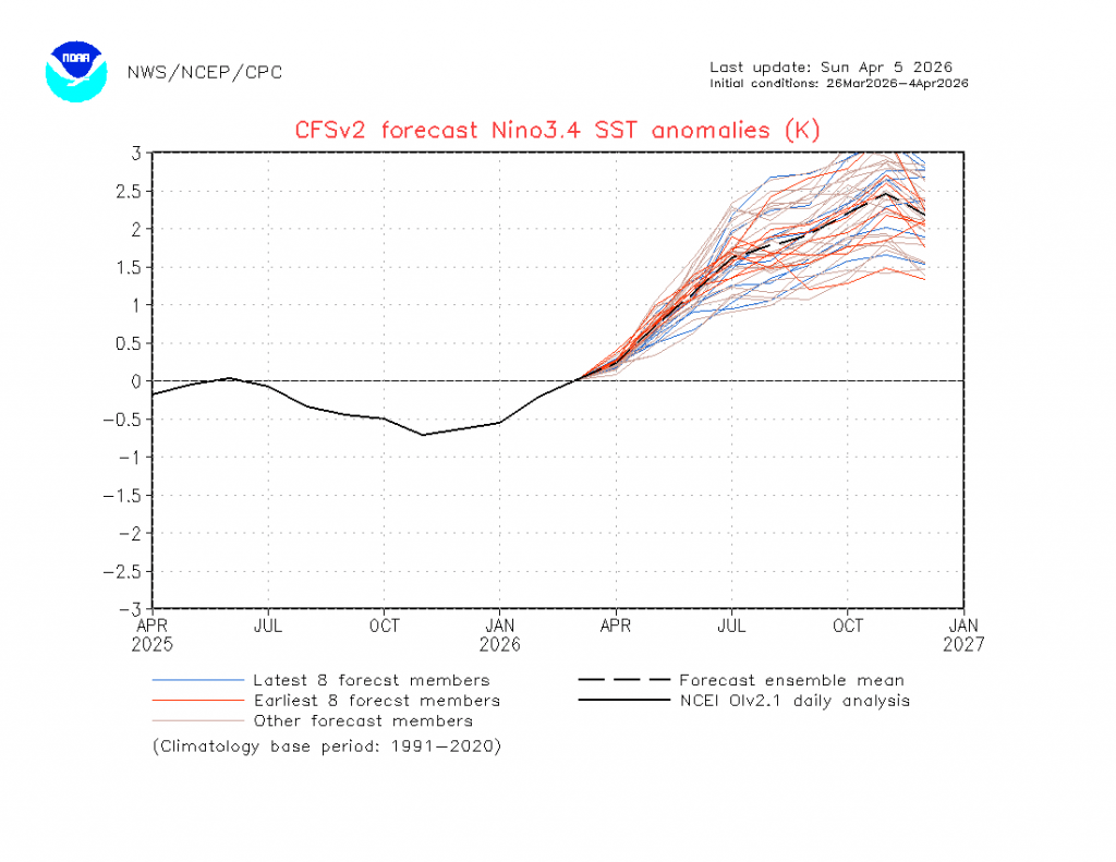
…shows us hitting close to 2.5c, while the top-of-the-class European model:
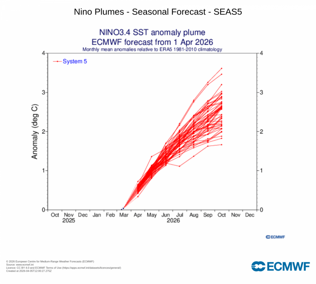
…shows us landing somewhere between 2c and 3c (and climbing). If those forecasts are on the mark we’ll see significant global impacts. For Australia that means a significant risk of hotter / drier weather in the east and the risk of a suppressed monsoon. East of the divide – where we live – is impacted but not always to the extent as west of the divide. We can still see wetter onshore events even during a drier El Nino episode…but still an increased risk of drier weather even for us.
One of our biggest climate drivers is the southern oscillation – something that is much harder to forecast in advance. In 2019 we saw the Pacific, Indian Ocean and southern circulation all push drier conditions, resulting in the devastating fires that hit much of the eastern seaboard. This year the Pacific is tending drier, the Indian Ocean is also tending drier (but not as strongly as the Pacific) and we’re months away from knowing what the southern circulation will do…so a good time to plan for drier but not get too stressed.
Temperatures on the other hand are likely to be well above average at times as we head into late winter and spring – both inland and, at times, along the coast. Higher temperatures can dry out fuels more quickly so from that perspective alone we’ll have to keep an eye on fire conditions as we head through winter and into spring. More on this significant event as we move through winter.
Looking at the global picture and – even before the El Nino has kicked in – the global average ocean temperature is sitting close to record highs – the red line shows 2026 values:
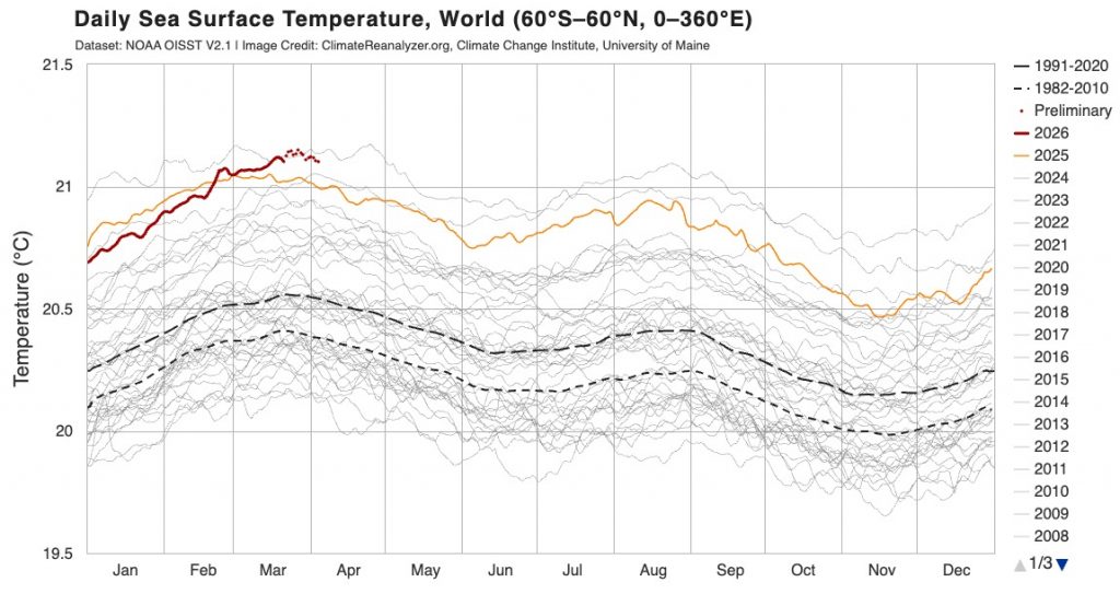
Once the El Nino fingerprint arrives expect to see us at record levels. Not surprisingly air temperatures are also sitting at close to record levels:
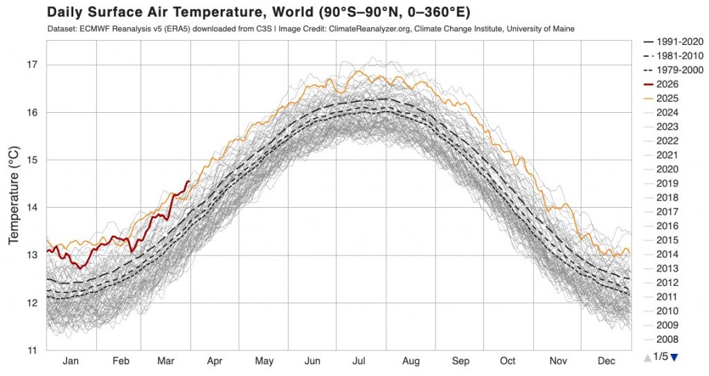
El Nino events release a *lot* of heat into the atmosphere – so likewise expect to see us hitting record levels as we end 2026 and move into 2027.
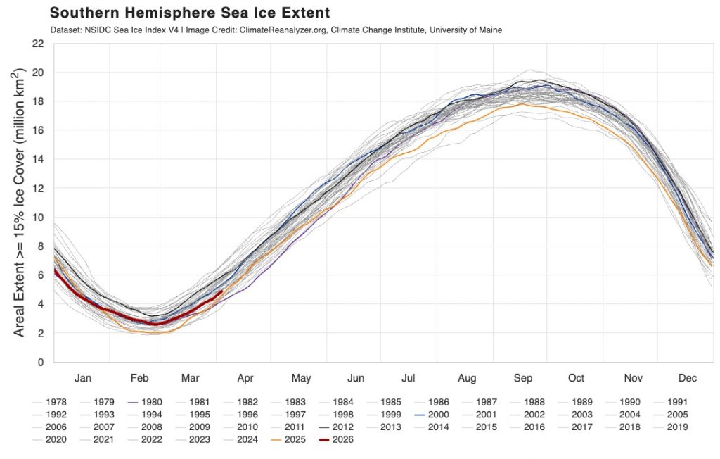
Some good news to finish – Antarctic sea ice levels are sitting close to normal for the time of year:
That’s all for now. I’ll post again when longer term outlooks are released / significant weather is looking likely. Until then thanks for reading 🙂