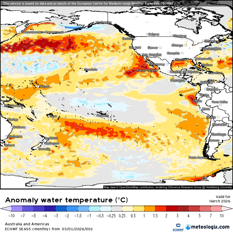
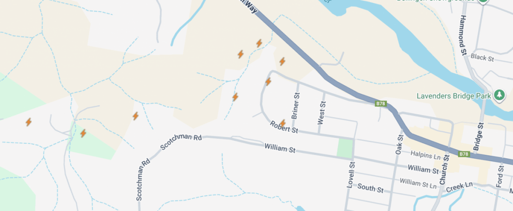
Well the promised storms certainly rolled through. Bigger storms late on Friday and then more in the west of the valleys through yesterday. Some decent rain totals as well – Thora saw over 40mm from Friday’s activities….though as is the nature of storms many saw considerably less. We had some good lightning as well – here’s the map showing lightning strikes from both days:
Quite a cluster in the west of town – not surprised to see some power outages in that area after the storms rolled through:
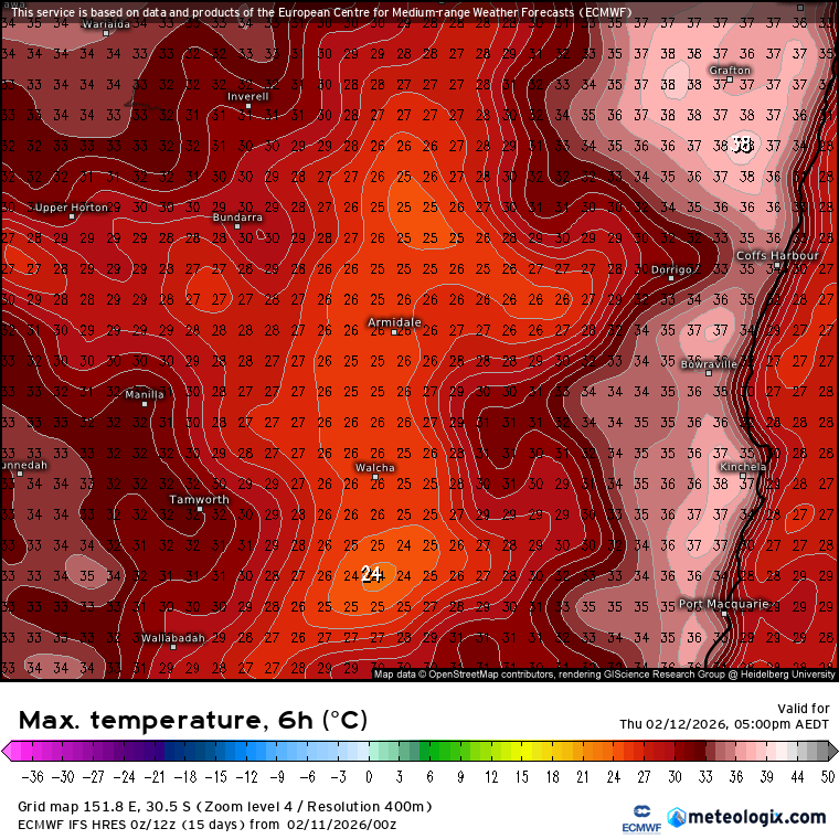
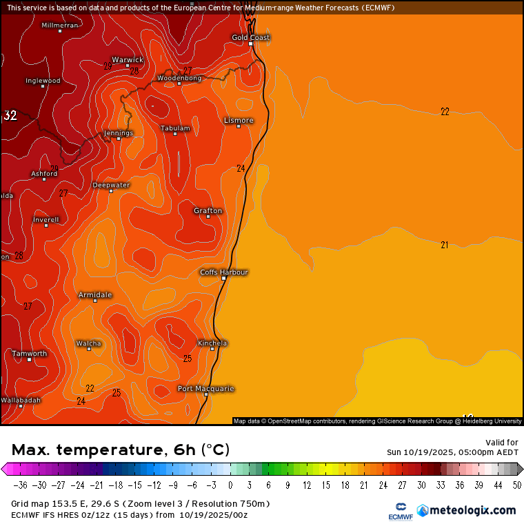
Good to see some decent rain with those storms as we have hotter weather roughh nlling in for the next few days – GFS won the battle of the models and a low will move across SE Aus and offshore to our south. That’ll drag in some hot air (though not as hot as western NSW) and with the low to our south we won’t see onshore winds until it moves away late Wednesday and into Thursday. Here’s the forecast max temps from today (nice and cool) through tomorrow (a quick heat up), Tuesday and Wednesday (peak of the heat) and Thursday (back to cooler conditions for us):
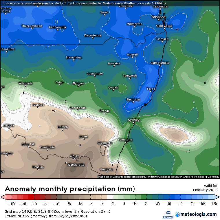
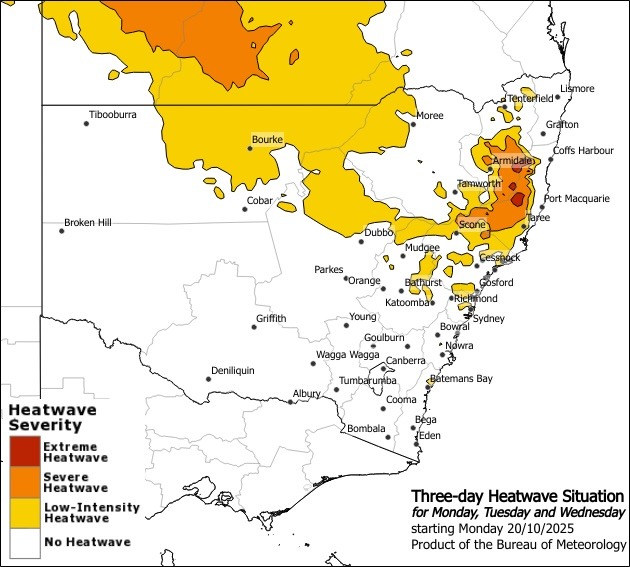
The BoM are in fact forecasting extreme heatwave conditions across the west of our region on Monday through Wednesday so worth being aware that temperatures could exceed what would normally be expected for this time of year in those locations. For those closer to the coast you’ll avoid the worst of the heat and could even be left wondering what all the chatter is about:
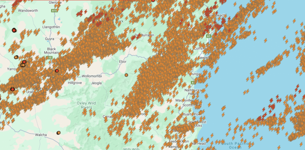
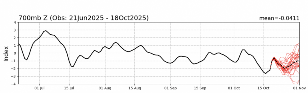
Looking ahead and the southern circulation looks to remain much weaker than normal over coming weeks:
This will continue to attempt to bring drier and hotter weather across our region at times…though from what we’ve seen so far the Indian and Pacific oceans are doing a pretty decent job bringing enough humidity to keep storms rolling through and the ground wet across our region. It won’t take much for it to dry out so we’ll still need to keep an eye on conditions over coming weeks.
At this stage it’s looking like the next change will move through next weekend and again late the following week. We could see storms kicking off with each change as it moves through but no significant totals looking likely at this time.
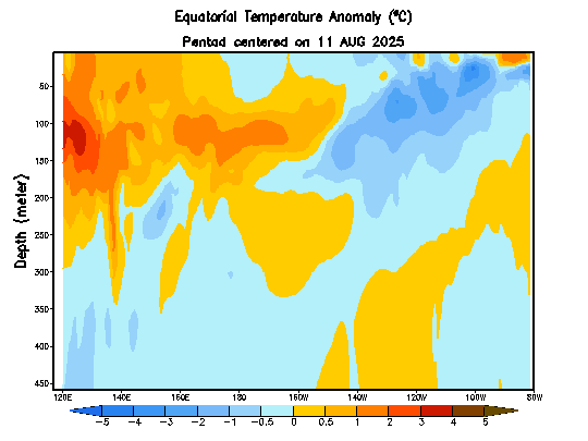
The Pacific is still looking La Nina-ish over coming months – however this cross section animation through the Pacific shows warm water starting to build across the west, and (with the right conditions) we could see that heat move across the Pacific and bring more El Nino-ish conditions through next winter and spring – something to keep an eye on:
That’s it for now…enjoy the cool when it’s around and take it easy in the heat.