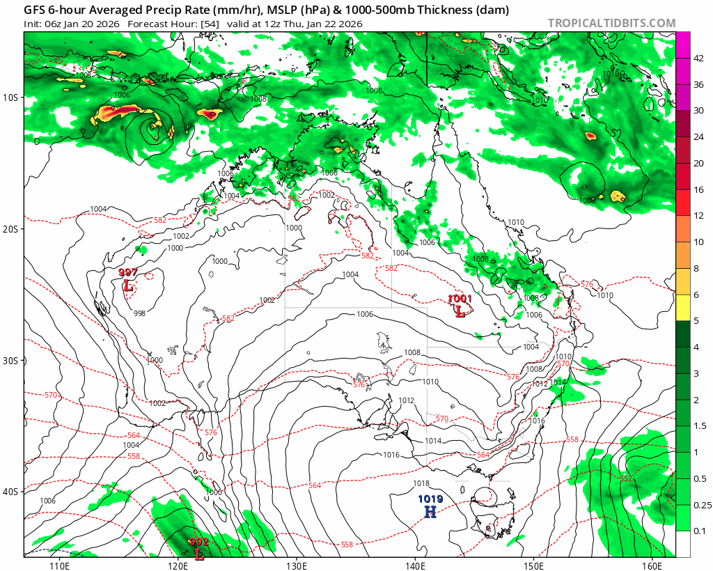
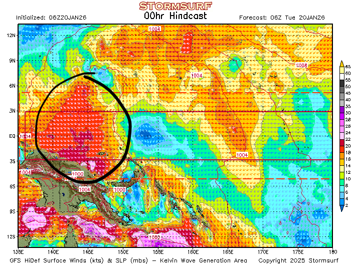
We’ve had a wet spell recently but that’s now clearing away. What we’ve got coming up is a drier spell across much of south-eastern Aus, and a cyclone likely to cross the WA coast and make it’s way inland. That’s important because cyclones have a lot of hot wet air rising inside the circulation. A lot of the water in the air condensates as it converts to rain, releasing even more heat. All that heat goes up…and must come down somewhere. The projected path of the WA cyclone means that a lot of the heat is likely to end up across SE Aus… First off here’s the projected path of the cyclone:
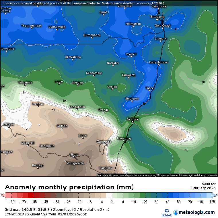
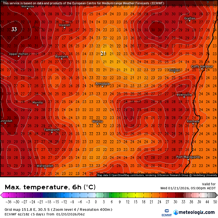
Lots of rain out west but not much incoming across our region. Now here’s the forecast max temps for tomorrow – warming up but not that hot :
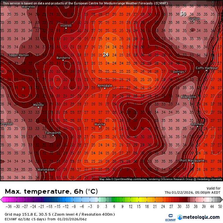
…but by the time we hit Thursday it’s warming up a little more:
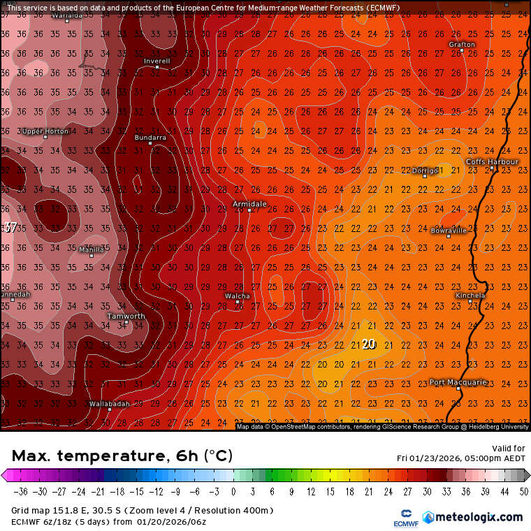
The good news is that we’ll see some cooler air move back in for Friday:
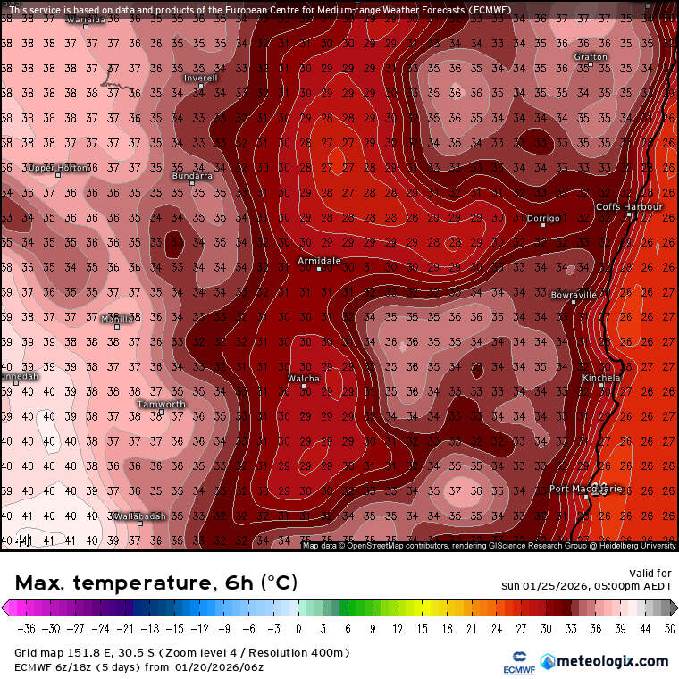
…but you’ll notice the heat still building west of the divide. Over the weekend we’ll see that heat continue to build inland…and will need to keep an eye on it as we could see it push east of the divide from time to time. It’s a balancing act – west of the divide is pretty much guaranteed big heat, but to the east we could see slightly cooler air try to move in. Regardless…we’re still looking at the potential for some significantly hot weather at times. By the time we get to Sunday we could see some real heat building across the valleys:
….and right now it looks like it could get even hotter come Monday – but it’ll be hotter still further inland:
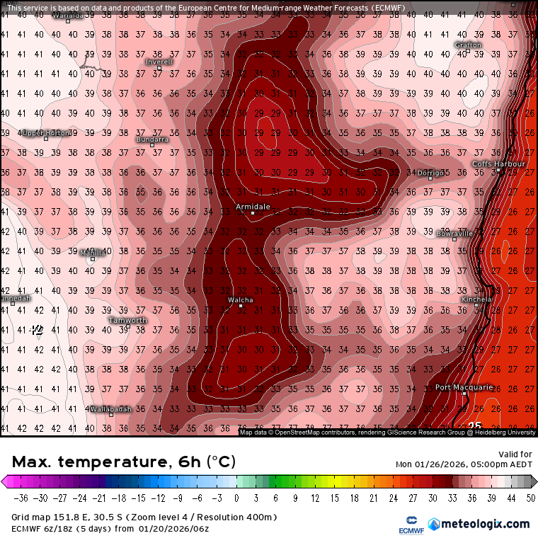
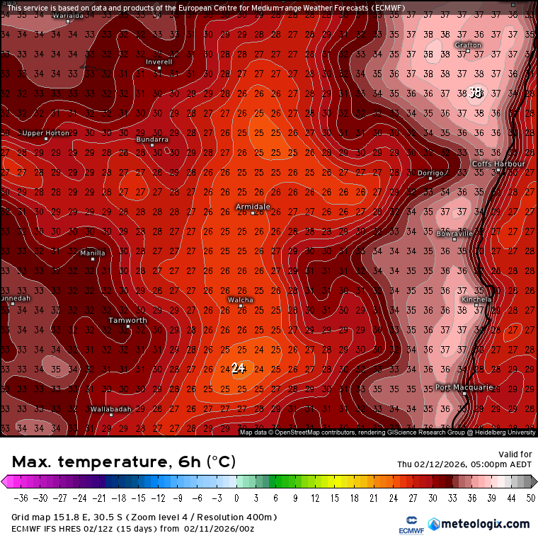
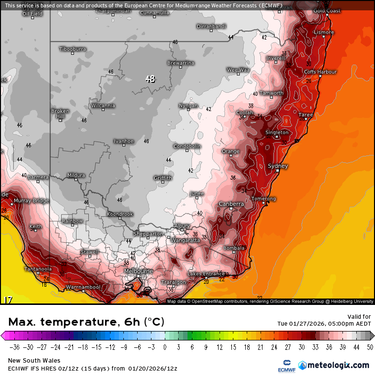
Monday is some way off, so don’t take those figures as fact just yet as there is also a good chance that the heat will remain west of the divide (where they will see well over a week of temps into the 40s) but worth the heads up that we could see some significantly higher temps rolling in from time to time over the coming week – at least until we see a change roll through the inland to clear the heat away. To give some idea of the heat across the inland here’s the currently forecast top temps for next Tuesday:
I’ll post again through the weekend with temperature updates. A quick look further ahead and we’ve still got a westerly wind burst in a key part of the Pacific:
That wind burst will push warm water east…and come up against warm water being pushed west. Where they meet the water can’t go up, so if the winds are strong enough it will get pushed down…generating an under-ocean wave of warm water that will move east and surface near the South American coast. If we see a couple of these events happening it can push the ocean (and then the atmosphere) into an El Nino state – and that is what the models currently see happening over coming months. Here’s the current forecast from the GFS model through to October:
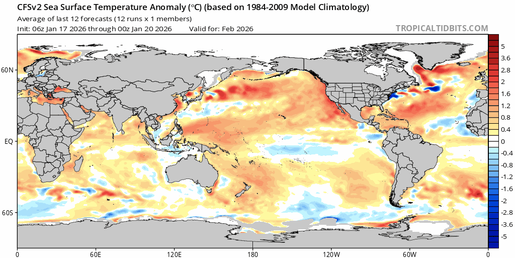
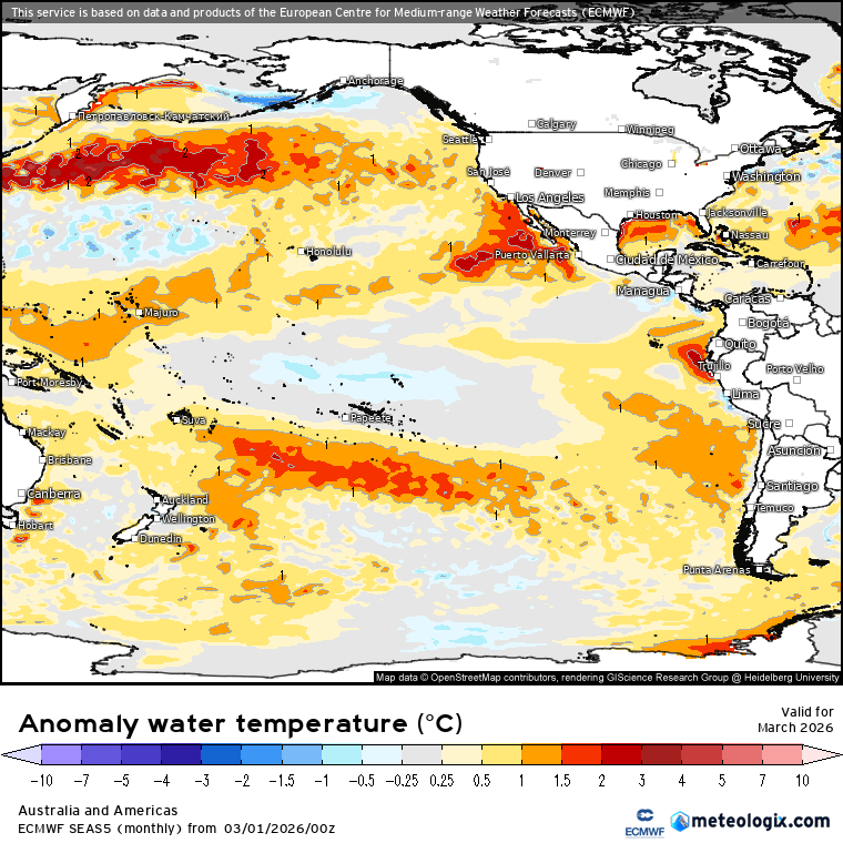
You can see the initial cold pool in the central equatorial Pacific (which may yet give us a wetter spell through Feb or March) quickly fade away and get replaced with much warmer water surfacing in the far east. That could well bring El Nino conditions late winter and early spring – something to keep an eye out for. We are also significantly influenced by the Indian Ocean and the Southern Circulation…so it’s not yet clear how conditions will develop over coming months…but the Pacific is BIG influence on our weather so definitely one to watch. More on that over coming months.
Until then keep cool, enjoy the cooler spells when they move across…and keep an eye on temperatures over the coming week.