it’s been a while since a post so a chance for some ramblings about what’s happening, and likely to happen. it’s rainy and cold as I write this – and that’s in part because the Indian Ocean Dipole (IOD) is turning negative. Here’s a quick explainer of the IOD:
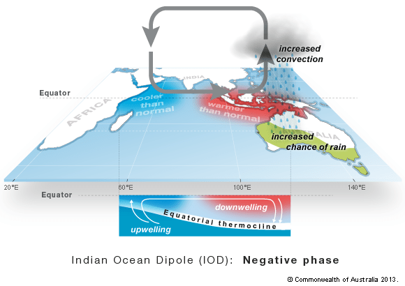
A negative IOD typically results in above-average winter–spring rainfall over parts of southern Australia as the warmer waters off northwest Australia provide more available moisture to weather systems crossing the country….and right now that’s exactly what is happening. I’ve added a doodle to the satellite image from yesterday that clearly shows a large plume of moisture moving across the country from the northern parts of WA:
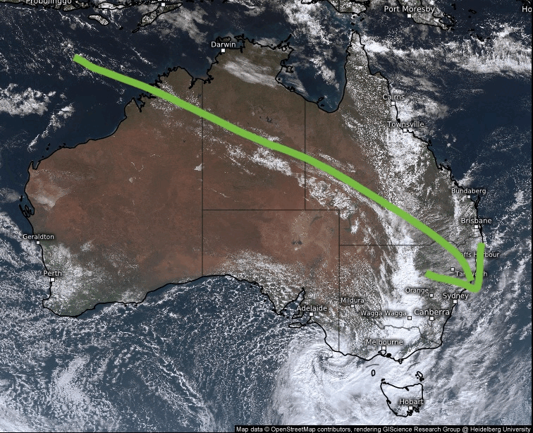
As that tropical plume hits up against an upper trough sitting across inland NSW the moisture condenses into rain…mostly on and west of the divide (as the air warms again when it drops off the divide and into the coastal plains thus reducing rain once again for the coastal strip)…but we’re still seeing some in the valleys as some Coral Sea moisture also comes into play.
We’ll see this happen once again this weekend as another strong change moves to our south and meets another moisture plume from WA…before it dries up a little into next week. Looking further ahead and the southern circulation is heading back into neutral territory in the short term:
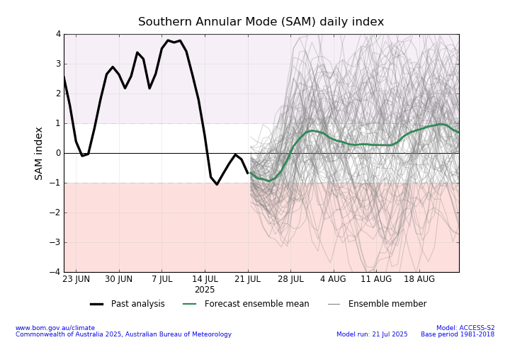
…and as such will have less of an impact on our weather in the short term. Looking further ahead and there are some signs that the upper air over the south pole is warming:
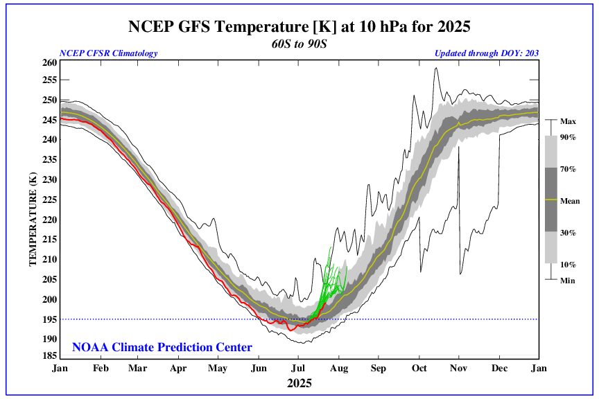
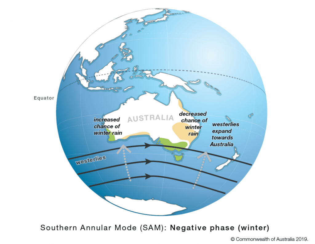
The red line shows observed temps and the green lines show the forecast. No guarantee this will play out as above but something I’ll keep an eye on – if it does we’ll likely see a weaker (negative) circulation as we head into late winter, with the chance of drier weather – as can be seen on this explainer from the BoM:
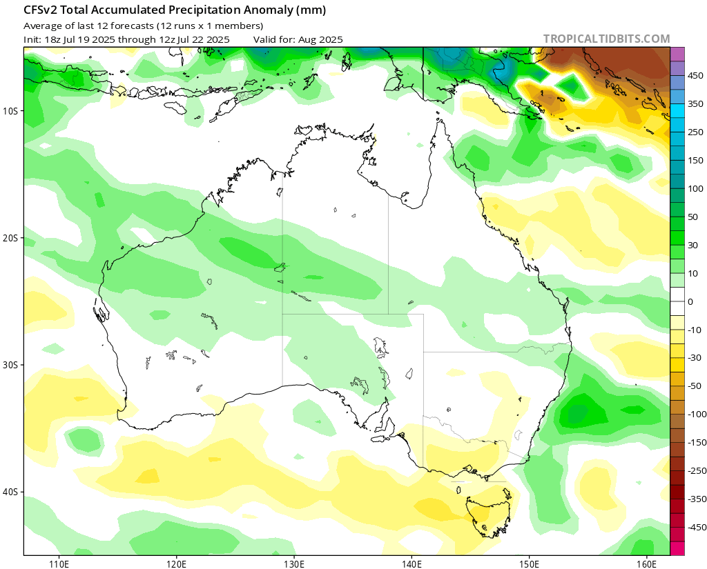
….that is some time off however and only a chance right now – will post again over coming weeks with an update. Sometimes different climate influencers can play against each other, and countering this is the forecast of continuing wetter influence from the Indian Ocean – in fact the forecast for August shows wetter weather streaming across from WA at times through the month:
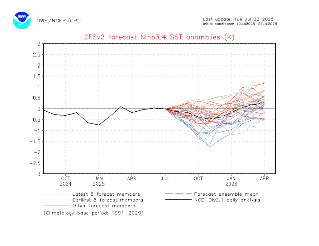
Looking further ahead and the Pacific looks like turning more La Nina-ish over coming months, with return to neutral and perhaps even El Nino-ish conditions as we head into 2026:
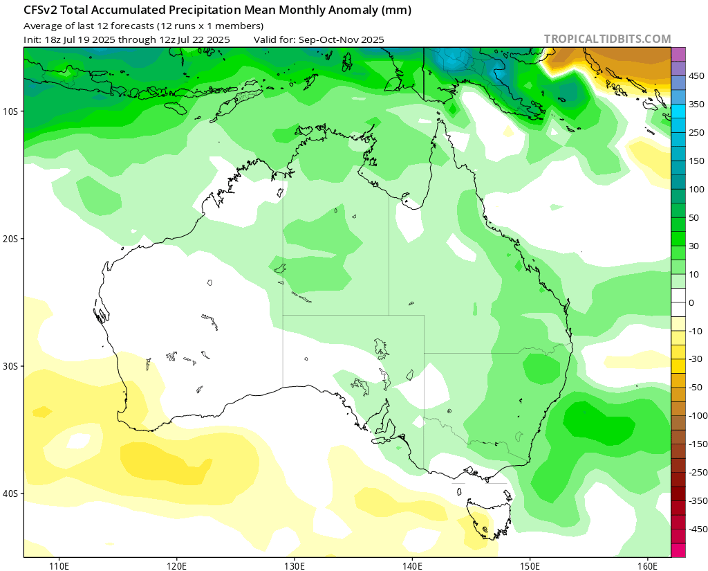
…but again that is a long way off. We can however see this forecast playing out with wetter weather forecast for our region through spring:
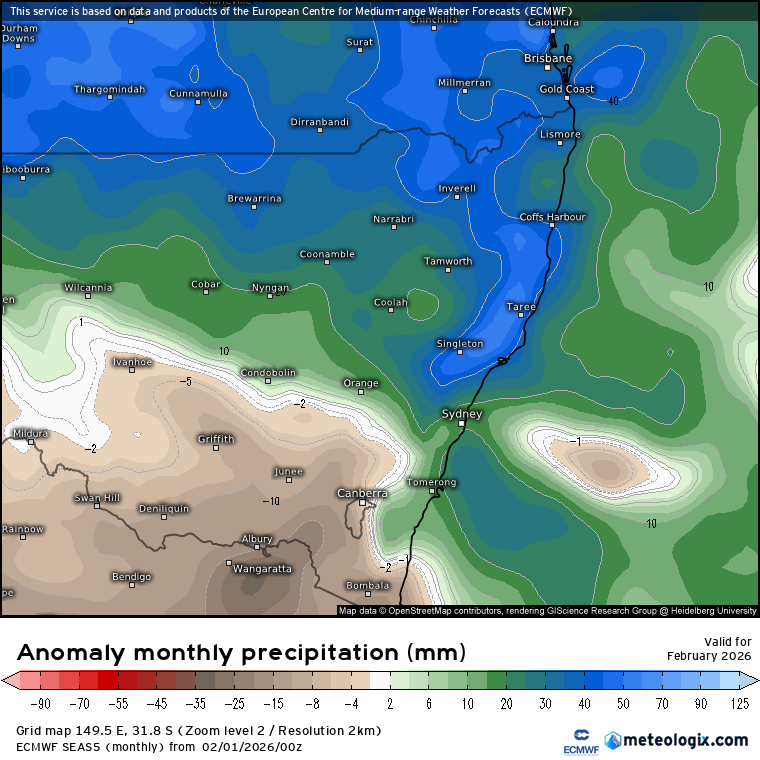
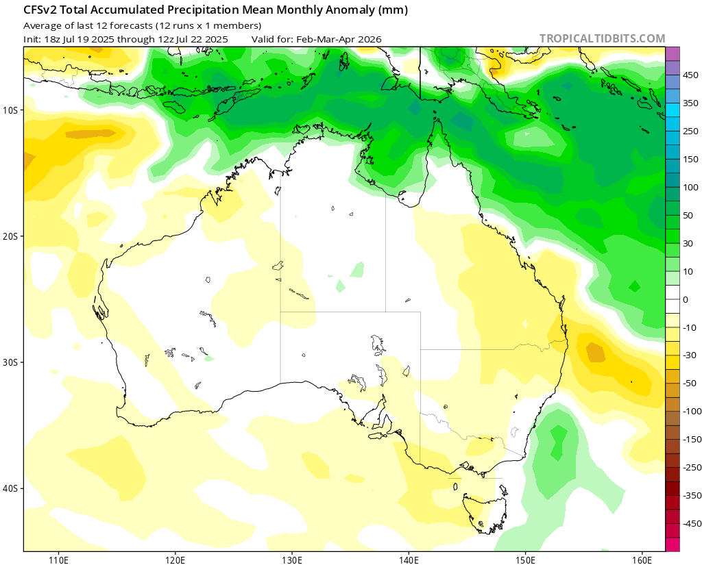
…before conditions look to dry out as we head into late summer / autumn:
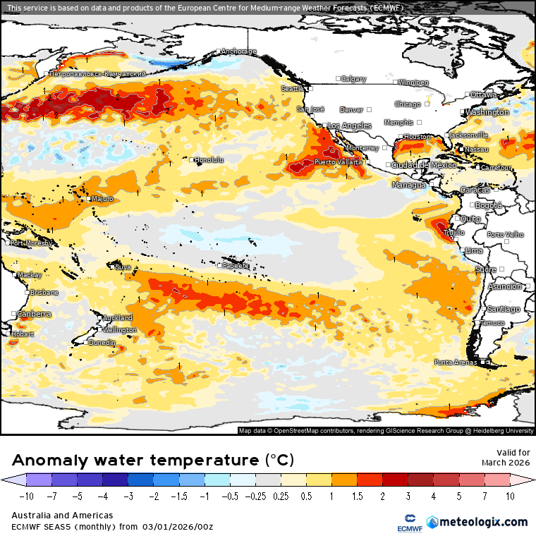
It’s worth remembering however that drier than average at our wetter time of year doesn’t necessarily mean dry…just hoping it means drier than the autumn just gone was! It’s also worth being aware that global ocean temperatures are sitting well above average:
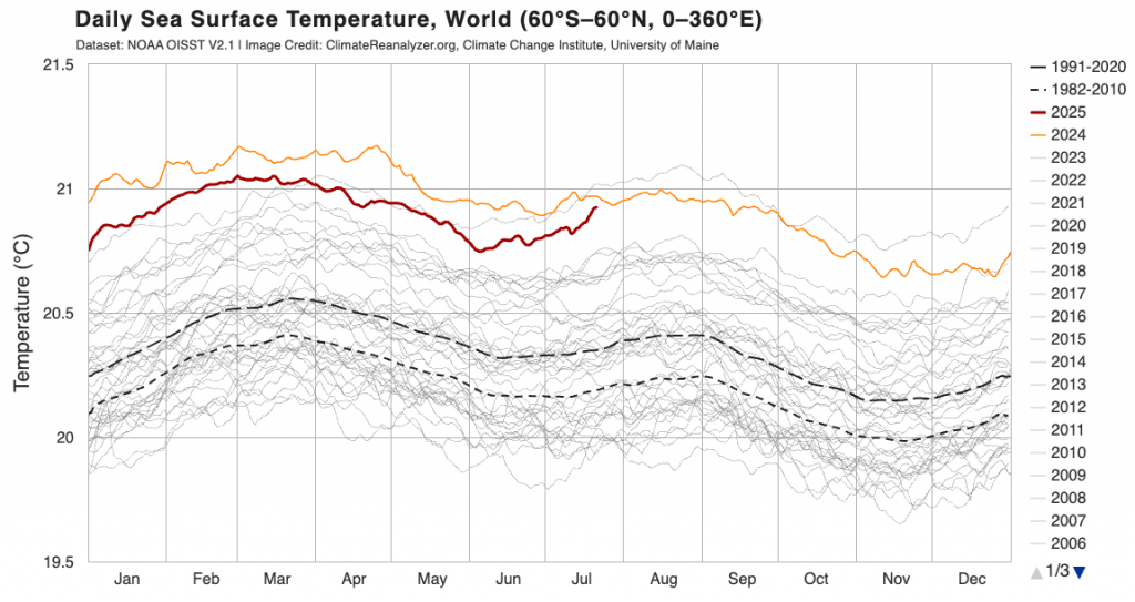
Whilst that doesn’t guarantee wetter weather is can make any wetter weather that does happen even wetter than it would have been – particularly with the Coral Sea currently sitting well above average:
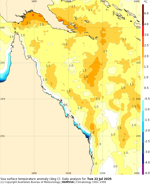
The Coral Sea anomalies feeds south along our coast via the East Australia Current – so while we continue to see hotter than average temperatures to our north we’ll continue to see them subsequently work their way south along our coast.
Worth noting here that the US Government is currently withdrawing funding / access for many of the monitoring systems that are used to assess the state of the global climate. Whilst this won’t stop the oceans and air from warming, it will make it harder to keep on top of what is happening.
On that cheery note back to the current weather, which is likewise less than cheery. Looking forward to more sunshine next week!