Anyone else over the rain? Totals have not yet been too high but a little rain over numerous days can still create a heap of mud – as anyone at the awesome Riversounds event at the showground can attest!
The showers, while persistent, haven’t given us huge daily totals – and a change (finally) moving in from the west tomorrow will clear them away for at least a few days…but as that change moves in the convergence of westerly winds meeting the onshore easterly flow, combined with some cold air up high, will generate some more significant convergence and a trough along the coast…and that means the risk of a significant uptick in rain totals later tonight and tomorrow. Here’s how it looks tomorrow:
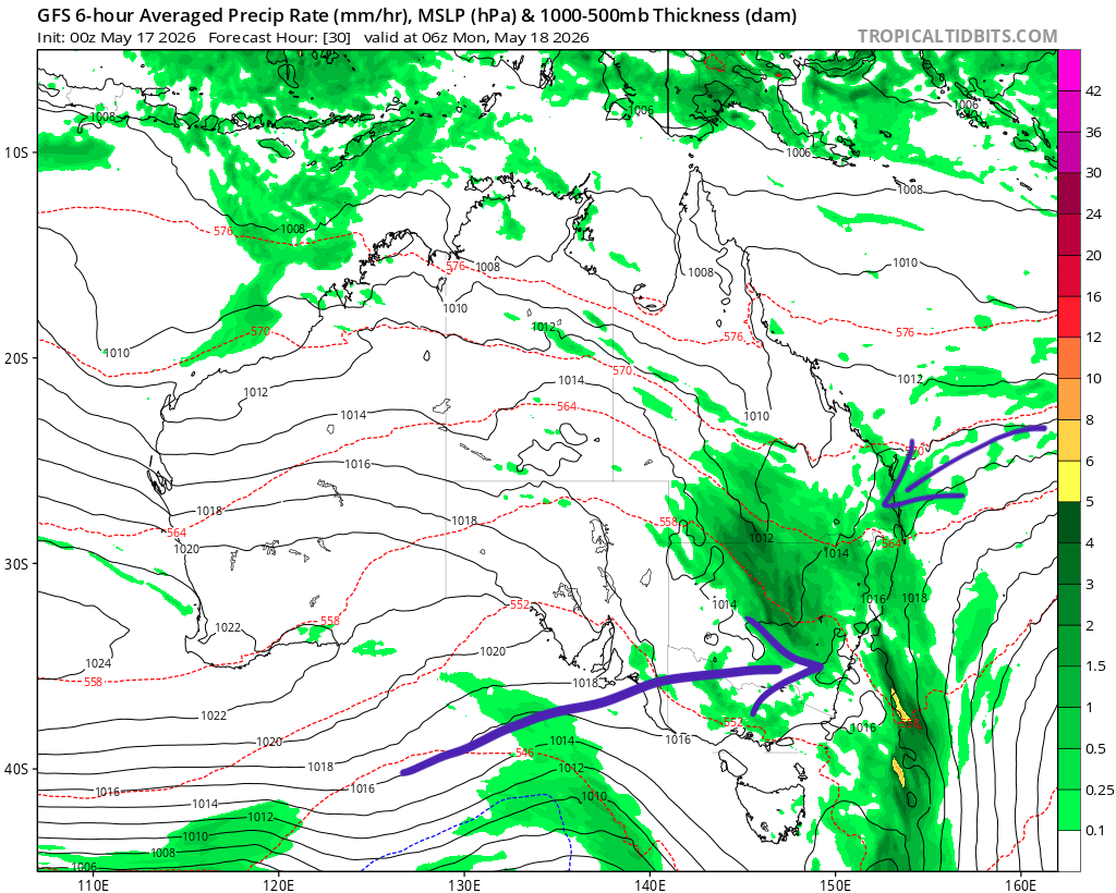
..and the animation for the week ahead looks like this:
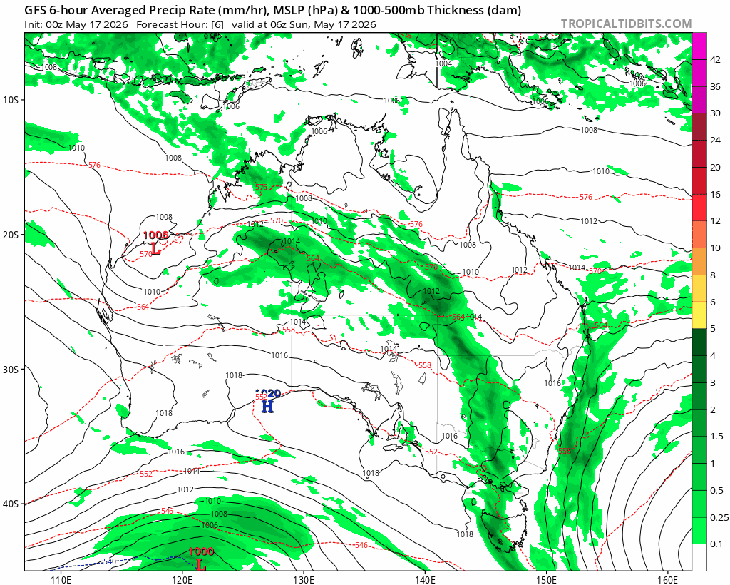
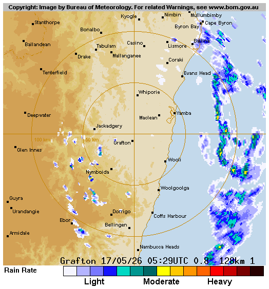
What does that mean in real time? The band of showers that gave us the rain yesterday has moved offshore:
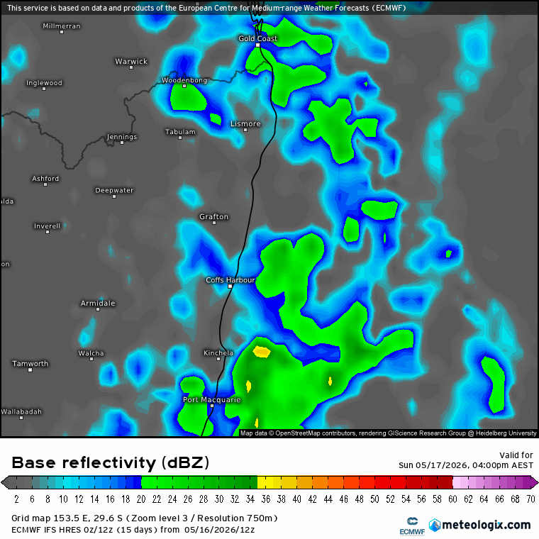
The forecast radar animation shows it well – the band moves onshore overnight, sits over us through tomorrow and then the westerlies win out and push it offshore once again:
Models show a range of totals so an average is likely the best forecast – and here’s the forecast totals until Tuesday:
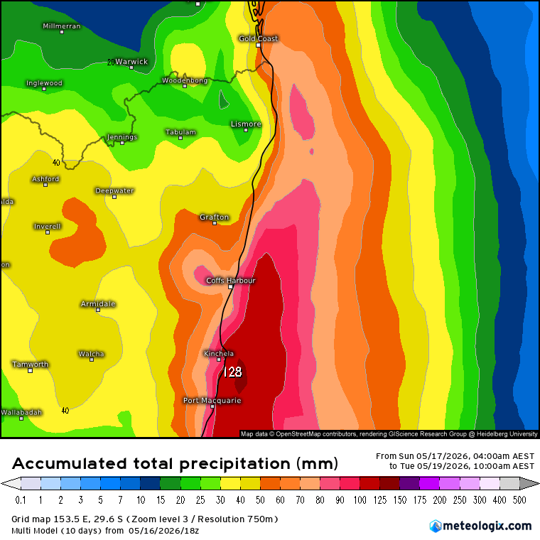
We’re unlikely to see widespread flooding from this event, but with saturated ground we could see some creek / river rises. More importantly the trigger for Waterfall Way closure at Gordonville’s Crossing is 50mm in 24 hours / 100mm over a week…and there’s a reasonable chance we’ll hit those totals over the next 48 hours…worth being aware and planning accordingly.
Once the current band moves offshore overnight Monday we’ll hit some drier weather for a few days. There’s a decent chance of more showery weather over coming weeks but we’re used to that by now!
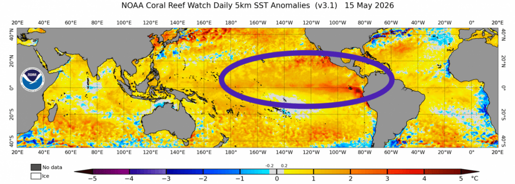
Looking further ahead the forecast El Nino is starting to develop across the Pacific:
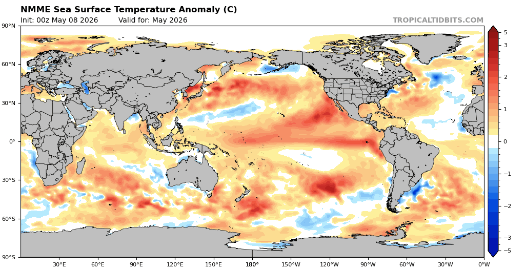
…and models show it continuing to strengthen over coming months, with a strong event looking likely. Here’s the forecast through December:
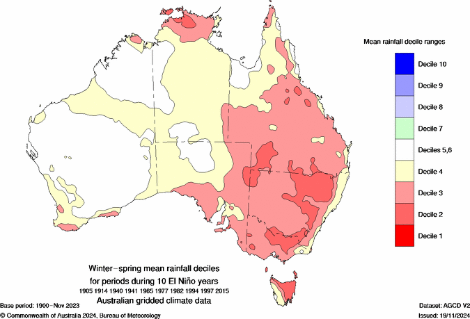
The event will have a significant global impact, and will likely take global temps to record levels in 2027. For eastern Aus the event should reduce rain totals across much of NSW, however impacts east of the divide are (usually but not always) less significant. Here’s how El Nino events usually impact Australian rainfall through winter and spring:
Rain impacts will kick in as the El Nino develops – likely June or July onwards. Whilst rain totals across our region won’t be impacted as much as elsewhere, temperatures however are likely to be well above average day and night right across Eastern Aus – in fact here’s the maximum temp forecast for July through September:
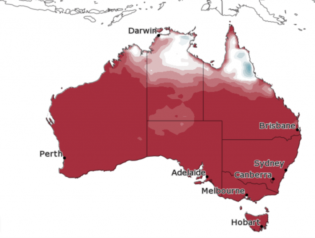
No escape on the coast for that one. We’ll usually expect westerly winds ahead of changes, and when that happens we could see some very hot weather drawn across our region from the inland.
Enough for now, thanks for reading, and keep an eye on rain totals through tomorrow, particularly if you need to travel west of Bellingen. Updates will be posted via the Bellingen Council website and Live Traffic if the road is temporarily closed.


