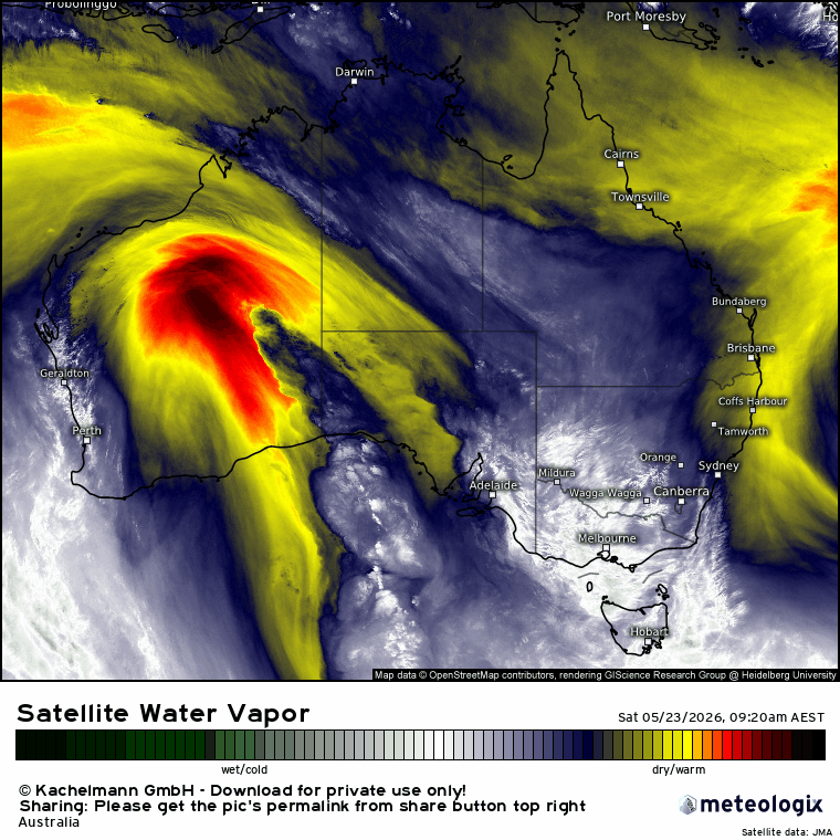
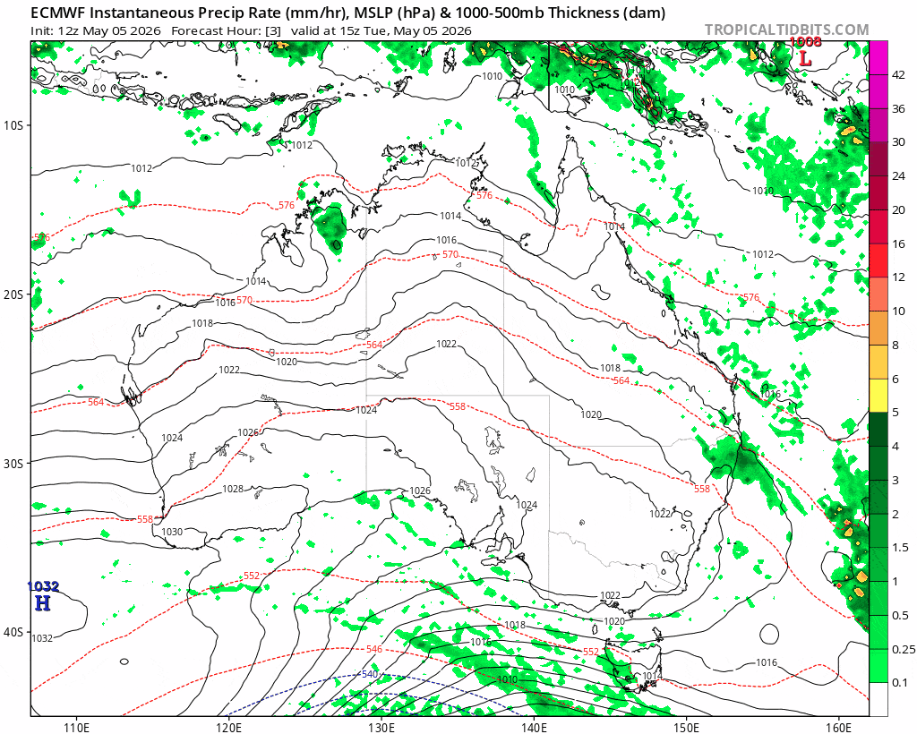
After what seems like a never ending stream of showers we’ve finally got some drier weather moving in as a southern low (temporarily) blasts all the showers back out to sea. We can see this happening on the 10 day animation below – initial drier blast moving in, then a drier spell for the coast, and then showers pushing back onshore once again. I’ve paused the animation at each step – dates are at the top:
Enjoy the dry while it lasts…suspect it’ll make a longer return this winter but not just yet. Beyond the 10 day mark there’s a chance we could see a more significant wet spell – but that is way outside the decent forecast range of the short term models so we’ll leave that for now…and will post again if it looks more likely in a week or so. Worth nothing that even though we have seem a row of wetter days we haven’t seen any decent totals…so the surface is fairly wet but deeper down it’s still fairly dry. If we do get a drier spell late winter / spring some sub-surface moisture would come in handy.
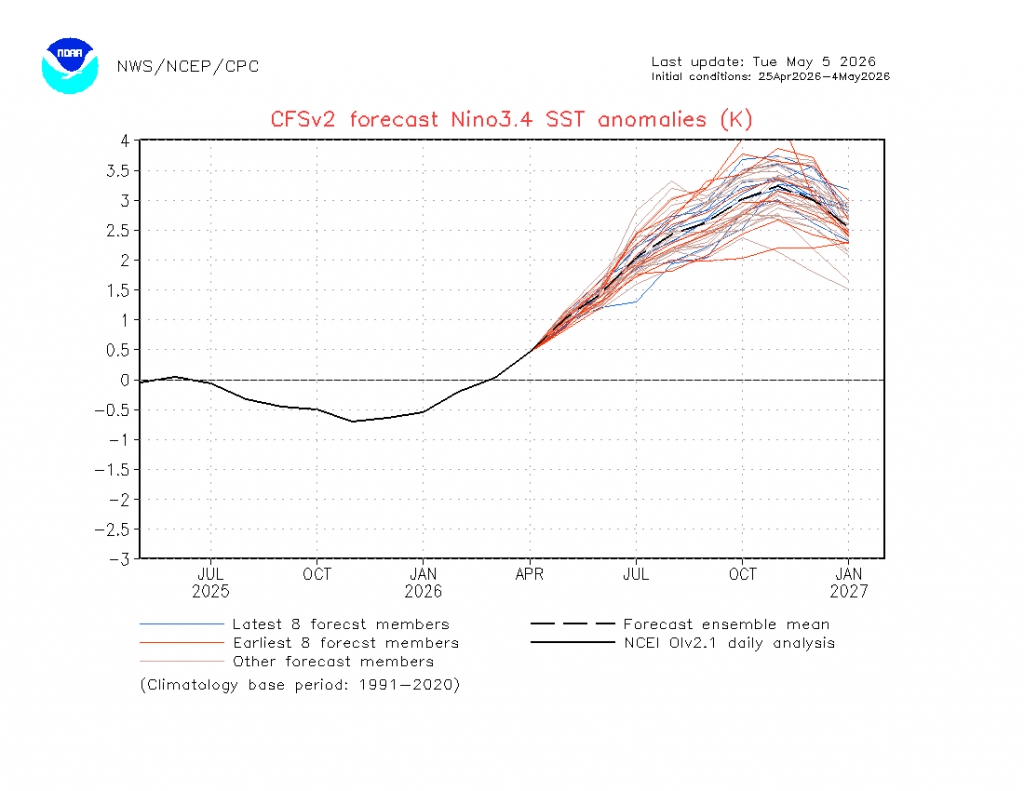
We’re into early May – and that means the sun starts getting stronger again later next month (!!) – and the longer term monthly models have just been released. The US model still shows a very strong El Nino forming:
…and this matches with the European model which is heading into record territory:
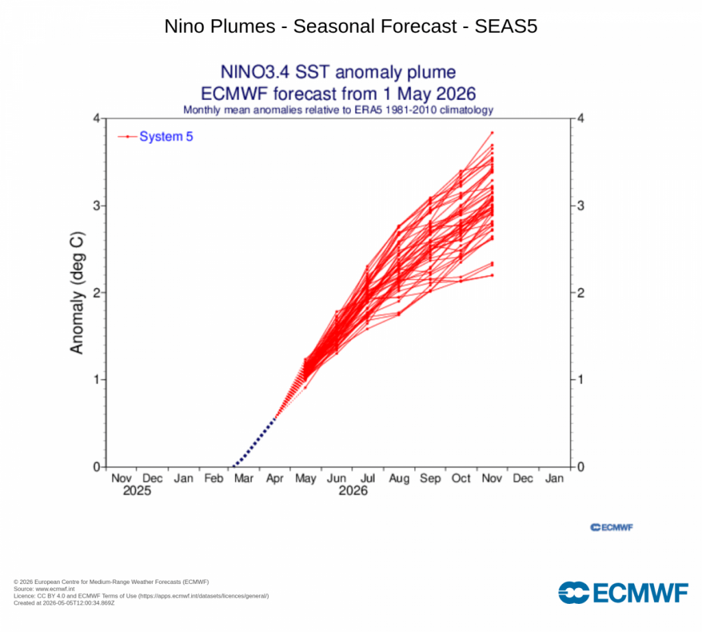
To give an idea of how strong the European model is, here’s a great explainer using the same data from Jeff Berardelli:

As usual we’re still some way out from the event – it could well end up a little different to the forecast – however models have been remarkably consistent with their forecasts for what could be a very significant event.
While we have some impacts east of the divide the strongest impacts are usually west of the divide. We can see this playing out even with the current showery spell – decent showers east of the divide but head to Armidale and beyond and there are still bushfires kicking off….as such it’s worth being aware but not stressing too much! There is also more than enough time for models to back off a little over the coming months – the more extreme an event the harder it is to forecast.
Looking at other climate drivers and the Indian Ocean driver is also indicating drier likely, but it’s looking a little less strong than it did last month. We’re still a couple of months away from knowing what impact the Southern Ocean circulation will have on our late winter / spring weather…more to come on that one late July / August.
Until the next post thanks for reading and likewise thanks to Kombu and Snapfrozen for keeping the Bellingen Weather site running 🙂