After a week of showers…we’ve got more to come. The 15 day animation shows showers rolling onshore from time to time until the weekend, when a southern ocean storm will push everything offshore for a time…before a chance we’ll see more showers moving back in:
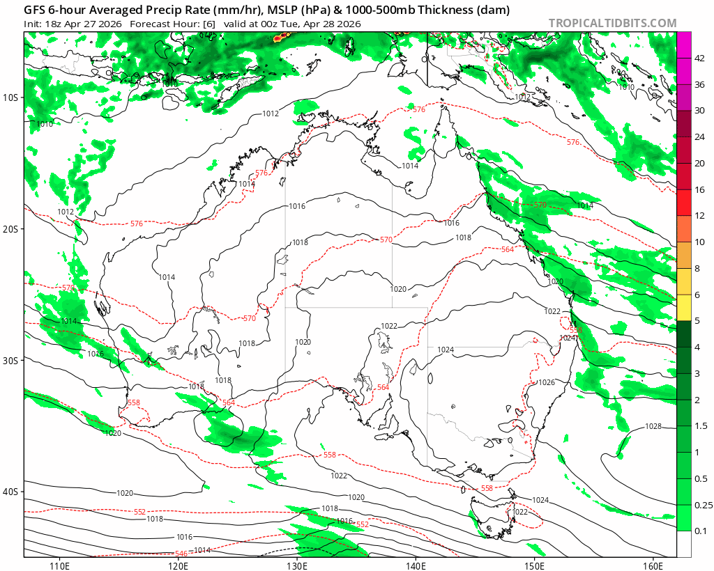
You can actually see the potential for 2 southern ocean systems to move in – and they’ll initially draw some warmer weather across our region (expect temps in the upper 20s, perhaps 30) before much cooler weather moves in:
Showers will be focussed mainly close to the coast and along the ranges. No huge totals likely at this time, just an ongoing increase in totals over the course of a week….which might add up to a decent total if you receive a stream of showers over a number of days. Conversely we’ll also see some decent drier spells, particularly as warmer-then-cooler westerly changes move through. Most of the rain with the westerly changes will sit on / west of the divide but don’t be surprised to see a stormy change move through as cooler air moves in.
Looking further ahead and there is a huge pulse of warmer than average water moving across the Pacific, just before the surface:
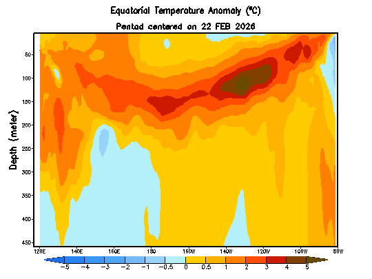
As that wave surfaces expect a rapid move towards El Nino. We’re already seeing warmer ocean temps surface in the far east:
…and those warmer temps will likely increase significantly over coming weeks. It even looks like another warm pulse is starting to develop in the west (and will then move east). The westerly wind bursts that brought those kelvin waves can be seen at the top of the image below…and it looks like further (weaker) westerly wind bursts will develop over coming weeks (see bottom of the image):
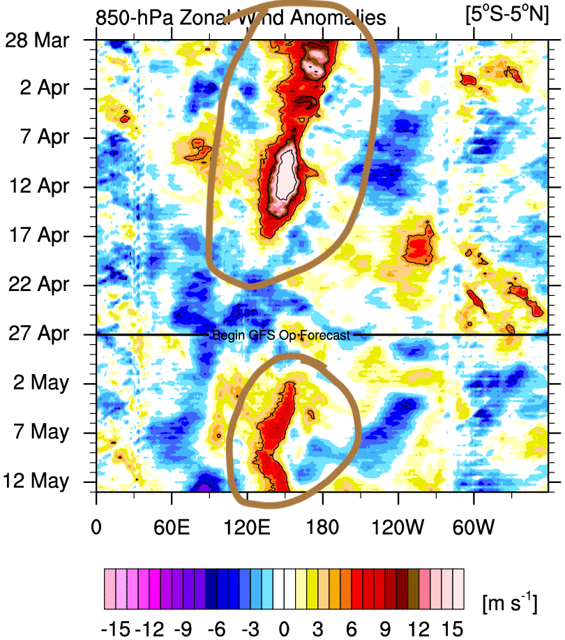
…so as such we’ll likely see a further push towards a decent event this winter. Models show a mighty strong (and potentially off-the-chart) event incoming:
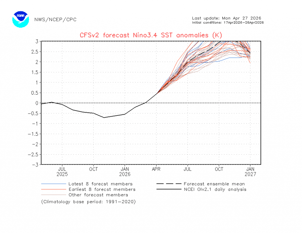
…but (1) models also tend to over-estimate events (2) with climate change taken into account the event looks a little less intense and (3) we’re still in our autumn predictability barrier so things will likely end up not quite as intense as models are suggesting…so despite spectacular model graphics we don’t yet know how this event will roll for us through the year. Regardless there are signs of a potentially strong event incoming – further updates incoming over coming months…
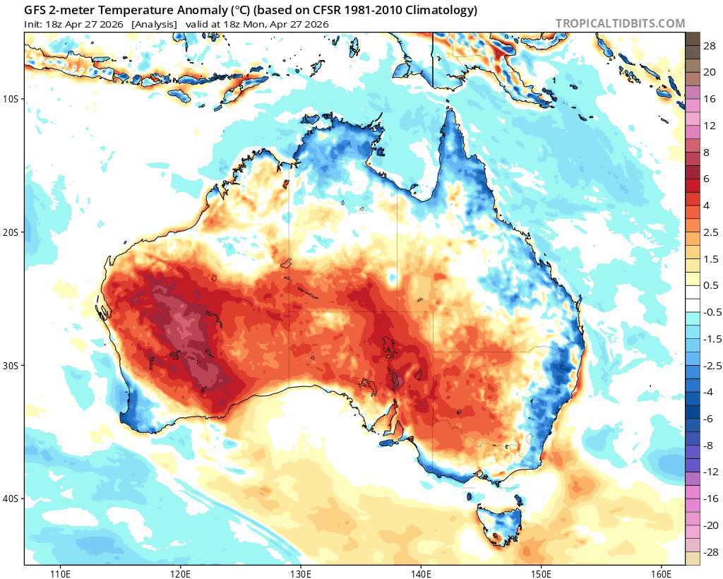
Worth also flagging that although we’ve seen some showers close to the coast, inland is really suffering. Here’s how it looks just west of Armidale right now – massively different to last year:
Got to hope for some big falls to our west before the forecast El Nino really kicks in.
While El Nino tends to make it a little drier for us (we’re less impacted than further inland) we’ve got two other key climate influencers that impact our weather. Right now the Indian Ocean influence is looking mildly drier as we move into winter, and the Southern Ocean influence is still a couple of months out from giving us a clear signal. More on those as we move through winter.
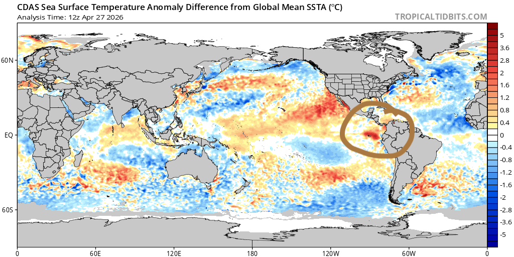
Worth noting that we’ve still got warmer than average water off our coast:
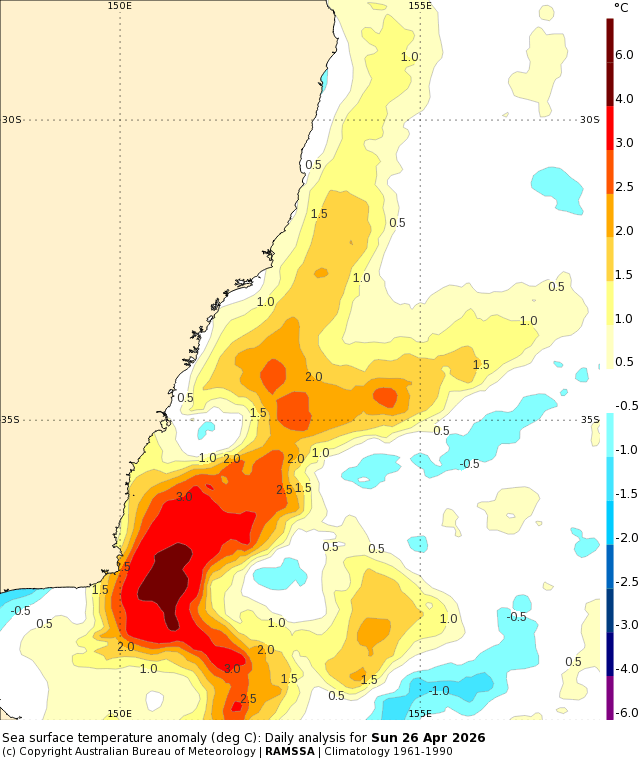
…and as such onshore flows are still likely to give us showers at times, even with El Nino kicking in. Inland doesn’t benefit from onshore showery events, hence the current dry and bigger impacts from El Nino events 🙁
OK enough rambling for now, back again in a week or so as the monthly forecasts come in once again. Thanks for making it to the end!


