After a long summer we’ll get our first blast of autumn over coming days. As is usual at the start of the change it won’t last long, as hotter and more humid weather tries to move straight back in…but over time we’ll see autumnal weather start to dominate with decreasing summer humidity. From the chart below – check out the southern ocean low throw strong southerly winds across eastern Aus:
Also worth checking out the cyclone moving down the west coast of Aus – will this one hit Perth? Right now it looks like it will be too far east, but something to watch over the next couple of days…
Meanwhile, back to our side of the country – and looking at temperature anomalies we can see that cold blast push over much of eastern Australia before heat from the west starts to move back in:
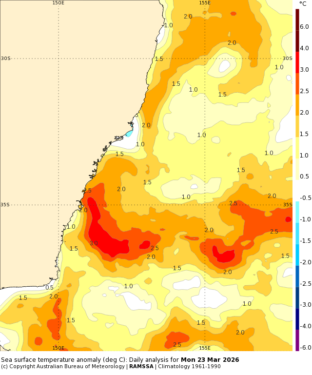
Enjoy the cool temps and lower humidity levels when it rolls in! Worth noting however that we still have ocean temperatures well above average off the NSW coast:
…so when we see easterly winds returning we’ll see humidity levels increasing again as well as a chance of some chunky showers moving in from the ocean. Upper level air temps will start to drop over coming weeks – likely faster than the ocean will cool – and this increasing temperature gradient will actually increase the chance of seeing onshore showers (and possibly an East Coast Low) whenever other conditions are right…but no sign of anything significant in the short term right now beyond a few showers.
Looking further ahead and models are still forecasting an El Nino to develop over our winter – you can see the warmer ocean temperatures develop over the eastern Pacific in this animation that runs through until the end of the year:
…however whilst this would normally mean cooler oceans off our coast a stronger than average East Australia Current will likely keep significantly warmer than average ocean temperatures off much of the NSW coast:
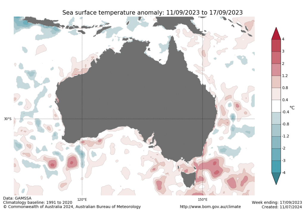
This differs from the 2023/4 El Nino:
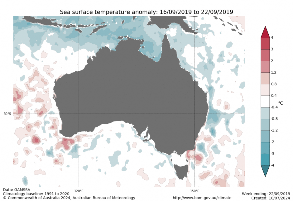
…and the 2019/20 El Nino:
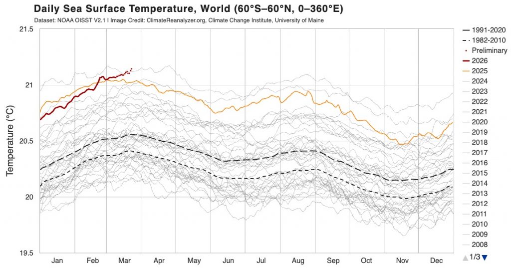
…and as such we could see some non-typical outcomes from the upcoming event – though what they will be is still, literally, up in the air. Climate change is definitely making an impact here – right now, and before the forecast El Nino has even kicked off, we have ocean temperatures at a record high:
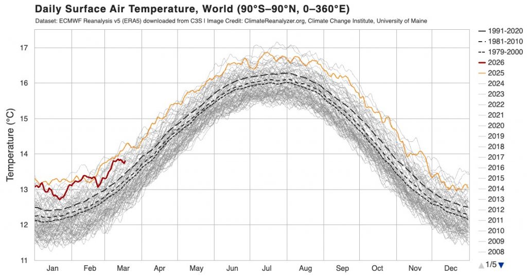
That is, to put it mildly, not good. Air temperatures are trailing ocean temperatures right now, but likely to increase over coming months as the El Nino moves in:
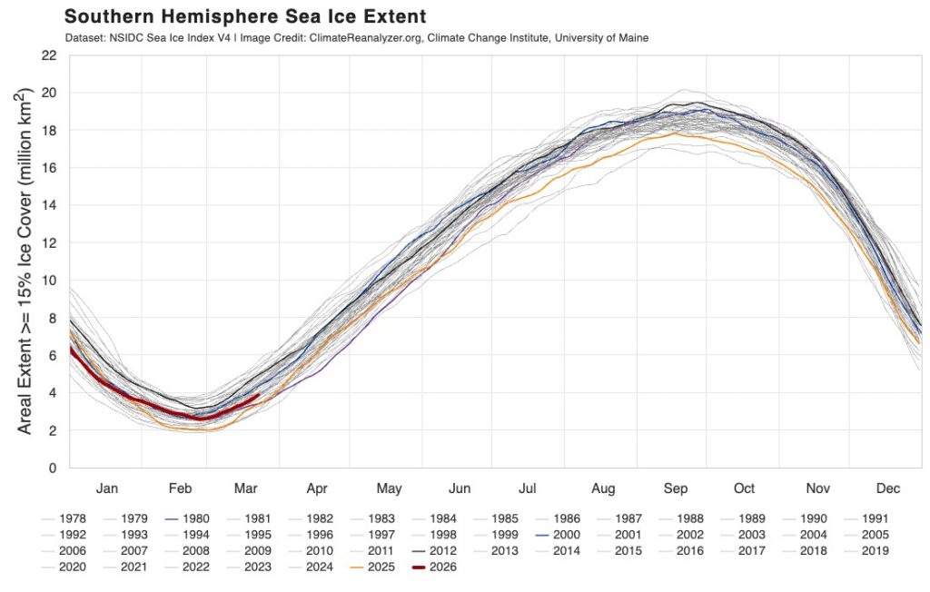
Some good news to finish – Antarctic ice is currently sitting exactly where it should for this time of year: