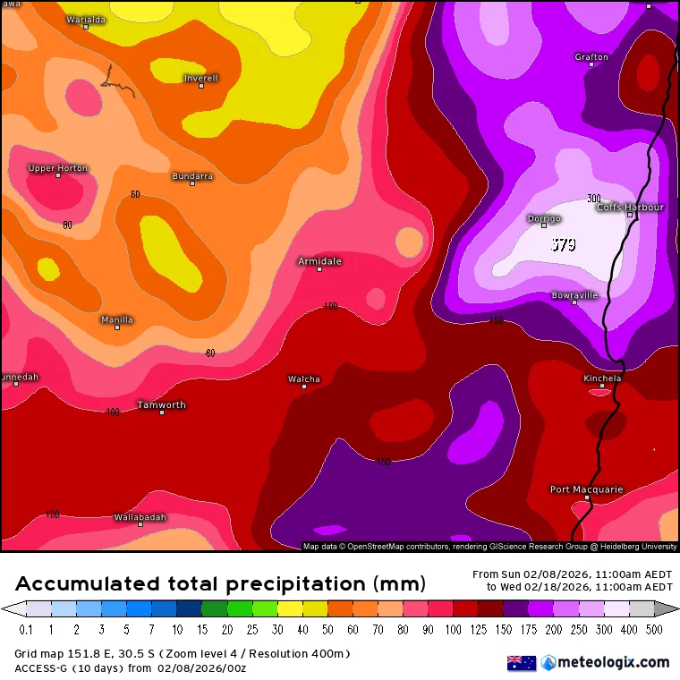
It still looks like wetter weather will move in as a change moves up the coast over the next couple of days…but right now it looks like the wettest weather will now be a little way to our north. There’s still time for that to change – and there is a chance that the rain band may redevelop further south as we get later into the weekend – but for now the extremely heavy falls appear to have relocated to the Gold Coast / Brisbane. Here’s the change in the Australian model out to Wednesday next week – a big decrease in totals across our region – but still note totals of 100mm plus are still looking possible:
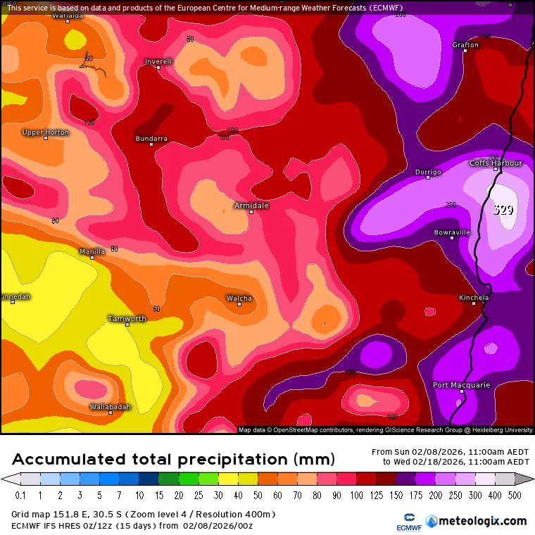
…and here’s the change in the European model – still showing decent totals over the next week (again 170mm is not a small total – just not as high as the totals previously predicted):
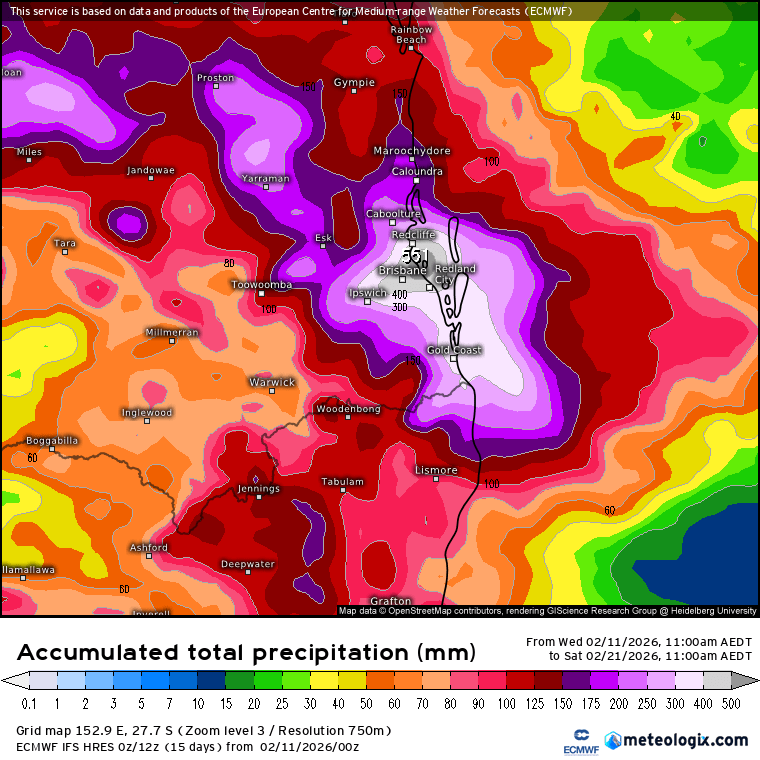
So where have the forecast flooding rain totals gone? Just a little way up the coast towards Brisbane / Sunshine Coast:
Most of that initial rain is going to fall in a relatively short period of time, so the flash flood risk is significant. For us – we’ll still see some rain as the change moves through, but will likely see most of our rain with the onshore flow in the days after the change has moved up the coast. We could well end up with some decent accumulating totals (100mm+ is nothing to be laughed at), particularly on the hills with showers moving in post-change (and perhaps lasting for a good number of days), but for now it looks like the flash flood potential for our region is lower than it appeared a few days back. It’s also fairly dry out there right now as well so with less intense rainfall likely we should see a lot of it getting absorbed rather than running off.
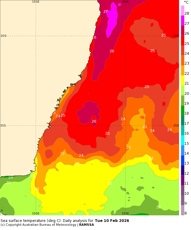
It’s always hard for models to pin down exactly where a change moving along the coast will slow down and intensify – so it looks like they got the threat right but not the exact location. Regardless it’s worth keeping an eye on this one, particularly with ocean temps of 27c just offshore:
As an aside it looks like the BoM see things similarly – no Flood Watch at this time for our region, but one in place now for SE Qld:
Initial Flood Watch for parts of South East Queensland and Wide Bay and Burnett and adjacent inland catchments
Issued at 1:22 pm AEST on Wednesday 11 February 2026
MINOR FLOODING POSSIBLE FROM FRIDAY, WITH A RISK OF ISOLATED MODERATE FLOODING
A trough will move east over southern and central Queensland from Thursday and linger for the remainder of the week, drawing deep tropical moisture more broadly across the state and enhancing shower and storm activity over multiple days. Moderate to heavy falls are likely across the Flood Watch area from later Thursday.
There is significant uncertainty in the location and timing of the heaviest falls, particularly from Saturday onwards. The situation will be monitored closely and Flood Warnings issued as required.
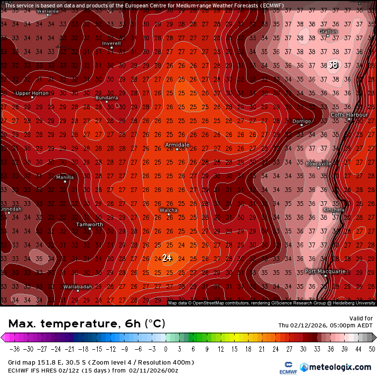
One other thing to note – it’s still summer and there is more hot air inland. Expect some of that heat to get dragged across our region as the change approaches tomorrow. Here’s the current forecast max temps through Thursday afternoon:
The good news – Friday will be considerably cooler, with temps in the low to mid 20s as a cooler onshore flow develops.


