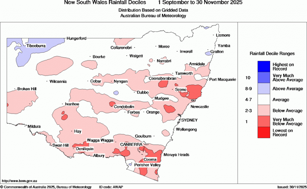
We’ve had some big bushfires down south of us over the last few weeks – and sure enough if we look at the 3 month rain anomalies we can see that there’s been some really dry weather down that way:
Chatting with a regional farmer (inland from Port Mac) today and they reckoned it’s been their driest spring since 2019. That was the last time the southern circulation was a weak as it’s been this year – no coincidence there. If we look at the strength of that circulation over the last few months and we can see it turned negative in early September and has sat there ever since:
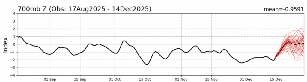
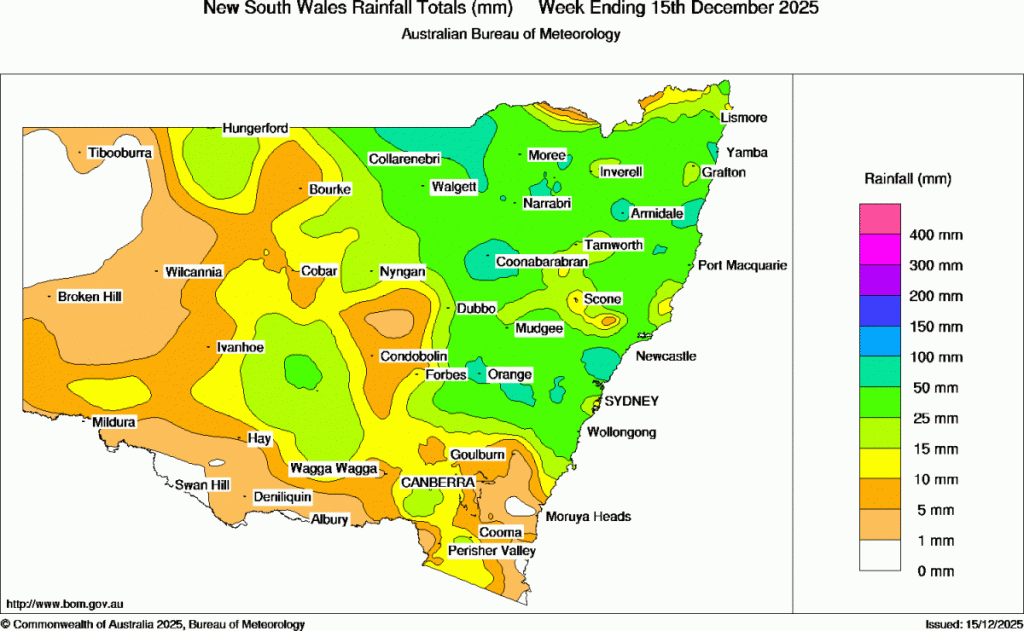
…but moving forward we can see it rapidly returning to neutral values over coming days. In fact much of NSW has already seen some decent (and for many much needed) rain over the last week:
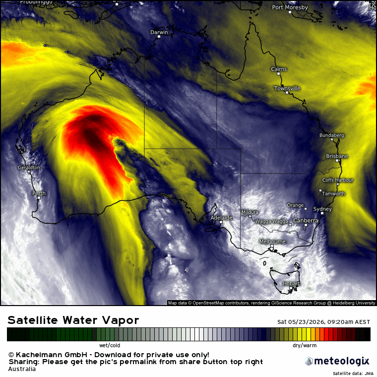
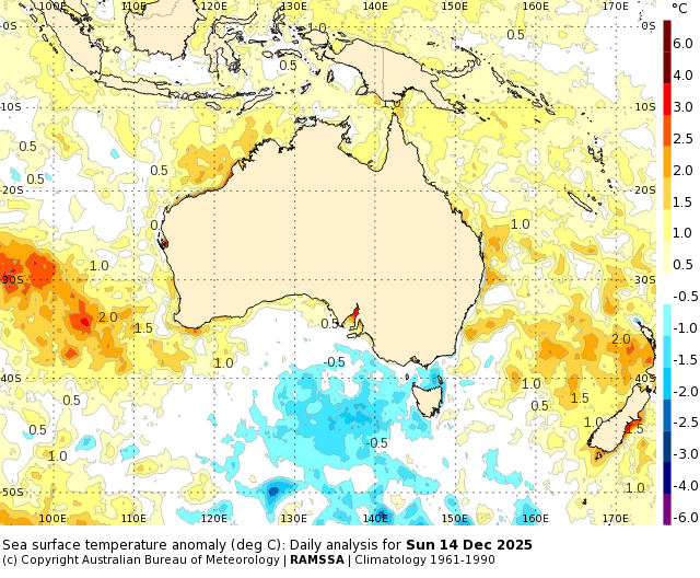
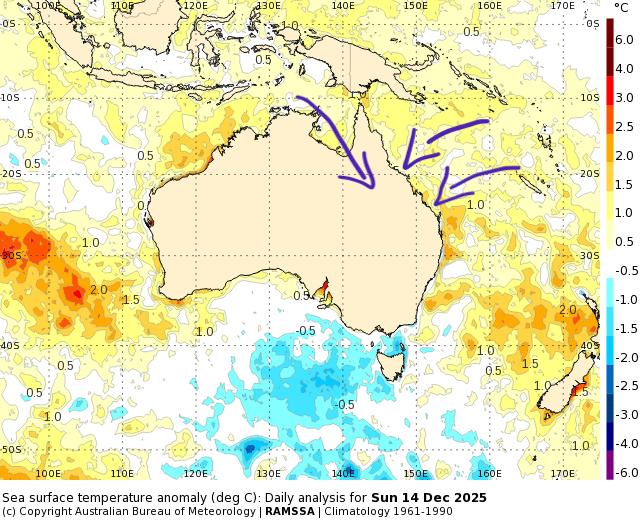
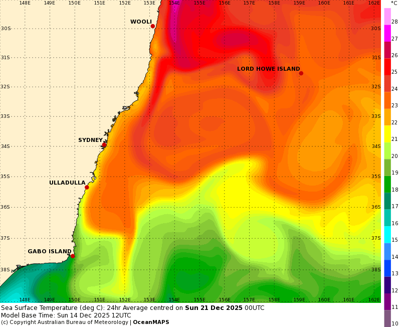
But that’s not it for the rain…Combine the lessening impact of the southern circulation with a weak La Nina and parts of eastern Aus will likely see some really wet weather over coming weeks as a flow from a very warm Gulf of Carpentaria meets the La Nina flow off the warmer than average Coral Sea. Here’s how much warmer than average the ocean is looking off our northern and eastern coast at the moment:
Add in the winds…
…and we’ll see some big falls developing through Queensland over the coming couple of weeks. Here’s the two week forecast rainfall accumulation:
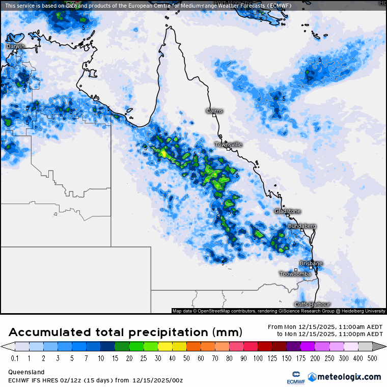
Expect to see potential flooding across large areas to our north over coming weeks if it comes off as currently forecast. Right now it looks like the vast majority of the rain will remain well to our north but I’ll keep an eye on the forecasts in case it decides to venture further south. Regardless we’ll still see some showers and storms, particularly over the hills over the next fortnight, with forecast rain totals looking like this:
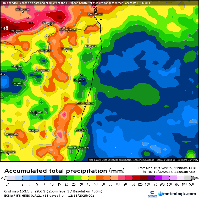
As is the way with showers and storms we’ll likely see some parts copping higher totals while others receive significantly less. The recent hotter than average ocean temps off our coast have cooled a little, but models show more warm water flowing south from offshore Queensland over the coming week:
That doesn’t mean it will be hot / wet / humid right through, but onshore winds will likely feel increasingly sticky over coming weeks, with the fuel also in place for some higher rain totals if other elements align. No sign of that right now however.
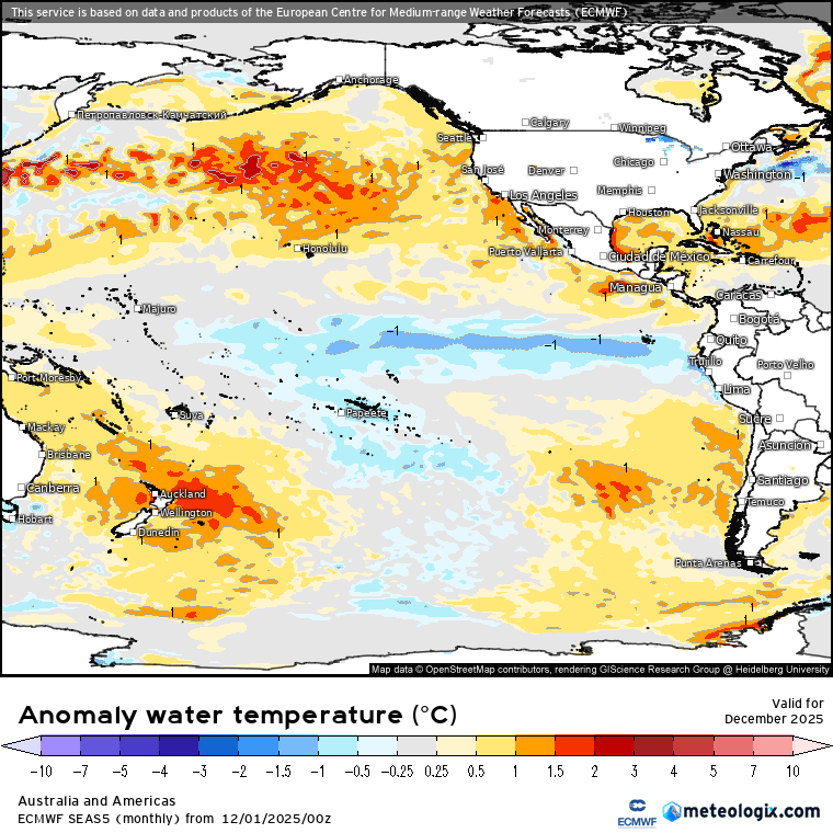
Looking further ahead and the models are still showing the current La Nina ocean pattern:
…becoming a lot more El Nino-ish as we head into winter:
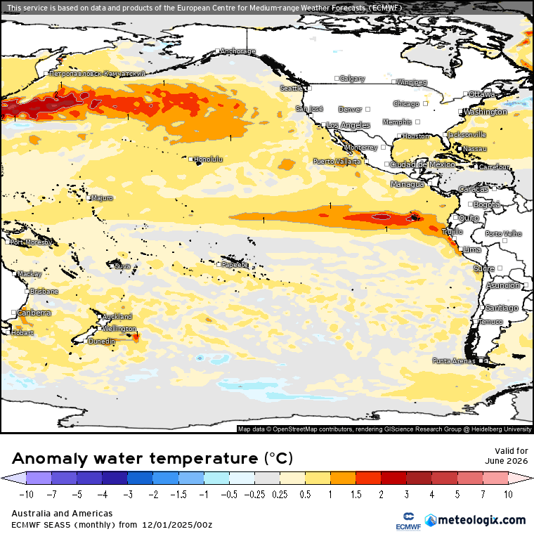
It takes a lot of elements to combine for us to see hotter / drier weather, but models are indicating one of those elements could be in place by next winter. Will keep an eye on that one and update over coming months.
Inevitably our weather will dry out at some point. We’ve seen some serious growth in the bush over recent years so once it does dry out fire risk will certainly be on the increase. Many local RFS brigades are on the lookout for new members. RFS crews are just locals working to support their community as and when they can. So we can ensure we have enough local members to tackle fires whenever they do return please do consider joining a local brigade – once the fires kick in there isn’t time to train new members, so this is an ideal time to consider signing up. There’s a heap of information on this page or you can contact your local crew via the Coffs Coast office – email coffscoastteam@rfs.nsw.gov.au If you live in Bellingen you can contact North Bellingen RFS at captain@northbellorfs.org.