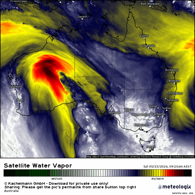
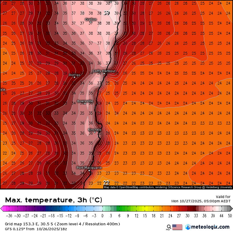
With the southern circulation pushing dry and Indian / Pacific oceans pushing wet we’re well into a spell of weather that swings from one side to the other. Today the southern circulation is dominant – and that means hot maximum temperatures:
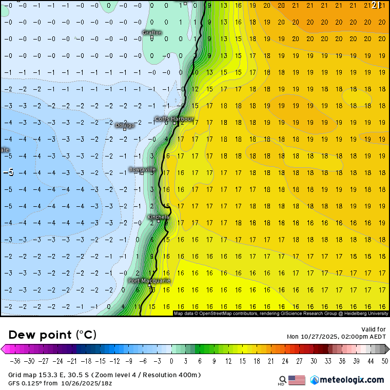
…combined with some very dry air – this is the dew point map for 2pm today:
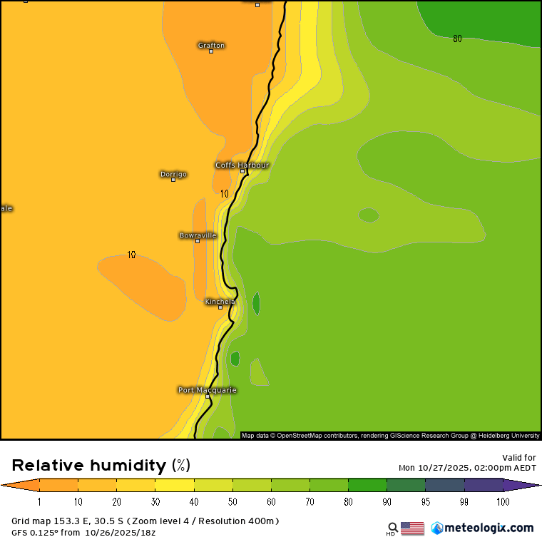
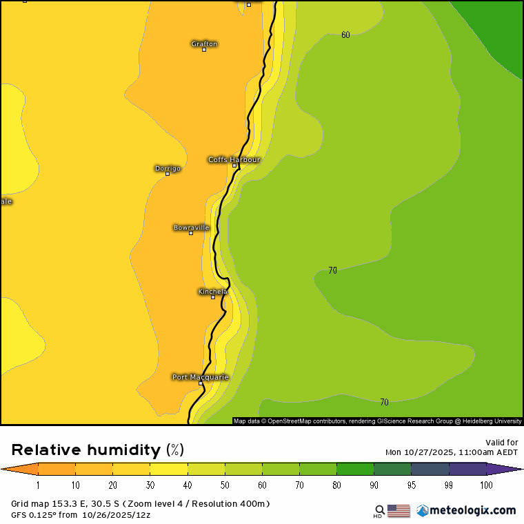
…and that gives us a relative humidity this afternoon dropping down to 10% in places:
Add some strongish winds today and recent dry weather and we’ve got a day of extreme fire danger through today. The good news is that conditions will rapidly moderate with a change moving in this evening. Check out how quickly the relative humidity increases through this evening and into the early hours of tomorrow morning as the south easterly change moves through:
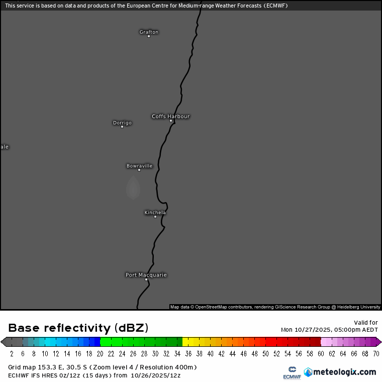
We’ll also see some showers moving in through tonight and into tomorrow – here’s how the models see it coming in – think of this as a model generated radar image that runs from 5pm today through 5pm Tuesday:
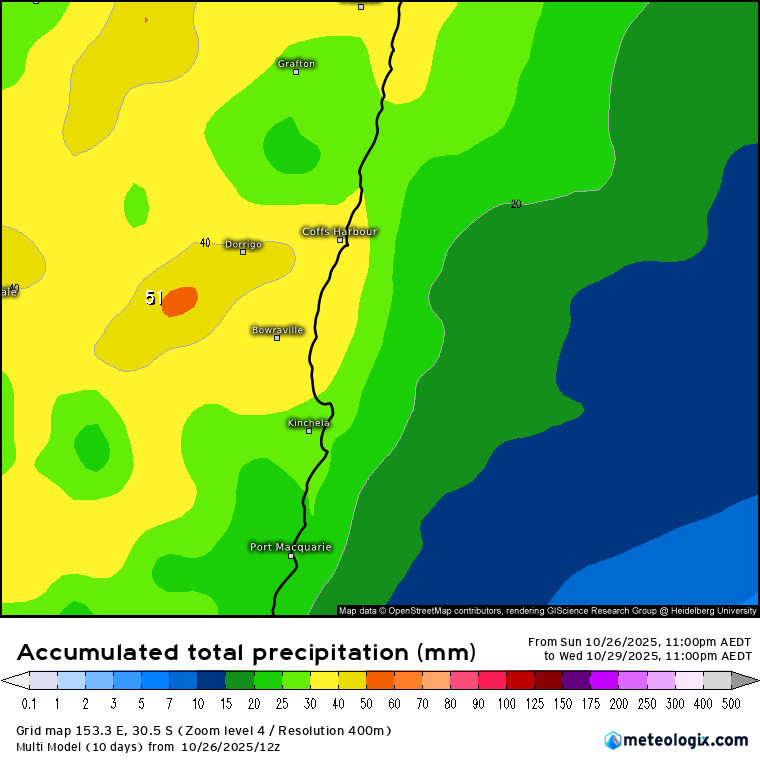
Models are a little over the place with rain totals so worth taking the multi model average right now – which shows some good totals by the end of Wednesday – sure the ground will happily soak it up:
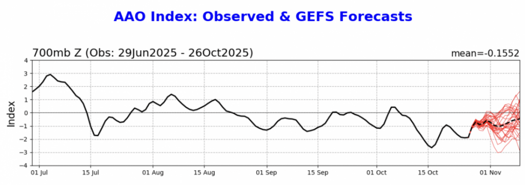
Looking further ahead and we’ve got the southern circulation remaining weaker than average:
…while both the Pacific and Indian Oceans continue to push wetter conditions (with blue wetter and orange drier):
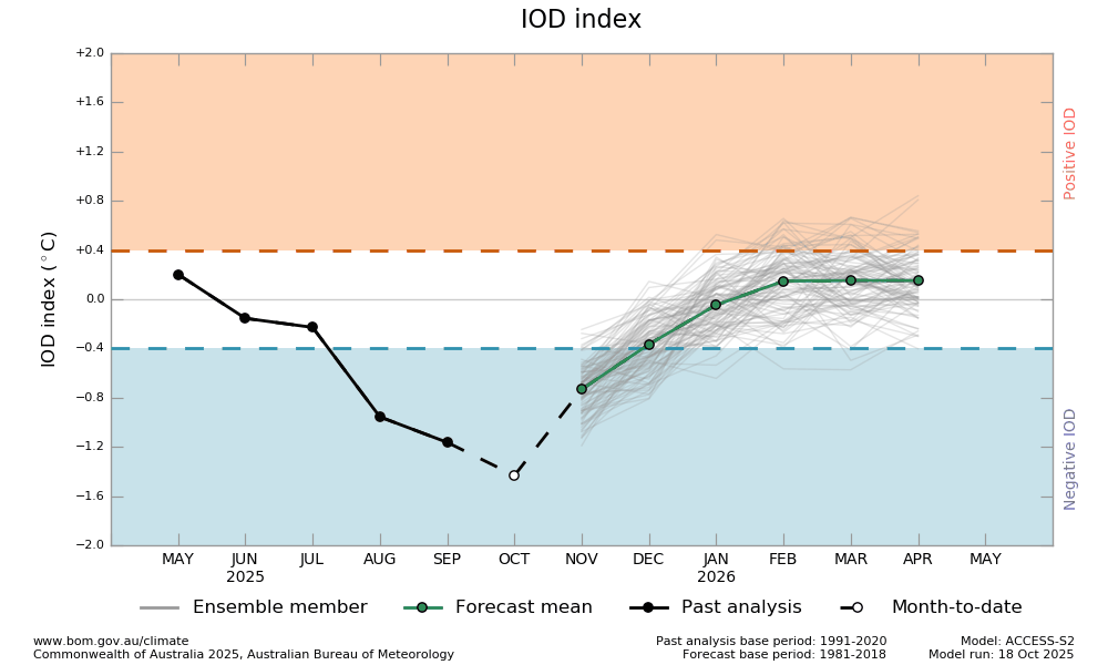
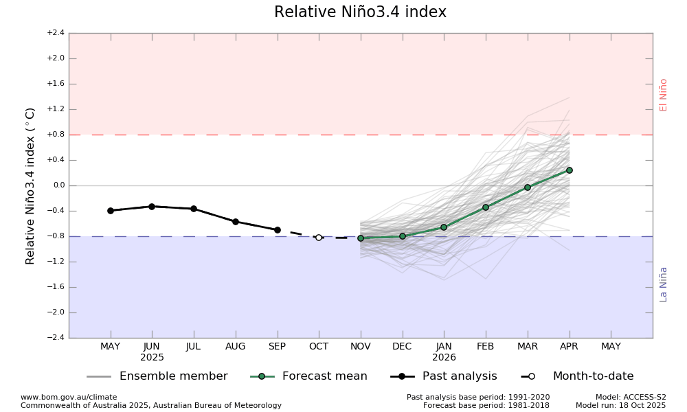
…so those opposing influences will continue to battle it out over coming weeks. The influence of the southern circulation and Indian Ocean will weaken over the next couple of months, leaving the Pacific to dominate – something we’ll keep an eye on as we head towards the end of the year.
A quick update and hopefully we get through today without significant fires – and get some soaking rain through the middle of the week, which should reduce fire threat at least temporarily. I’ll finish with a sneak link to the old BoM radar for our area (for anyone else finding the new site a challenge) – at least for now you can access it here: Grafton Radar 😉