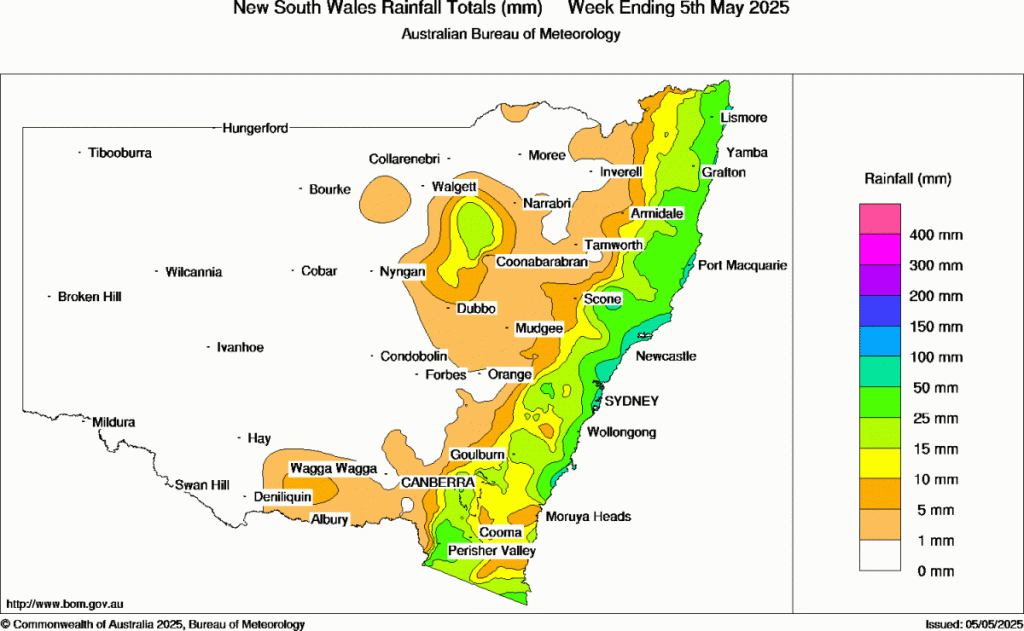
Anyone else over this weather? The ground is saturated and the showers just keep giving. The last week has given more decent totals along the coast:
….which comes off the back of a wet April:

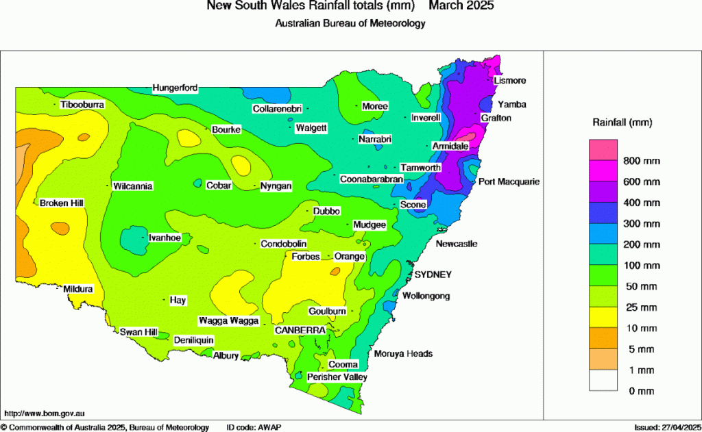
…which comes off the back of an even wetter March:
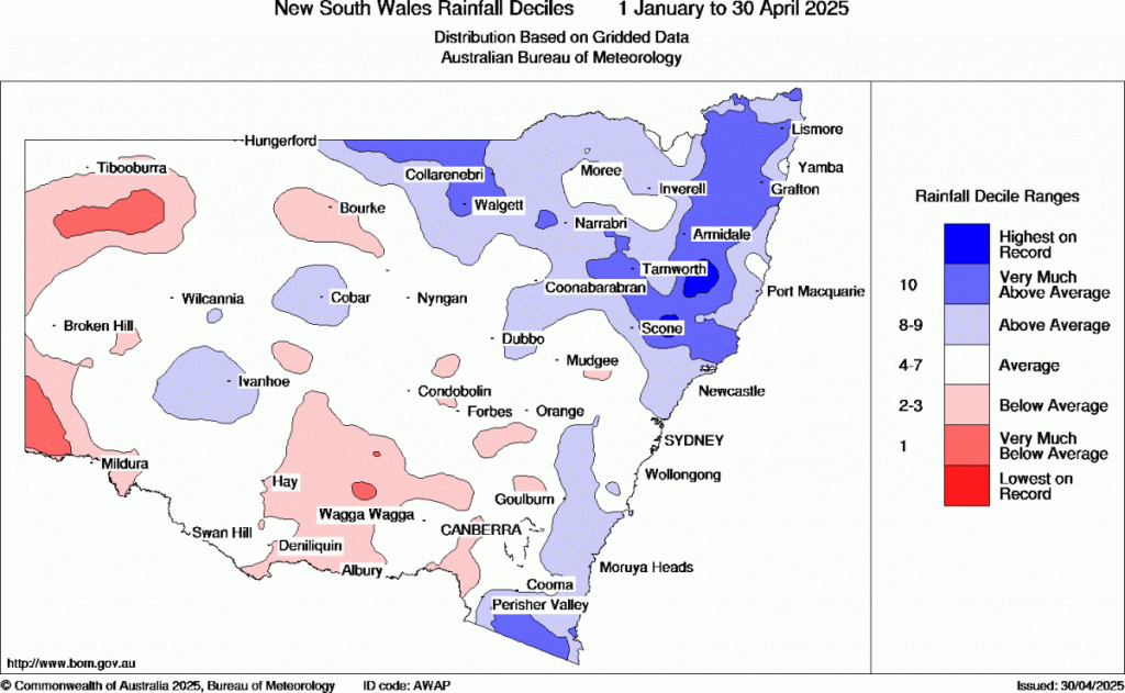
….which means that for the year to date we’re sitting well above average, with some inland locations sitting at record amounts of rain:
The reasons? In part natural variability but also indications of climate change in action. The warmer than average ocean temperatures off our coast have the ability to deliver higher rain totals (when conditions align)…and the warming world tends to push cold fronts further south, thus reducing the number of cold fronts that move through the southern half of Australia and clear the moisture out to sea. It doesn’t mean it will thus remain wet going forward into the long term (in fact climate change tends to expand both flood and drought) but certainly has the potential to ramp up wetter spells.
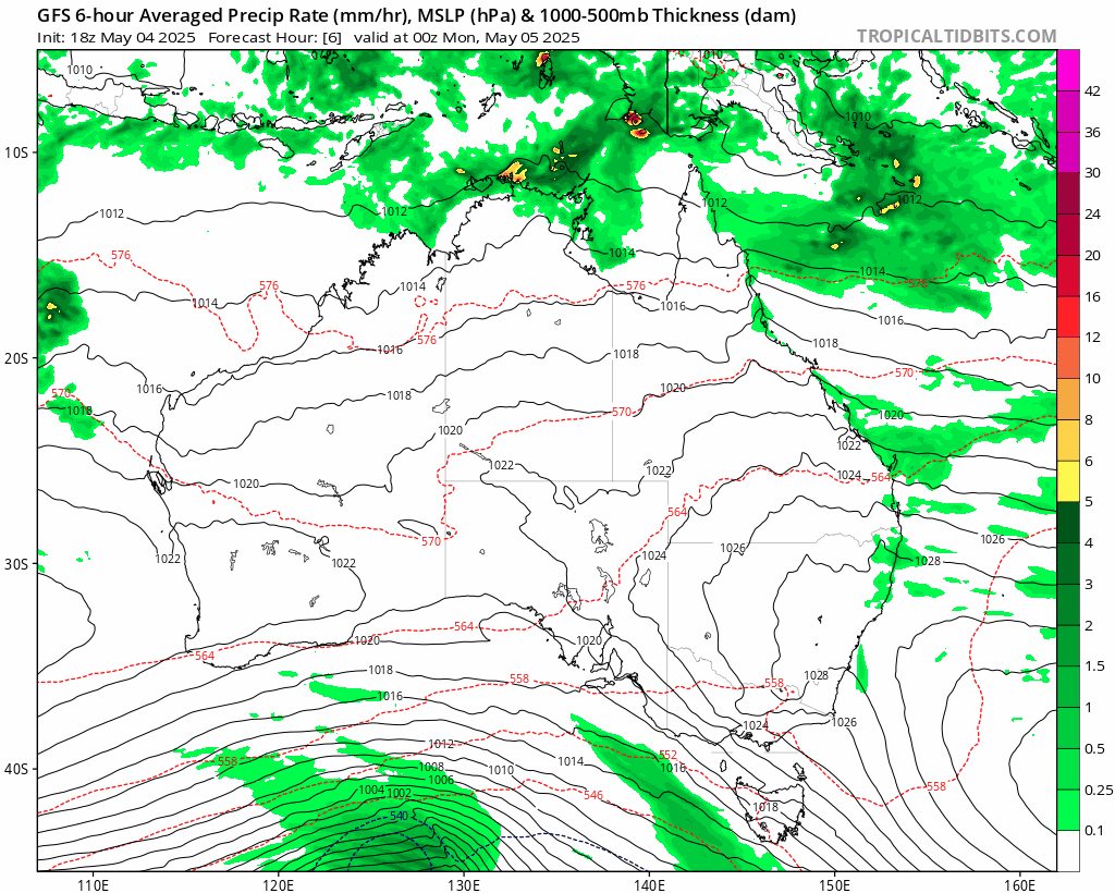
So what do we have going forward? A clearing trend through tomorrow and Wednesday…before showers return in abundance as the next high moves in to our south and directs onshore winds across our region once again. Here’s an animation running from today through day 10. You can see showers clearing early as onshore winds weaken, before sweeping back in later in the week and then persisting for some time:
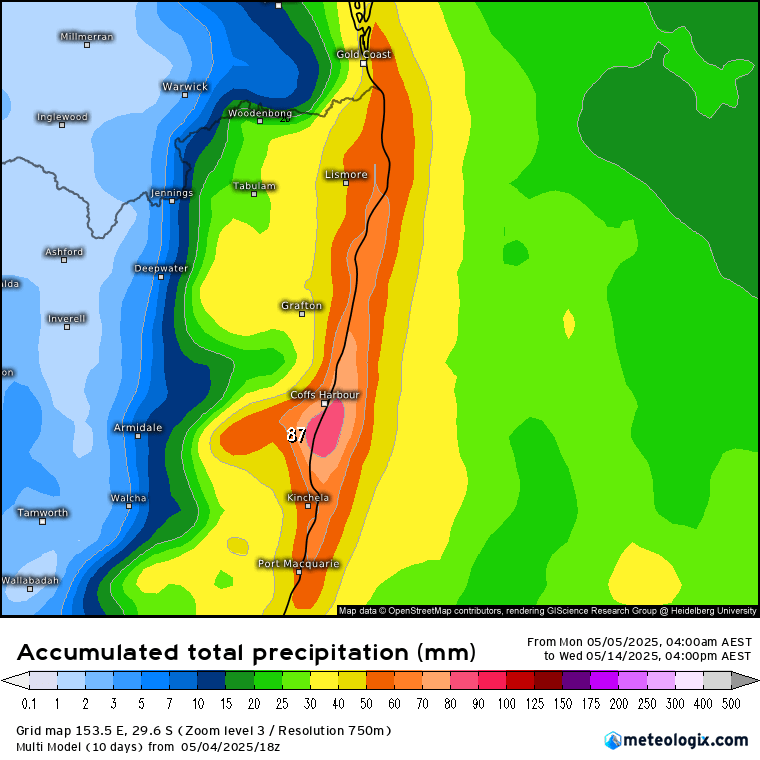
Rain totals over the next 9 days averaged across all models look like this:
It’s worth flagging however that some models show a broader disturbance moving in on the easterlies late weekend / into next week. if that disturbance moves ashore we would see a more substantial increase in showers with more significant river rises possible, while other models show the disturbance remaining offshore (and eventually dragging our showers away once more) – something to watch. I’ll post again if it looks like the forecast wet weather late weekend will be enough to bring rivers up – but for now worth being aware that at the least we’ll see yet more showers move back in after a drier couple of days, with the potential for some higher totals.
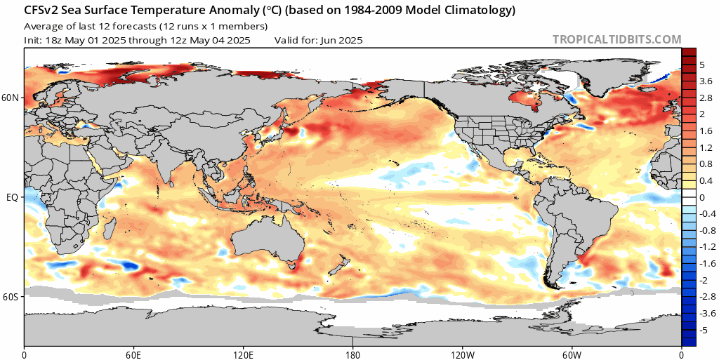
Longer term it looks like the current La Nina type weather we are seeing should fade away as we move into late winter / spring. The cooler anomalies across the eastern Pacific are forecast to slowly warm over the coming months, reducing the likelihood of a continuation of this much-wetter-than-average weather:
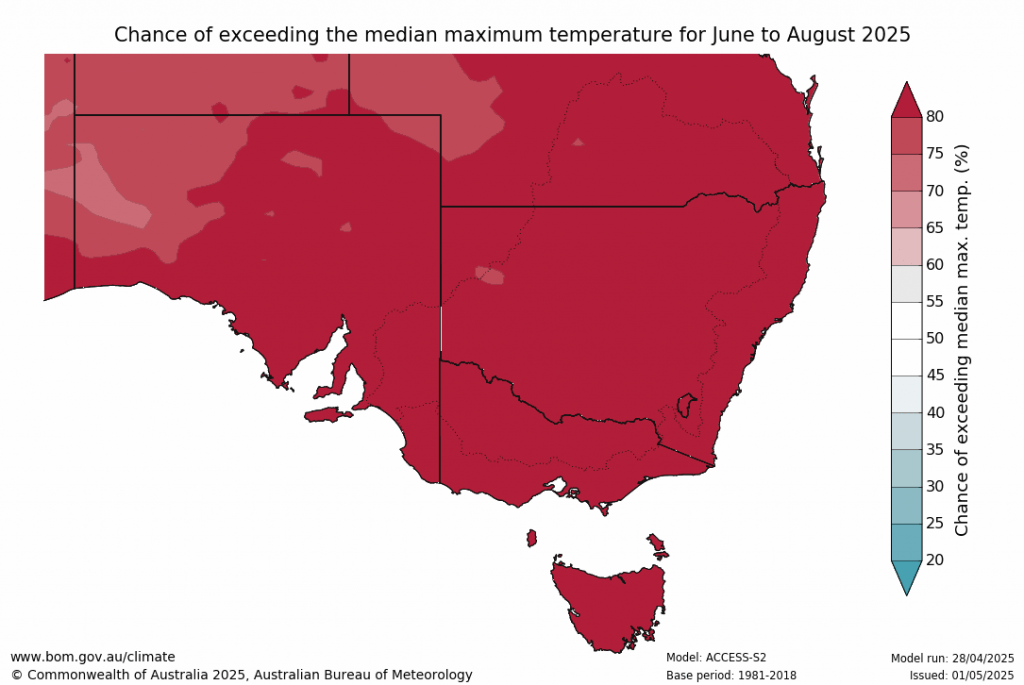
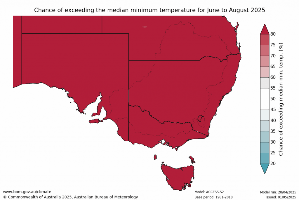
…however it’s also worth being aware that the continuing warmer than average ocean temperatures around Australia will likely contribute towards higher than average day and night time temperatures, higher than average humidity levels and a risk of wetter weather at times when other elements line up. The latest BoM long term outlook for June through August certainly confirms that:
That’s easily enough red for this post, and that’s also all for now. I’ll post again if the upcoming showery spell looks like bringing significantly wetter conditions. In the meantime hope you get to enjoy the drier weather through the middle of this week 🙂