General
Drier…for a time…Longer Term Outlook
After what seems like a never ending stream of showers we’ve finally got some drier weather moving in as a southern low (temporarily) blasts all
After what seems like a never ending stream of showers we’ve finally got some drier weather moving in as a southern low (temporarily) blasts all
After a week of showers…we’ve got more to come. The 15 day animation shows showers rolling onshore from time to time until the weekend, when
First off we’ve had a dry spell recently – enough to bring fires across much of NE NSW: Most of the fire activity has been
We’ve had a fairlyu dry couple of weeks – dry enough for local RFS brigades to have callouts to escaped burns: It’s actually looking fairly
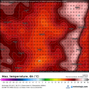
After a long summer we’ll get our first blast of autumn over coming days. As is usual at the start of the change it won’t
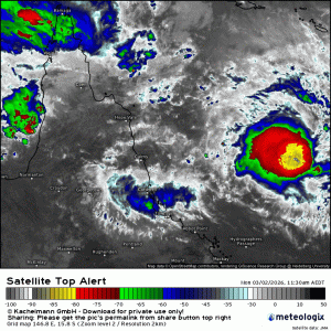
It looks like the models are sticking to their guns with big falls looking likely to our north as a tropical low moves inland across
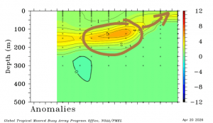
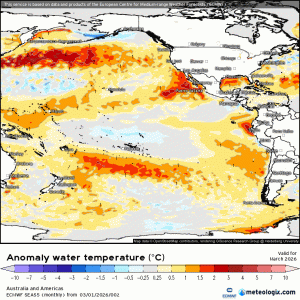
We’ve got some very toasty waters just offshore from the NE NSW coast – tropical water getting pushed south: …from a warmer than average Coral
It still looks like wetter weather will move in as a change moves up the coast over the next couple of days…but right now it
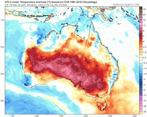
Sure enough inland SE Aus was recently blasted with some record-breaking heat – both in terms of temperatures reached and duration of the heatwave. Two