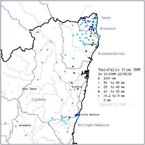
Wow what a wet start to the week for August! This is usually our dry / fire season so while damp it makes for a pleasant change. Looks like the BoM high resolution models have been on the mark with the rain totals / locations to date with 24 hour (to 9am) totals looking like this:
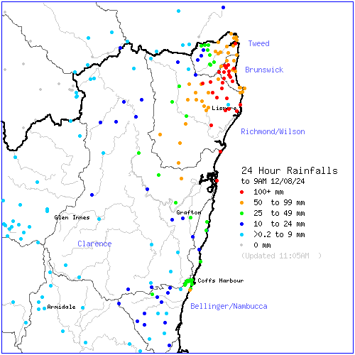
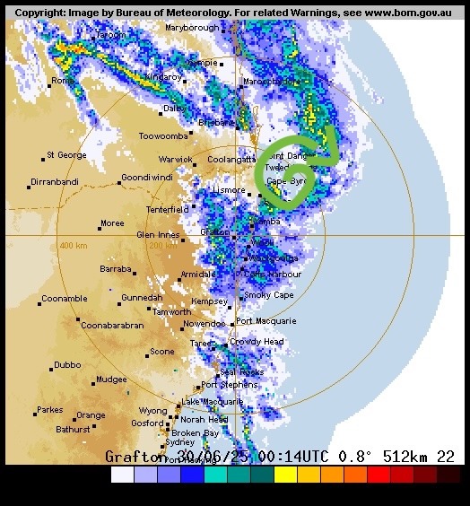
You can easily see all the totals in excess of 100mm across far NE NSW and then running down the coast. In the two hours since 9am the rain has continued to tumble down across those areas:
It can also be useful sometimes to see a longer radar run to see the bigger picture:
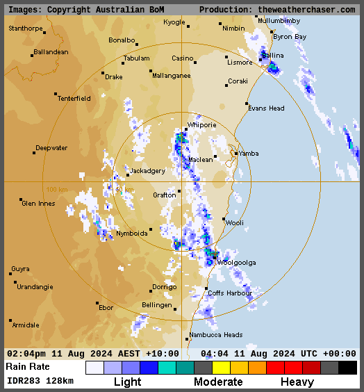
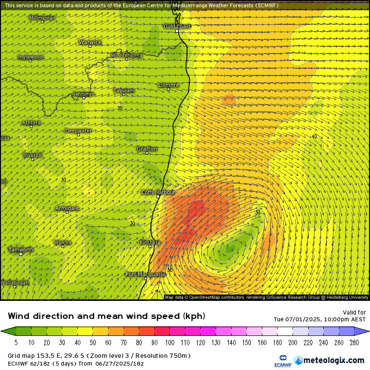
We can see the heavier rain develop to the north and then slowly move down the coast. We’ll likely see this feature weaken through this afternoon but ongoing showers / rain at times over the next few days will still bring us some decent totals. The current model runs out to 5 days still show some good accumulations over time:
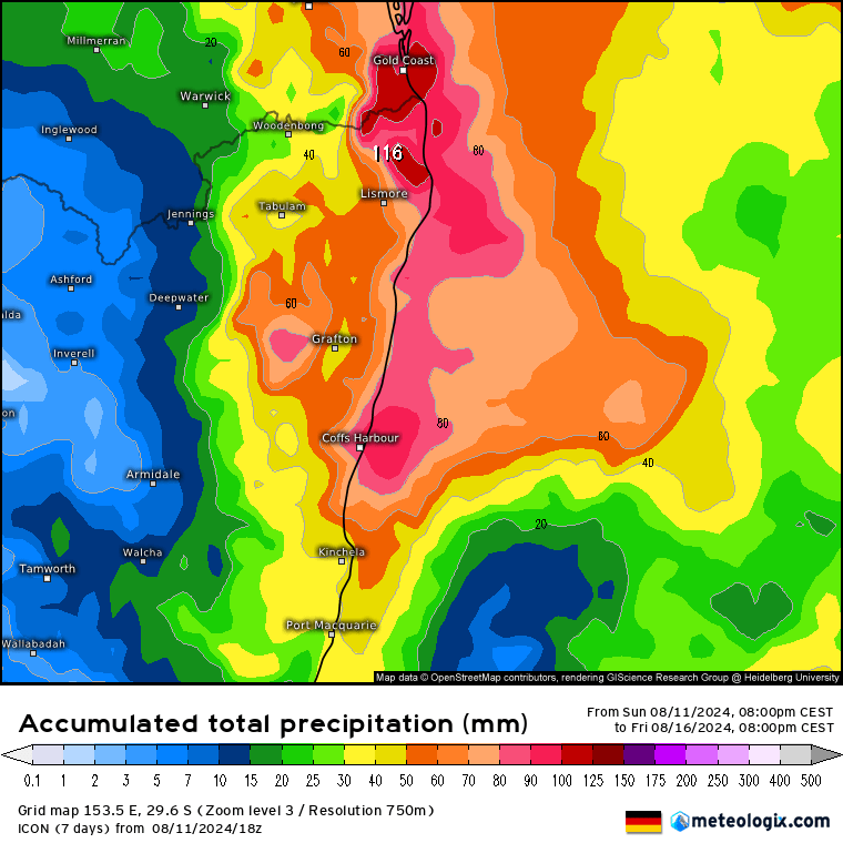
Worth noting that the BoM has now updated their Flood Watch to once again include our local rivers.
Looking beyond this week and it is likely to dry out a little over the next month, with weekly rainfall outlooks currently looking like this:
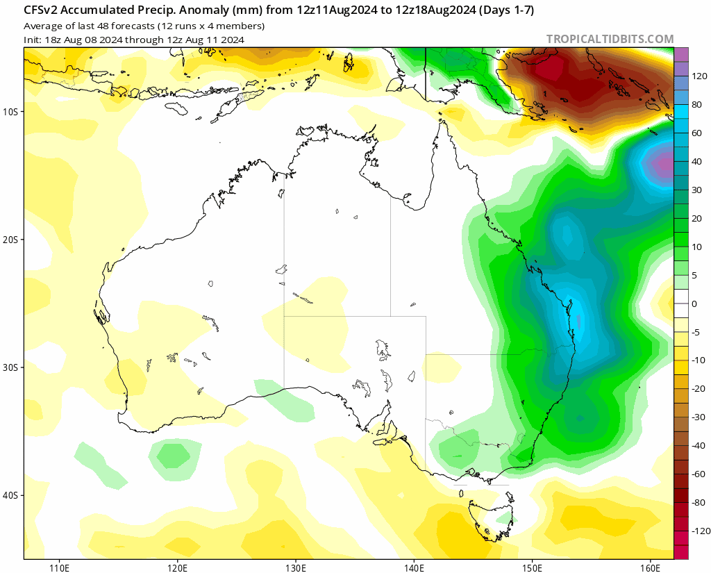
That doesn’t mean sunshine all the time, but less likely to see the current pattern continuing. There are also some indications of some warmer weather sweeping in before cool changes – combine that with wet soils and we should see some decent Spring growth over the next couple of months.
If we do see higher falls this week the Kombu Floodcam page have images from across our region. Latest weather information including river heights is available on the Bellingen Weather site, with warnings available from the BoM.