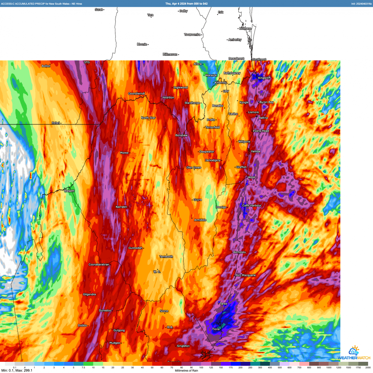
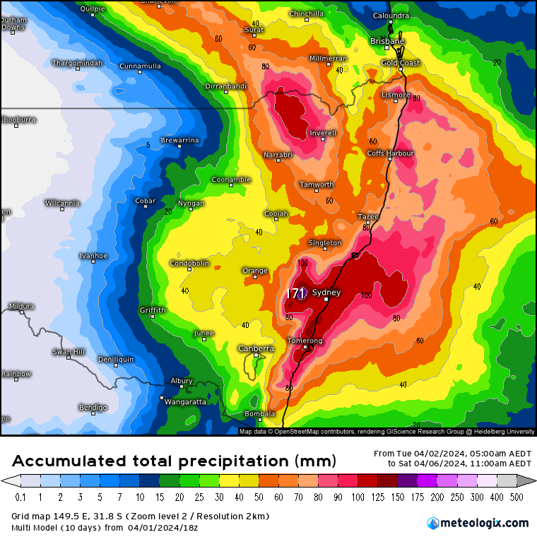
A quick post to flag the risk of some decent totals with showers and storms over the next couple of days before it dries up again. The BoM high resolution models both suggest the chance of decent totals across the hills with showers and storms from now through the end of Saturday:
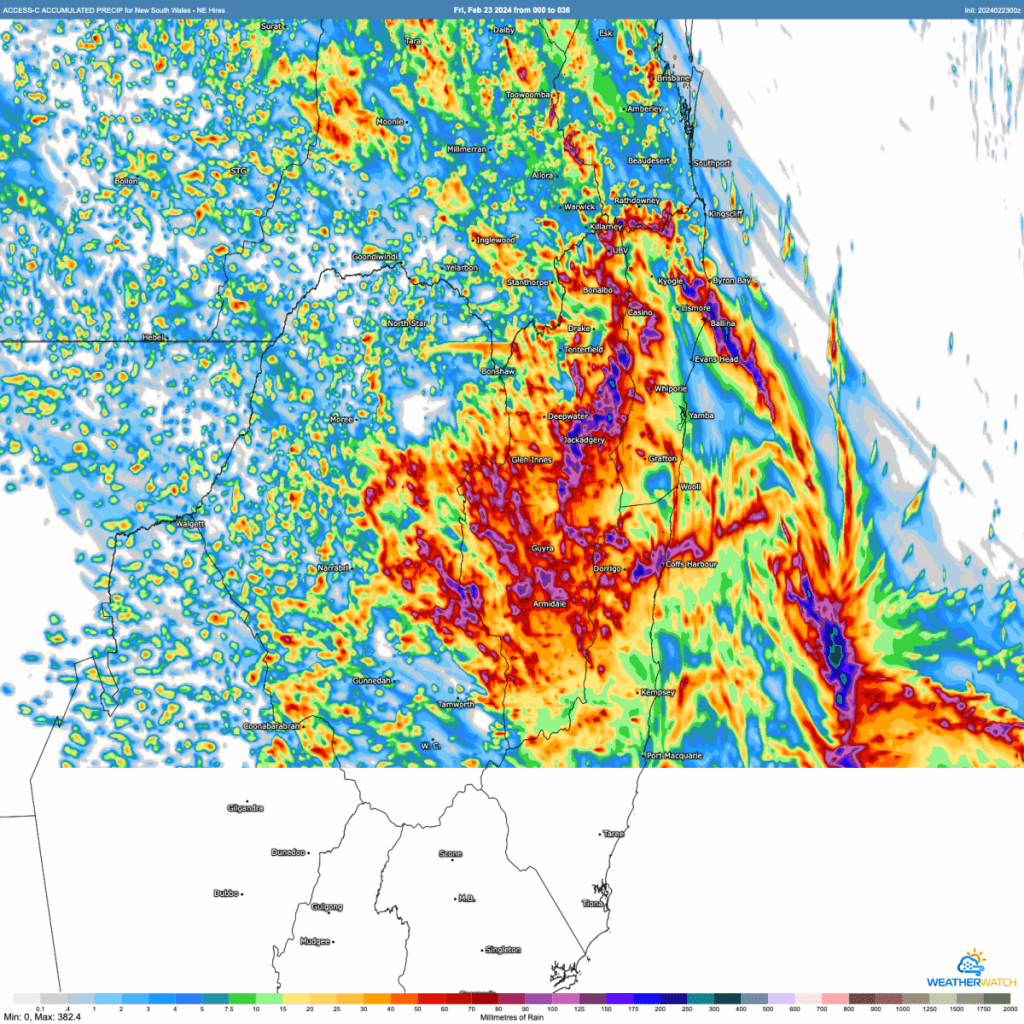
As is always the case with showers and storms, some locations across NE NSW will see some big totals, while others see considerably less – but definitely one to keep an eye on as we could see some river rises (with the Never Never being one river that could see some quick rises).
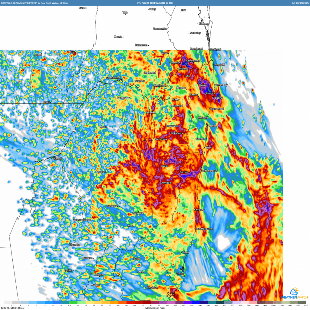
This system is not too dissimilar from the one that came through on Monday, but will stretch across 2 days rather than just the one afternoon. Worth checking out the radar animation of the system that gave over 50mm in an hour in Gleniffer on Monday:
Once the current system clears through later tomorrow we’ll see the weather dry up – and likely warm up. You can see the current heat clear through with the change over the weekend before more significant heat develops across WA and then moves to the eastern states through next week…before a possibly even stronger cold change sweeps across much of eastern Australia in a couple of weeks:
Looking further ahead and models indicate warmer than average ocean temperatures around the Australian coastline right through this year – likely increasing humidity levels, temperatures and rain totals:
In fact the latest model runs show the chance of a significant La Nina event through our late winter / spring which could further increase rain totals:
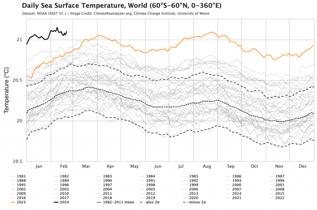
This is something we’ll need to watch closely. Ocean temperatures are in fact currently higher than previously recorded for this time of year:
Another location watching the oceanic changes is the USA, where a significant cyclone season is looking likely.
That’s it for now…enjoy the storms and thanks to NOAA, Tropical Tidbits, BoM, Weather Chaser and Meteologix for images.
Thanks to Kombu Wholefoods and Snapfrozen for ongoing support to keep the weather station and website running 🙂